
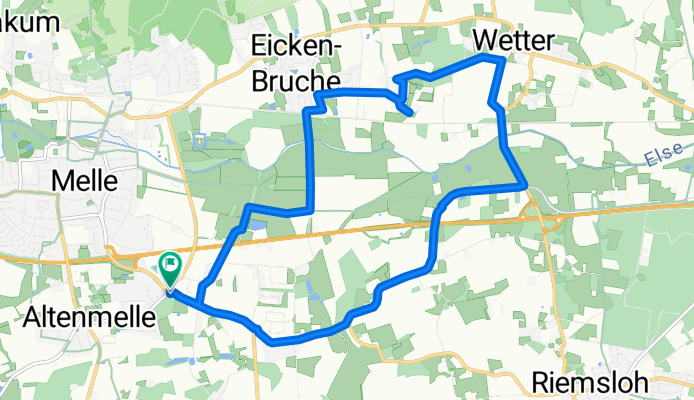
Wittekindsweg nach Wittekindsweg 12B
A cycling route starting in Melle, Lower Saxony, Germany.
Overview
About this route
- 1 h
- Duration
- 13.4 km
- Distance
- 83 m
- Ascent
- 128 m
- Descent
- 13.6 km/h
- Avg. speed
- 139 m
- Max. altitude
Route photos


Route quality
Waytypes & surfaces along the route
Waytypes
Quiet road
5.8 km
(43 %)
Path
5.2 km
(39 %)
Surfaces
Paved
8.1 km
(60 %)
Unpaved
0.3 km
(2 %)
Asphalt
7.4 km
(55 %)
Paved (undefined)
0.7 km
(5 %)
Continue with Bikemap
Use, edit, or download this cycling route
You would like to ride Wittekindsweg nach Wittekindsweg 12B or customize it for your own trip? Here is what you can do with this Bikemap route:
Free features
- Save this route as favorite or in collections
- Copy & plan your own version of this route
- Sync your route with Garmin or Wahoo
Premium features
Free trial for 3 days, or one-time payment. More about Bikemap Premium.
- Navigate this route on iOS & Android
- Export a GPX / KML file of this route
- Create your custom printout (try it for free)
- Download this route for offline navigation
Discover more Premium features.
Get Bikemap PremiumFrom our community
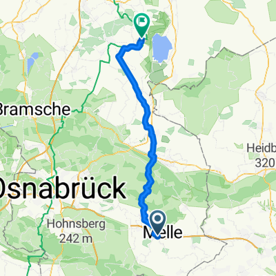
Other popular routes starting in Melle
 In der Eue/Zwickenbach/Grönegausee
- Distance
- 19 km
- Ascent
- 66 m
- Descent
- 65 m
- Location
- Melle, Lower Saxony, Germany
 Wittekindsweg nach Wittekindsweg 12B
- Distance
- 10.9 km
- Ascent
- 85 m
- Descent
- 131 m
- Location
- Melle, Lower Saxony, Germany
 Wittekindsweg nach Wittekindsweg 12B
- Distance
- 13.4 km
- Ascent
- 83 m
- Descent
- 128 m
- Location
- Melle, Lower Saxony, Germany
 Kurze Thekentour
- Distance
- 19.6 km
- Ascent
- 35 m
- Descent
- 35 m
- Location
- Melle, Lower Saxony, Germany
 Wittenauer Straße, Melle nach Dümmerstraße, Damme
- Distance
- 49.7 km
- Ascent
- 240 m
- Descent
- 279 m
- Location
- Melle, Lower Saxony, Germany
 Rund um Melle Oktober 2024
- Distance
- 44.1 km
- Ascent
- 277 m
- Descent
- 330 m
- Location
- Melle, Lower Saxony, Germany
 Suttorf-Brincke-Tour
- Distance
- 45.6 km
- Ascent
- 229 m
- Descent
- 251 m
- Location
- Melle, Lower Saxony, Germany
 Enzianhütte
- Distance
- 38.3 km
- Ascent
- 240 m
- Descent
- 239 m
- Location
- Melle, Lower Saxony, Germany
Open it in the app