

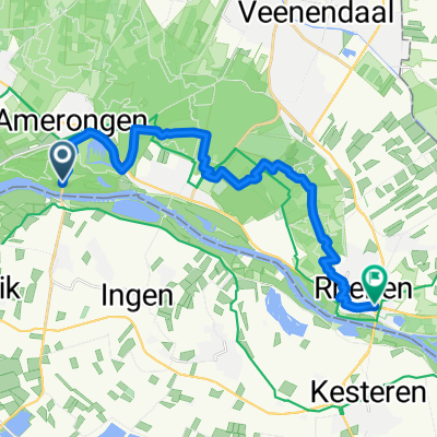
Trekvogelpad naar Rhenen
A cycling route starting in Amerongen, Utrecht, The Netherlands.
Overview
About this route
- 1 h 6 min
- Duration
- 17.1 km
- Distance
- 158 m
- Ascent
- 135 m
- Descent
- 15.4 km/h
- Avg. speed
- 66 m
- Max. altitude
Continue with Bikemap
Use, edit, or download this cycling route
You would like to ride Trekvogelpad naar Rhenen or customize it for your own trip? Here is what you can do with this Bikemap route:
Free features
- Save this route as favorite or in collections
- Copy & plan your own version of this route
- Sync your route with Garmin or Wahoo
Premium features
Free trial for 3 days, or one-time payment. More about Bikemap Premium.
- Navigate this route on iOS & Android
- Export a GPX / KML file of this route
- Create your custom printout (try it for free)
- Download this route for offline navigation
Discover more Premium features.
Get Bikemap PremiumFrom our community
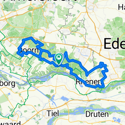
Other popular routes starting in Amerongen
 Trekvogelpad naar Rhenen
- Distance
- 17.1 km
- Ascent
- 158 m
- Descent
- 135 m
- Location
- Amerongen, Utrecht, The Netherlands
 Amerongen-Amerongen 120k
- Distance
- 120.3 km
- Ascent
- 265 m
- Descent
- 265 m
- Location
- Amerongen, Utrecht, The Netherlands
 Lengthy ride through Utrechtse Heuvelrug
- Distance
- 46.2 km
- Ascent
- 271 m
- Descent
- 272 m
- Location
- Amerongen, Utrecht, The Netherlands
 Rondje Betuwe
- Distance
- 27.7 km
- Ascent
- 18 m
- Descent
- 16 m
- Location
- Amerongen, Utrecht, The Netherlands
 Langzame rit in Amerongen
- Distance
- 64.3 km
- Ascent
- 3,176 m
- Descent
- 3,179 m
- Location
- Amerongen, Utrecht, The Netherlands
 MTB Leersum
- Distance
- 20.4 km
- Ascent
- 165 m
- Descent
- 167 m
- Location
- Amerongen, Utrecht, The Netherlands
 MTB Amerongen 2.0 Utrechte heuvelrug
- Distance
- 17.3 km
- Ascent
- 203 m
- Descent
- 203 m
- Location
- Amerongen, Utrecht, The Netherlands
 Utrecht Mega ruta Simple
- Distance
- 84.3 km
- Ascent
- 408 m
- Descent
- 411 m
- Location
- Amerongen, Utrecht, The Netherlands
Open it in the app