
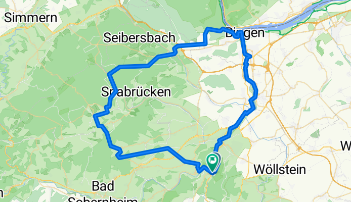
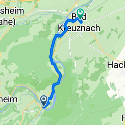
4TT26 C1 Stromberg
A cycling route starting in Bad Münster am Stein-Ebernburg, Rhineland-Palatinate, Germany.
Overview
About this route
- 4 h 19 min
- Duration
- 75.6 km
- Distance
- 1,253 m
- Ascent
- 1,254 m
- Descent
- 17.5 km/h
- Avg. speed
- 483 m
- Max. altitude
Route quality
Waytypes & surfaces along the route
Waytypes
Track
15.9 km
(21 %)
Quiet road
11.3 km
(15 %)
Surfaces
Paved
61.3 km
(81 %)
Asphalt
55.2 km
(73 %)
Paved (undefined)
6 km
(8 %)
Undefined
14.4 km
(19 %)
Continue with Bikemap
Use, edit, or download this cycling route
You would like to ride 4TT26 C1 Stromberg or customize it for your own trip? Here is what you can do with this Bikemap route:
Free features
- Save this route as favorite or in collections
- Copy & plan your own version of this route
- Sync your route with Garmin or Wahoo
Premium features
Free trial for 3 days, or one-time payment. More about Bikemap Premium.
- Navigate this route on iOS & Android
- Export a GPX / KML file of this route
- Create your custom printout (try it for free)
- Download this route for offline navigation
Discover more Premium features.
Get Bikemap PremiumFrom our community
Other popular routes starting in Bad Münster am Stein-Ebernburg
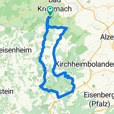 4TT26 C3 Donnersberg
- Distance
- 86.3 km
- Ascent
- 1,439 m
- Descent
- 1,440 m
- Location
- Bad Münster am Stein-Ebernburg, Rhineland-Palatinate, Germany
 Rundroute Bad Münster, NaheRW und KleinbahnRW
- Distance
- 55.4 km
- Ascent
- 725 m
- Descent
- 775 m
- Location
- Bad Münster am Stein-Ebernburg, Rhineland-Palatinate, Germany
 Tagesausflug im Sommer 2017
- Distance
- 58.1 km
- Ascent
- 417 m
- Descent
- 420 m
- Location
- Bad Münster am Stein-Ebernburg, Rhineland-Palatinate, Germany
 An der Nahe
- Distance
- 47 km
- Ascent
- 376 m
- Descent
- 264 m
- Location
- Bad Münster am Stein-Ebernburg, Rhineland-Palatinate, Germany
 4TT26 C1 Stromberg
- Distance
- 75.6 km
- Ascent
- 1,253 m
- Descent
- 1,254 m
- Location
- Bad Münster am Stein-Ebernburg, Rhineland-Palatinate, Germany
 4TT26 E3 Donnersberg
- Distance
- 131.8 km
- Ascent
- 2,313 m
- Descent
- 2,314 m
- Location
- Bad Münster am Stein-Ebernburg, Rhineland-Palatinate, Germany
 4TT26 E2 Hunsrück
- Distance
- 139.2 km
- Ascent
- 2,448 m
- Descent
- 2,447 m
- Location
- Bad Münster am Stein-Ebernburg, Rhineland-Palatinate, Germany
 Zur Alsenz, Bad Kreuznach nach Bad Kreuznach, Bad Kreuznach
- Distance
- 6.7 km
- Ascent
- 56 m
- Descent
- 66 m
- Location
- Bad Münster am Stein-Ebernburg, Rhineland-Palatinate, Germany
Open it in the app