
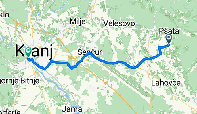
Cerklje na Gorenjskem - Kranj
A cycling route starting in Cerklje na Gorenjskem, Municipality of Cerklje na Gorenjskem, Slovenia.
Overview
About this route
- 55 min
- Duration
- 16.4 km
- Distance
- 107 m
- Ascent
- 126 m
- Descent
- 17.8 km/h
- Avg. speed
- 406 m
- Max. altitude

Route quality
Waytypes & surfaces along the route
Waytypes
Quiet road
11.7 km
(71 %)
Cycleway
3.6 km
(22 %)
Surfaces
Paved
14 km
(85 %)
Asphalt
13.8 km
(84 %)
Paved (undefined)
0.2 km
(1 %)
Undefined
2.5 km
(15 %)
Continue with Bikemap
Use, edit, or download this cycling route
You would like to ride Cerklje na Gorenjskem - Kranj or customize it for your own trip? Here is what you can do with this Bikemap route:
Free features
- Save this route as favorite or in collections
- Copy & plan your own version of this route
- Sync your route with Garmin or Wahoo
Premium features
Free trial for 3 days, or one-time payment. More about Bikemap Premium.
- Navigate this route on iOS & Android
- Export a GPX / KML file of this route
- Create your custom printout (try it for free)
- Download this route for offline navigation
Discover more Premium features.
Get Bikemap PremiumFrom our community
Other popular routes starting in Cerklje na Gorenjskem
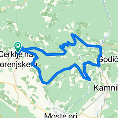
 Nova tura
- Distance
- 36.1 km
- Ascent
- 257 m
- Descent
- 258 m
- Location
- Cerklje na Gorenjskem, Municipality of Cerklje na Gorenjskem, Slovenia
 Od žičnice na krvavec
- Distance
- 24.9 km
- Ascent
- 1,296 m
- Descent
- 1,373 m
- Location
- Cerklje na Gorenjskem, Municipality of Cerklje na Gorenjskem, Slovenia
 sportstracker-MountainBiking-2025-05-28T13-09-26Z
- Distance
- 36.7 km
- Ascent
- 1,121 m
- Descent
- 1,120 m
- Location
- Cerklje na Gorenjskem, Municipality of Cerklje na Gorenjskem, Slovenia
 Relaxed route
- Distance
- 37.6 km
- Ascent
- 302 m
- Descent
- 185 m
- Location
- Cerklje na Gorenjskem, Municipality of Cerklje na Gorenjskem, Slovenia
 Krvavec - Zvoh
- Distance
- 30.9 km
- Ascent
- 1,577 m
- Descent
- 1,592 m
- Location
- Cerklje na Gorenjskem, Municipality of Cerklje na Gorenjskem, Slovenia
 Cerkljansko & Kamniško
- Distance
- 45.6 km
- Ascent
- 1,159 m
- Descent
- 1,161 m
- Location
- Cerklje na Gorenjskem, Municipality of Cerklje na Gorenjskem, Slovenia
 Okolo Grintovca:)
- Distance
- 134.8 km
- Ascent
- 1,890 m
- Descent
- 1,890 m
- Location
- Cerklje na Gorenjskem, Municipality of Cerklje na Gorenjskem, Slovenia
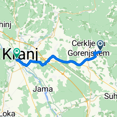 Cerklje na Gorenjskem - Kranj
- Distance
- 16.4 km
- Ascent
- 107 m
- Descent
- 126 m
- Location
- Cerklje na Gorenjskem, Municipality of Cerklje na Gorenjskem, Slovenia
Open it in the app