
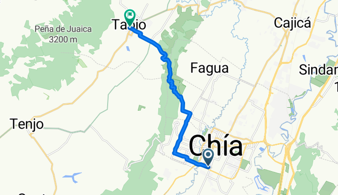
De Carrera a Tabio
A cycling route starting in Chía, Cundinamarca, Colombia.
Overview
About this route
- 1 h 22 min
- Duration
- 11.2 km
- Distance
- 181 m
- Ascent
- 154 m
- Descent
- 8.3 km/h
- Avg. speed
- 2,662 m
- Max. altitude

Route quality
Waytypes & surfaces along the route
Waytypes
Road
10.1 km
(90 %)
Quiet road
0.9 km
(8 %)
Undefined
0.2 km
(2 %)
Surfaces
Paved
5.6 km
(50 %)
Unpaved
4.6 km
(41 %)
Unpaved (undefined)
4.6 km
(41 %)
Asphalt
4.2 km
(37 %)
Continue with Bikemap
Use, edit, or download this cycling route
You would like to ride De Carrera a Tabio or customize it for your own trip? Here is what you can do with this Bikemap route:
Free features
- Save this route as favorite or in collections
- Copy & plan your own version of this route
- Sync your route with Garmin or Wahoo
Premium features
Free trial for 3 days, or one-time payment. More about Bikemap Premium.
- Navigate this route on iOS & Android
- Export a GPX / KML file of this route
- Create your custom printout (try it for free)
- Download this route for offline navigation
Discover more Premium features.
Get Bikemap PremiumFrom our community
Other popular routes starting in Chía
 Ruta a Via A Tabio
- Distance
- 35.7 km
- Ascent
- 964 m
- Descent
- 963 m
- Location
- Chía, Cundinamarca, Colombia
 De Vía Chia - Tabio a Vía Chia - Tabio
- Distance
- 16.6 km
- Ascent
- 349 m
- Descent
- 375 m
- Location
- Chía, Cundinamarca, Colombia
 De Vía Chia - Tabio a Vía Chia - Tabio
- Distance
- 36.2 km
- Ascent
- 397 m
- Descent
- 419 m
- Location
- Chía, Cundinamarca, Colombia
 De Vía Fonquetá a Carrera 7a 3-86
- Distance
- 27.7 km
- Ascent
- 297 m
- Descent
- 300 m
- Location
- Chía, Cundinamarca, Colombia
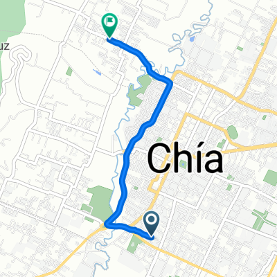 De Carrera a Vía Chia - Tabio
- Distance
- 3.8 km
- Ascent
- 69 m
- Descent
- 61 m
- Location
- Chía, Cundinamarca, Colombia
 De VW4H+M8 a Via Fagua
- Distance
- 11.9 km
- Ascent
- 244 m
- Descent
- 281 m
- Location
- Chía, Cundinamarca, Colombia
 Pionono
- Distance
- 38.3 km
- Ascent
- 312 m
- Descent
- 317 m
- Location
- Chía, Cundinamarca, Colombia
 De Calle a Calle # 1-37
- Distance
- 45.3 km
- Ascent
- 993 m
- Descent
- 1,012 m
- Location
- Chía, Cundinamarca, Colombia
Open it in the app