
Von Gundelfingen bis Taizé
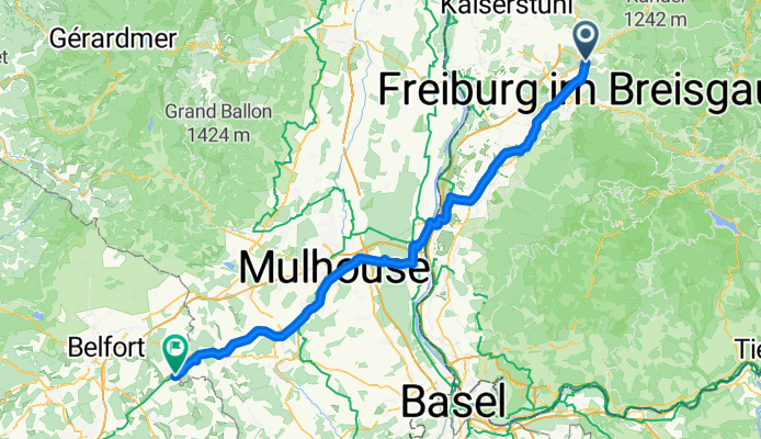
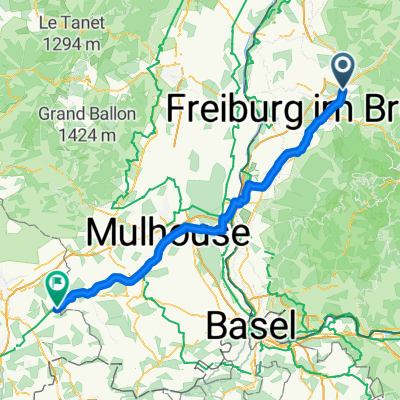
Gundelfingen - Montreux-Château
A cycling route starting in Gundelfingen, Baden-Wurttemberg, Germany.
Overview
About this route
- 5 h 38 min
- Duration
- 98.9 km
- Distance
- 353 m
- Ascent
- 241 m
- Descent
- 17.6 km/h
- Avg. speed
- 354 m
- Max. altitude
Part of
Von Gundelfingen bis Taizé
5 stages
Route quality
Waytypes & surfaces along the route
Waytypes
Path
30.7 km
(31 %)
Access road
20.8 km
(21 %)
Surfaces
Paved
90 km
(91 %)
Unpaved
4 km
(4 %)
Asphalt
86 km
(87 %)
Paved (undefined)
3 km
(3 %)
Continue with Bikemap
Use, edit, or download this cycling route
You would like to ride Gundelfingen - Montreux-Château or customize it for your own trip? Here is what you can do with this Bikemap route:
Free features
- Save this route as favorite or in collections
- Copy & plan your own version of this route
- Split it into stages to create a multi-day tour
- Sync your route with Garmin or Wahoo
Premium features
Free trial for 3 days, or one-time payment. More about Bikemap Premium.
- Navigate this route on iOS & Android
- Export a GPX / KML file of this route
- Create your custom printout (try it for free)
- Download this route for offline navigation
Discover more Premium features.
Get Bikemap PremiumFrom our community
Other popular routes starting in Gundelfingen
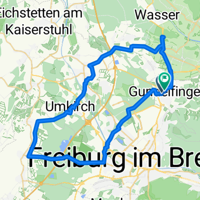
 Rundkurs Gundelfingen - St. Peter
- Distance
- 38.9 km
- Ascent
- 674 m
- Descent
- 568 m
- Location
- Gundelfingen, Baden-Wurttemberg, Germany
 Gundelfingen - Montreux-Château
- Distance
- 98.9 km
- Ascent
- 353 m
- Descent
- 241 m
- Location
- Gundelfingen, Baden-Wurttemberg, Germany
 freiburg - kirchzarten
- Distance
- 15.7 km
- Ascent
- 192 m
- Descent
- 40 m
- Location
- Gundelfingen, Baden-Wurttemberg, Germany
 Schlossberg-Rosskopf Tour
- Distance
- 26.8 km
- Ascent
- 829 m
- Descent
- 829 m
- Location
- Gundelfingen, Baden-Wurttemberg, Germany
 Höllental - Ibenbachtal - St. Peter - Glottertal
- Distance
- 43.6 km
- Ascent
- 536 m
- Descent
- 538 m
- Location
- Gundelfingen, Baden-Wurttemberg, Germany
 Mühlenstraße nach Mühlenstraße
- Distance
- 39.4 km
- Ascent
- 145 m
- Descent
- 144 m
- Location
- Gundelfingen, Baden-Wurttemberg, Germany
 Gundelfingen-Freiamt-Streitberg-Nordweil
- Distance
- 59.2 km
- Ascent
- 409 m
- Descent
- 431 m
- Location
- Gundelfingen, Baden-Wurttemberg, Germany
 Gundelfingen Kandelhöhenweg
- Distance
- 33.8 km
- Ascent
- 696 m
- Descent
- 697 m
- Location
- Gundelfingen, Baden-Wurttemberg, Germany
Open it in the app