
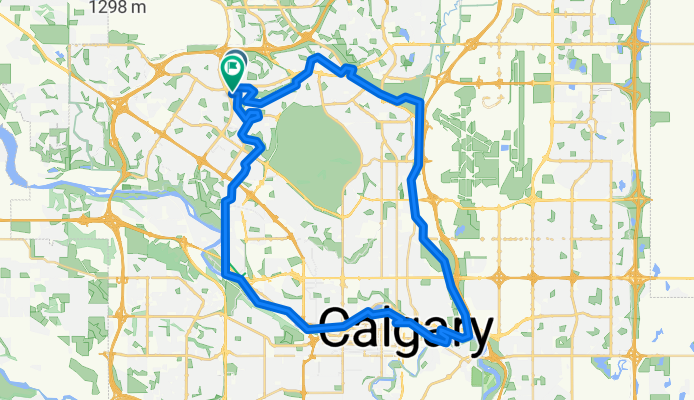
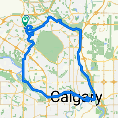
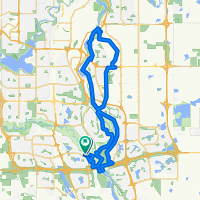
20250920 RCSS Edgemont Nose Creek south Bow River west Home Rd north LOOP
A cycling route starting in Calgary, Alberta, Canada.
Overview
About this route
- 2 h 49 min
- Duration
- 48.4 km
- Distance
- 368 m
- Ascent
- 370 m
- Descent
- 17.2 km/h
- Avg. speed
- 1,251 m
- Max. altitude

Route quality
Waytypes & surfaces along the route
Waytypes
Cycleway
39.2 km
(81 %)
Road
4.4 km
(9 %)
Surfaces
Paved
46 km
(95 %)
Asphalt
42.6 km
(88 %)
Paved (undefined)
2.9 km
(6 %)
Continue with Bikemap
Use, edit, or download this cycling route
You would like to ride 20250920 RCSS Edgemont Nose Creek south Bow River west Home Rd north LOOP or customize it for your own trip? Here is what you can do with this Bikemap route:
Free features
- Save this route as favorite or in collections
- Copy & plan your own version of this route
- Sync your route with Garmin or Wahoo
Premium features
Free trial for 3 days, or one-time payment. More about Bikemap Premium.
- Navigate this route on iOS & Android
- Export a GPX / KML file of this route
- Create your custom printout (try it for free)
- Download this route for offline navigation
Discover more Premium features.
Get Bikemap PremiumFrom our community
Other popular routes starting in Calgary
 20250920 RCSS Edgemont Nose Creek south Bow River west Home Rd north LOOP
- Distance
- 48.4 km
- Ascent
- 368 m
- Descent
- 370 m
- Location
- Calgary, Alberta, Canada
 Route 2
- Distance
- 17.5 km
- Ascent
- 146 m
- Descent
- 52 m
- Location
- Calgary, Alberta, Canada
 Crescent Heights - Bow River South 30K
- Distance
- 32.9 km
- Ascent
- 121 m
- Descent
- 122 m
- Location
- Calgary, Alberta, Canada
 37th/Leighton Centre Loop
- Distance
- 42.9 km
- Ascent
- 506 m
- Descent
- 508 m
- Location
- Calgary, Alberta, Canada
 leg 2
leg 2- Distance
- 14.3 km
- Ascent
- 548 m
- Descent
- 399 m
- Location
- Calgary, Alberta, Canada
 Fish Creek - Stoney Bridge - Cranston Ridge - Riverstone - Fish Creek Bridge Loop
- Distance
- 26.8 km
- Ascent
- 209 m
- Descent
- 195 m
- Location
- Calgary, Alberta, Canada
 Fish Creek - Stoney Bridge - McKenzie Ridge - Ogden Road - Irrigation Canal - Glenmore Trail - 24th St - Sue Higgins Bridge Loop
- Distance
- 43.6 km
- Ascent
- 188 m
- Descent
- 176 m
- Location
- Calgary, Alberta, Canada
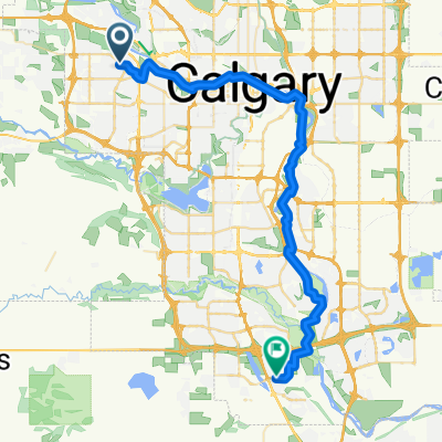 Coachway Gdns SW, Calgary to Walden Gate SE, Calgary
- Distance
- 41.7 km
- Ascent
- 177 m
- Descent
- 355 m
- Location
- Calgary, Alberta, Canada
Open it in the app