

방교동, 화성시에서 동부대로, 화성시까지
A cycling route starting in Osan, Gyeonggi-do, South Korea.
Overview
About this route
- 28 min
- Duration
- 3.6 km
- Distance
- 31 m
- Ascent
- 23 m
- Descent
- 7.6 km/h
- Avg. speed
- 39 m
- Max. altitude

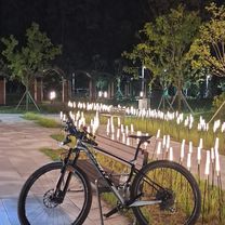
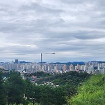
Route photos

Continue with Bikemap
Use, edit, or download this cycling route
You would like to ride 방교동, 화성시에서 동부대로, 화성시까지 or customize it for your own trip? Here is what you can do with this Bikemap route:
Free features
- Save this route as favorite or in collections
- Copy & plan your own version of this route
- Sync your route with Garmin or Wahoo
Premium features
Free trial for 3 days, or one-time payment. More about Bikemap Premium.
- Navigate this route on iOS & Android
- Export a GPX / KML file of this route
- Create your custom printout (try it for free)
- Download this route for offline navigation
Discover more Premium features.
Get Bikemap PremiumFrom our community
Other popular routes starting in Osan
 393-20 393-20 ~ 오산동
- Distance
- 29.7 km
- Ascent
- 176 m
- Descent
- 153 m
- Location
- Osan, Gyeonggi-do, South Korea
 함정카드ㄷㄷㄷㄷ
- Distance
- 18.2 km
- Ascent
- 246 m
- Descent
- 255 m
- Location
- Osan, Gyeonggi-do, South Korea
 with chanhoo
- Distance
- 57.5 km
- Ascent
- 308 m
- Descent
- 360 m
- Location
- Osan, Gyeonggi-do, South Korea
![롯데캐슬.호반베르디움Ph0]으로 라우팅](https://media.bikemap.net/routes/17273074/gallery/thumbs/5ea4c6d7-d8a7-42a6-8a26-ca91c44eae3a.jpg.208x208_q80_crop.jpg) 롯데캐슬.호반베르디움Ph0]으로 라우팅
롯데캐슬.호반베르디움Ph0]으로 라우팅- Distance
- 9 km
- Ascent
- 508 m
- Descent
- 529 m
- Location
- Osan, Gyeonggi-do, South Korea
![Ph0]에서 경로B140호 393-20](https://media.bikemap.net/routes/17604210/gallery/thumbs/defd9bcd-af53-4ff5-b60a-f9971498acc8.jpg.208x208_q80_crop.jpg) Ph0]에서 경로B140호 393-20
Ph0]에서 경로B140호 393-20- Distance
- 33.2 km
- Ascent
- 243 m
- Descent
- 219 m
- Location
- Osan, Gyeonggi-do, South Korea
 오산동 ~ 오산동
- Distance
- 42.7 km
- Ascent
- 259 m
- Descent
- 284 m
- Location
- Osan, Gyeonggi-do, South Korea
 방교동, 화성시에서 동부대로, 화성시까지
- Distance
- 3.6 km
- Ascent
- 31 m
- Descent
- 23 m
- Location
- Osan, Gyeonggi-do, South Korea
![고림동Ph0]으로 라우팅](https://www.bikemap.net/media/temp/routes_gallery/c98f9c94-a100-4990-8bcc-14f7e8ccc070.jpg) 고림동Ph0]으로 라우팅
고림동Ph0]으로 라우팅- Distance
- 14.7 km
- Ascent
- 51 m
- Descent
- 114 m
- Location
- Osan, Gyeonggi-do, South Korea
Open it in the app