

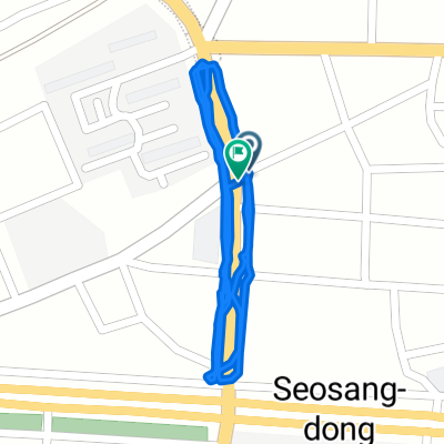
느린 주행
A cycling route starting in Changwon, Gyeongsangnam-do, South Korea.
Overview
About this route
- 1 h 38 min
- Duration
- 1.5 km
- Distance
- 94 m
- Ascent
- 126 m
- Descent
- 0.9 km/h
- Avg. speed
- 36 m
- Max. altitude

Continue with Bikemap
Use, edit, or download this cycling route
You would like to ride 느린 주행 or customize it for your own trip? Here is what you can do with this Bikemap route:
Free features
- Save this route as favorite or in collections
- Copy & plan your own version of this route
- Sync your route with Garmin or Wahoo
Premium features
Free trial for 3 days, or one-time payment. More about Bikemap Premium.
- Navigate this route on iOS & Android
- Export a GPX / KML file of this route
- Create your custom printout (try it for free)
- Download this route for offline navigation
Discover more Premium features.
Get Bikemap PremiumFrom our community
Other popular routes starting in Changwon
 보통 경로
보통 경로- Distance
- 2.2 km
- Ascent
- 81 m
- Descent
- 107 m
- Location
- Changwon, Gyeongsangnam-do, South Korea
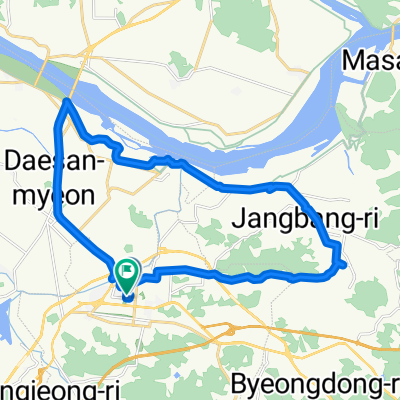
 Daesan-myeon 747 to Bugok-myeon 234-2, Changyeong
- Distance
- 48.6 km
- Ascent
- 126 m
- Descent
- 87 m
- Location
- Changwon, Gyeongsangnam-do, South Korea
![하단동 1149-30Ph0]으로 라우팅](https://media.bikemap.net/routes/17681529/gallery/thumbs/d6447977-3b58-49ae-9fa9-7faab52285a4.jpg.208x208_q80_crop.jpg) 하단동 1149-30Ph0]으로 라우팅
하단동 1149-30Ph0]으로 라우팅- Distance
- 72.7 km
- Ascent
- 226 m
- Descent
- 261 m
- Location
- Changwon, Gyeongsangnam-do, South Korea
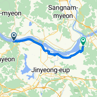
 진영읍 ~ 진영읍
- Distance
- 27.7 km
- Ascent
- 171 m
- Descent
- 208 m
- Location
- Changwon, Gyeongsangnam-do, South Korea
 Changwon - Kimhae
- Distance
- 19.2 km
- Ascent
- 62 m
- Descent
- 61 m
- Location
- Changwon, Gyeongsangnam-do, South Korea
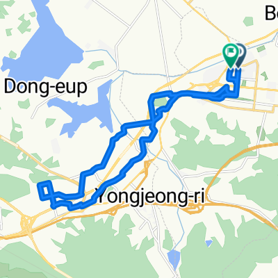 서재골공원 ~ 서재골공원
- Distance
- 17.6 km
- Ascent
- 82 m
- Descent
- 83 m
- Location
- Changwon, Gyeongsangnam-do, South Korea
 느린 주행
느린 주행- Distance
- 1.5 km
- Ascent
- 94 m
- Descent
- 126 m
- Location
- Changwon, Gyeongsangnam-do, South Korea
 35.222, 128.675에서 35.232, 128.689까지
- Distance
- 9.2 km
- Ascent
- 103 m
- Descent
- 85 m
- Location
- Changwon, Gyeongsangnam-do, South Korea
Open it in the app