
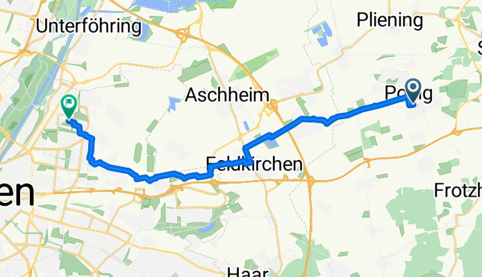
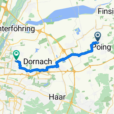
Buchenweg nach Ruth-Drexel-Straße
A cycling route starting in Poing, Bavaria, Germany.
Overview
About this route
- 1 h 5 min
- Duration
- 18.1 km
- Distance
- 34 m
- Ascent
- 30 m
- Descent
- 16.7 km/h
- Avg. speed
- 525 m
- Max. altitude
Route photos


Route quality
Waytypes & surfaces along the route
Waytypes
Quiet road
9.1 km
(50 %)
Path
7.4 km
(41 %)
Surfaces
Paved
15.6 km
(86 %)
Unpaved
0.7 km
(4 %)
Asphalt
15.6 km
(86 %)
Loose gravel
0.5 km
(3 %)
Continue with Bikemap
Use, edit, or download this cycling route
You would like to ride Buchenweg nach Ruth-Drexel-Straße or customize it for your own trip? Here is what you can do with this Bikemap route:
Free features
- Save this route as favorite or in collections
- Copy & plan your own version of this route
- Sync your route with Garmin or Wahoo
Premium features
Free trial for 3 days, or one-time payment. More about Bikemap Premium.
- Navigate this route on iOS & Android
- Export a GPX / KML file of this route
- Create your custom printout (try it for free)
- Download this route for offline navigation
Discover more Premium features.
Get Bikemap PremiumFrom our community
Other popular routes starting in Poing
 Buchenweg nach Ruth-Drexel-Straße
- Distance
- 18.1 km
- Ascent
- 34 m
- Descent
- 30 m
- Location
- Poing, Bavaria, Germany
 Rundfahrt nach Ebersberg
- Distance
- 44.8 km
- Ascent
- 134 m
- Descent
- 137 m
- Location
- Poing, Bavaria, Germany
 Poing-Glonn-Holzkirchen-Poing
- Distance
- 97.8 km
- Ascent
- 829 m
- Descent
- 794 m
- Location
- Poing, Bavaria, Germany
 Poinger/Zorendinger Runde
- Distance
- 42.8 km
- Ascent
- 340 m
- Descent
- 322 m
- Location
- Poing, Bavaria, Germany
 Poing - Forstern - Isen - MS - Poing
- Distance
- 54.8 km
- Ascent
- 275 m
- Descent
- 278 m
- Location
- Poing, Bavaria, Germany
 Poing, Poing nach Bogenhausen, München
- Distance
- 16.4 km
- Ascent
- 34 m
- Descent
- 27 m
- Location
- Poing, Bavaria, Germany
 Isar Mühle
- Distance
- 45.1 km
- Ascent
- 59 m
- Descent
- 59 m
- Location
- Poing, Bavaria, Germany
 Poing Ebersbergerforst Poing
- Distance
- 46.2 km
- Ascent
- 153 m
- Descent
- 152 m
- Location
- Poing, Bavaria, Germany
Open it in the app