

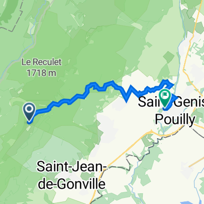
Tiocan zakruta do Crozet cez modru
A cycling route starting in Saint-Jean-de-Gonville, Auvergne-Rhône-Alpes, France.
Overview
About this route
0
- 2:36 h
- Duration
- 16.4 km
- Distance
- 796 m
- Ascent
- 873 m
- Descent
- 6.3 km/h
- Avg. speed
- 1,076 m
- Max. altitude
sfsolaris
created this 1 month ago
Route quality
Waytypes & surfaces along the route
Waytypes
Track
6.5 km
40 %
Quiet road
5.4 km
33 %
Surfaces
Paved
5.4 km
(33 %)
Unpaved
7.2 km
(44 %)
Asphalt
5.4 km
33 %
Gravel
4.9 km
30 %
Continue with Bikemap
Use, edit, or download this cycling route
You would like to ride Tiocan zakruta do Crozet cez modru or customize it for your own trip? Here is what you can do with this Bikemap route:
Free features
- Save this route as favorite or in collections
- Copy & plan your own version of this route
- Sync your route with Garmin or Wahoo
Premium features
Free trial for 3 days, or one-time payment. More about Bikemap Premium.
- Navigate this route on iOS & Android
- Export a GPX / KML file of this route
- Create your custom printout (try it for free)
- Download this route for offline navigation
Discover more Premium features.
Get Bikemap PremiumFrom our community
Other popular routes starting in Saint-Jean-de-Gonville
- De Chemin du Pré la Tour, Saint-Jean-de-Gonville à 81 Rue des Corneilles, Péron0
- 4.5 km
- 87 m
- 32 m
- Saint-Jean-de-Gonville, Auvergne-Rhône-Alpes, France
- 263 Rue du Bourg, Saint-Jean de Gonville to 48 Lotissement Le Clos Saint-Jean, Saint-Jean de Gonville0
- 38.4 km
- 463 m
- 465 m
- Saint-Jean-de-Gonville, Auvergne-Rhône-Alpes, France
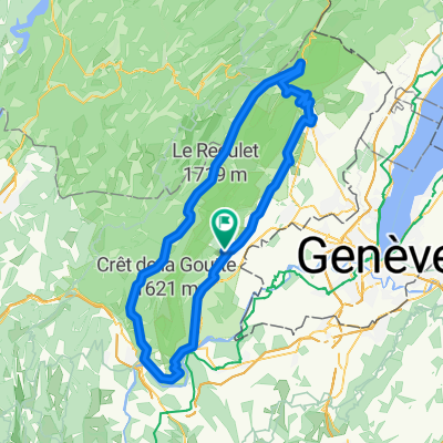
- Saint-Jean-de-Gonville - Culoz0
- 108.2 km
- 2,440 m
- 3,491 m
- Saint-Jean-de-Gonville, Auvergne-Rhône-Alpes, France


Open it in the app