

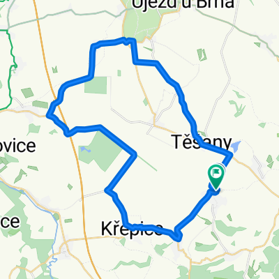
Ždánický les - k rybníku Horáček
A cycling route starting in Šitbořice, South Moravian, Czechia.
Overview
About this route
I haven't been there in a long time, I had to check if the pond is still there :)
- -:--
- Duration
- 31 km
- Distance
- 368 m
- Ascent
- 367 m
- Descent
- ---
- Avg. speed
- ---
- Max. altitude

Route quality
Waytypes & surfaces along the route
Waytypes
Track
27.3 km
(88 %)
Access road
2.8 km
(9 %)
Quiet road
0.9 km
(3 %)
Surfaces
Paved
13 km
(42 %)
Unpaved
14.9 km
(48 %)
Paved (undefined)
12.7 km
(41 %)
Ground
9 km
(29 %)
Continue with Bikemap
Use, edit, or download this cycling route
You would like to ride Ždánický les - k rybníku Horáček or customize it for your own trip? Here is what you can do with this Bikemap route:
Free features
- Save this route as favorite or in collections
- Copy & plan your own version of this route
- Sync your route with Garmin or Wahoo
Premium features
Free trial for 3 days, or one-time payment. More about Bikemap Premium.
- Navigate this route on iOS & Android
- Export a GPX / KML file of this route
- Create your custom printout (try it for free)
- Download this route for offline navigation
Discover more Premium features.
Get Bikemap PremiumFrom our community
Other popular routes starting in Šitbořice
 Okruh severozápad od Šitek
- Distance
- 34.3 km
- Ascent
- 180 m
- Descent
- 187 m
- Location
- Šitbořice, South Moravian, Czechia
 bike 9.3.2011 (schwinn)
- Distance
- 31.9 km
- Ascent
- 371 m
- Descent
- 374 m
- Location
- Šitbořice, South Moravian, Czechia
 Šitbořice - Mohyla míru I.
- Distance
- 41.1 km
- Ascent
- 411 m
- Descent
- 408 m
- Location
- Šitbořice, South Moravian, Czechia
 Cesta na Mohylu
- Distance
- 40.4 km
- Ascent
- 340 m
- Descent
- 340 m
- Location
- Šitbořice, South Moravian, Czechia
 Bořetice I
- Distance
- 37.1 km
- Ascent
- 579 m
- Descent
- 579 m
- Location
- Šitbořice, South Moravian, Czechia
 Šitbořice - rozhledna Hustopeče a zpět
- Distance
- 25.6 km
- Ascent
- 394 m
- Descent
- 394 m
- Location
- Šitbořice, South Moravian, Czechia
 Šitbořice - Otnice - Klobouky - Boleradice - Šitbořice
- Distance
- 45.4 km
- Ascent
- 383 m
- Descent
- 383 m
- Location
- Šitbořice, South Moravian, Czechia
 První 2013
- Distance
- 12.7 km
- Ascent
- 180 m
- Descent
- 180 m
- Location
- Šitbořice, South Moravian, Czechia
Open it in the app