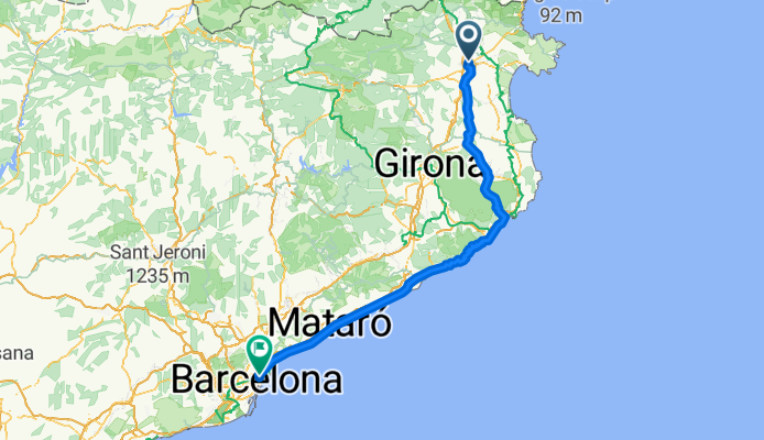
Cycling Route in Figueres, Catalonia, Spain
[2ème jour] Figueres - Barcelone

Open this route in Bikemap Web
Distance
Ascent
Descent
Duration
Avg. Speed
Max. Elevation
Cycling Route in Figueres, Catalonia, Spain

Open this route in Bikemap Web
Figueres : rond point de sortie sud/sud-est Pla de Sant Pau puis suivre la route jusqu'au 5ème rond point après Santa Llogaia d'Alguema, prendre la sortie du rond après celle direction Vilamorell.
Garrigàs
Vilaür
Camallera
Gaüses
La Garriga Petita
Pla de Roda (Carretera de Diana puis Cani de Sobranigues)
Sobranigues (Cani de Sobranigues)
Flaçà (Carretera Girona-Palamos)
Bosc de la Pedrera (Carretera Girona-Palamos)
Corçà (abords)(Carretera Girona-Palamos)
La Bisbal d'Empordà
Sant Pol
Cantera
Calonge
Sant Antoni de Calonge
Torre Valentina
Platja d'Aro
S'Agaro
Sant Feliu de Guixols
Unrbanitzacio Giverola (abords)
Tossa de Mar
Font de Sant Llorenç (abords)
Lloret de Mar
Plana d'en Roviralta
Serra Llarga
Santa Bàrbara
Blanes
Palafolls (abords)
Malgrat de Mar (abords)
Pineda de Mar
Calella
Sant Pol de Mar
Canet de Mar
Arenys de Mar
Caldes d'Estrac
Mataro
Vilassar de Mar
Premià de Mar
el Masnou
Mongat
Badalona
Sant Adrià se Besòs
Barcelona

You can use this route as a template in our cycling route planner so that you don’t have to start from scratch. Customize it based on your needs to plan your perfect cycling tour.