Val di Ledro - Pian d'Oneda
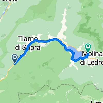
A cycling route starting in Condino, Trentino-Alto Adige, Italy.
Overview
About this route
Proposta gita Aribi co partenza dal Passo d?Ampola ed arrivo a Pian d'Oneda
- -:--
- Duration
- 47.9 km
- Distance
- 195 m
- Ascent
- 547 m
- Descent
- ---
- Avg. speed
- ---
- Avg. speed
Route quality
Waytypes & surfaces along the route
Waytypes
Quiet road
14.3 km
(30 %)
Cycleway
13.2 km
(28 %)
Surfaces
Paved
38.3 km
(80 %)
Unpaved
4.8 km
(10 %)
Asphalt
29.4 km
(61 %)
Paved (undefined)
8.5 km
(18 %)
Continue with Bikemap
Use, edit, or download this cycling route
You would like to ride Val di Ledro - Pian d'Oneda or customize it for your own trip? Here is what you can do with this Bikemap route:
Free features
- Save this route as favorite or in collections
- Copy & plan your own version of this route
- Sync your route with Garmin or Wahoo
Premium features
Free trial for 3 days, or one-time payment. More about Bikemap Premium.
- Navigate this route on iOS & Android
- Export a GPX / KML file of this route
- Create your custom printout (try it for free)
- Download this route for offline navigation
Discover more Premium features.
Get Bikemap PremiumFrom our community
Other popular routes starting in Condino
- Val di Ledro - Pian d'Oneda
- Distance
- 47.9 km
- Ascent
- 195 m
- Descent
- 547 m
- Location
- Condino, Trentino-Alto Adige, Italy
- Tremalzo
- Distance
- 12.4 km
- Ascent
- 992 m
- Descent
- 45 m
- Location
- Condino, Trentino-Alto Adige, Italy
- Via al Lago d'Ampola, Ledro do Via al Lago d'Ampola 8, Ledro
- Distance
- 71.3 km
- Ascent
- 5,979 m
- Descent
- 6,059 m
- Location
- Condino, Trentino-Alto Adige, Italy
- Heckmair - objizdka Lago dell'Ampola
- Distance
- 25.8 km
- Ascent
- 1,310 m
- Descent
- 1,973 m
- Location
- Condino, Trentino-Alto Adige, Italy
- Ampola
- Distance
- 30.6 km
- Ascent
- 230 m
- Descent
- 735 m
- Location
- Condino, Trentino-Alto Adige, Italy
- Riva del Garda-4
- Distance
- 43.2 km
- Ascent
- 1,167 m
- Descent
- 1,819 m
- Location
- Condino, Trentino-Alto Adige, Italy
- Tremalzo-Pass
- Distance
- 32 km
- Ascent
- 1,068 m
- Descent
- 1,071 m
- Location
- Condino, Trentino-Alto Adige, Italy
- Tremalzo
- Distance
- 13.1 km
- Ascent
- 1,068 m
- Descent
- 258 m
- Location
- Condino, Trentino-Alto Adige, Italy
Open it in the app