
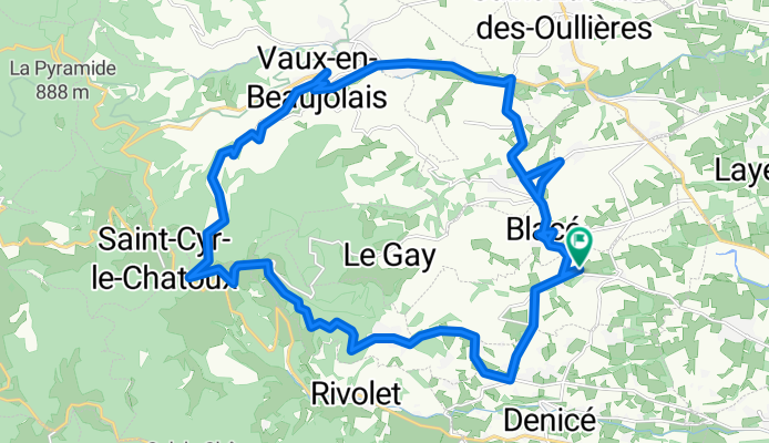
Beaujolais_Circuit_01
A cycling route starting in Blacé, Auvergne-Rhône-Alpes, France.
Overview
About this route
Circuit au départ de Saint Julien
- -:--
- Duration
- 28.4 km
- Distance
- 564 m
- Ascent
- 564 m
- Descent
- ---
- Avg. speed
- ---
- Max. altitude
Route quality
Waytypes & surfaces along the route
Waytypes
Road
21.9 km
(77 %)
Quiet road
1.7 km
(6 %)
Undefined
4.8 km
(17 %)
Surfaces
Paved
8.5 km
(30 %)
Asphalt
8.5 km
(30 %)
Undefined
19.9 km
(70 %)
Continue with Bikemap
Use, edit, or download this cycling route
You would like to ride Beaujolais_Circuit_01 or customize it for your own trip? Here is what you can do with this Bikemap route:
Free features
- Save this route as favorite or in collections
- Copy & plan your own version of this route
- Sync your route with Garmin or Wahoo
Premium features
Free trial for 3 days, or one-time payment. More about Bikemap Premium.
- Navigate this route on iOS & Android
- Export a GPX / KML file of this route
- Create your custom printout (try it for free)
- Download this route for offline navigation
Discover more Premium features.
Get Bikemap PremiumFrom our community
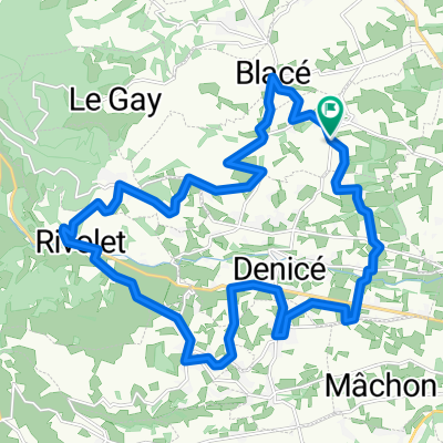
Other popular routes starting in Blacé
 beaujolais 2013 cogny
- Distance
- 23.4 km
- Ascent
- 417 m
- Descent
- 420 m
- Location
- Blacé, Auvergne-Rhône-Alpes, France
 De D19, Salles-Arbuissonnas-en-Beaujolais à D19, Salles-Arbuissonnas-en-Beaujolais
- Distance
- 25.5 km
- Ascent
- 386 m
- Descent
- 455 m
- Location
- Blacé, Auvergne-Rhône-Alpes, France
 Parcours autours Saint Julien Rhone
- Distance
- 25.9 km
- Ascent
- 515 m
- Descent
- 519 m
- Location
- Blacé, Auvergne-Rhône-Alpes, France
 bruno chercher son fiol
- Distance
- 39.8 km
- Ascent
- 237 m
- Descent
- 229 m
- Location
- Blacé, Auvergne-Rhône-Alpes, France
 Cols du Beaujolais
- Distance
- 83.2 km
- Ascent
- 1,834 m
- Descent
- 1,832 m
- Location
- Blacé, Auvergne-Rhône-Alpes, France
 Biucokiques Blacé
- Distance
- 25.5 km
- Ascent
- 752 m
- Descent
- 760 m
- Location
- Blacé, Auvergne-Rhône-Alpes, France
 De 774 Chemin des Côtes, Saint-Julien à 1–64 Rue de l'Église, Odenas
- Distance
- 8.5 km
- Ascent
- 480 m
- Descent
- 467 m
- Location
- Blacé, Auvergne-Rhône-Alpes, France
 09 fevrier
- Distance
- 15.8 km
- Ascent
- 513 m
- Descent
- 513 m
- Location
- Blacé, Auvergne-Rhône-Alpes, France
Open it in the app