
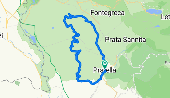
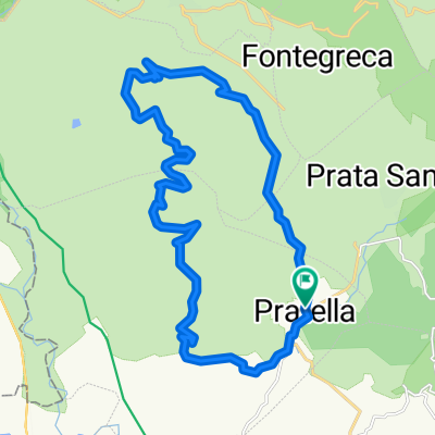
Pratella - Ciorlano - Pale eoliche
A cycling route starting in Pratella, Campania, Italy.
Overview
About this route
Departure from Pratella, direction Ciorlano to then climb in altitude in the area of wind turbines and descend from the opposite side for the return to Pratella.
- -:--
- Duration
- 25.7 km
- Distance
- 928 m
- Ascent
- 924 m
- Descent
- ---
- Avg. speed
- ---
- Max. altitude
Route highlights
Points of interest along the route
Point of interest after 11.8 km
Colle del Campo - 765m
Point of interest after 14.5 km
Monte Capritti - 757m
Point of interest after 18.3 km
Colle Cupone - 717m
Continue with Bikemap
Use, edit, or download this cycling route
You would like to ride Pratella - Ciorlano - Pale eoliche or customize it for your own trip? Here is what you can do with this Bikemap route:
Free features
- Save this route as favorite or in collections
- Copy & plan your own version of this route
- Sync your route with Garmin or Wahoo
Premium features
Free trial for 3 days, or one-time payment. More about Bikemap Premium.
- Navigate this route on iOS & Android
- Export a GPX / KML file of this route
- Create your custom printout (try it for free)
- Download this route for offline navigation
Discover more Premium features.
Get Bikemap PremiumFrom our community
Other popular routes starting in Pratella
 Pratella - Ciorlano - Pale eoliche
- Distance
- 25.7 km
- Ascent
- 928 m
- Descent
- 924 m
- Location
- Pratella, Campania, Italy
Open it in the app