
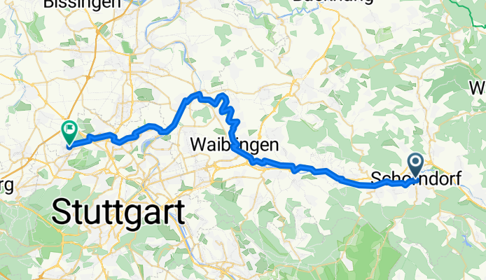
Remstalradweg Schornd.-Neckarrems
A cycling route starting in Schorndorf, Baden-Württemberg, Germany.
Overview
About this route
Flußwanderweg Schorndorf, Waiblingen, Neckarrems, Mühlhausen, Korntal
- -:--
- Duration
- 46.5 km
- Distance
- 241 m
- Ascent
- 183 m
- Descent
- ---
- Avg. speed
- ---
- Avg. speed

Route quality
Waytypes & surfaces along the route
Waytypes
Track
15.9 km
(34 %)
Quiet road
15.2 km
(33 %)
Surfaces
Paved
40.7 km
(87 %)
Unpaved
1.6 km
(3 %)
Asphalt
35.2 km
(76 %)
Concrete
3.9 km
(8 %)
Continue with Bikemap
Use, edit, or download this cycling route
You would like to ride Remstalradweg Schornd.-Neckarrems or customize it for your own trip? Here is what you can do with this Bikemap route:
Free features
- Save this route as favorite or in collections
- Copy & plan your own version of this route
- Sync your route with Garmin or Wahoo
Premium features
Free trial for 3 days, or one-time payment. More about Bikemap Premium.
- Navigate this route on iOS & Android
- Export a GPX / KML file of this route
- Create your custom printout (try it for free)
- Download this route for offline navigation
Discover more Premium features.
Get Bikemap PremiumFrom our community
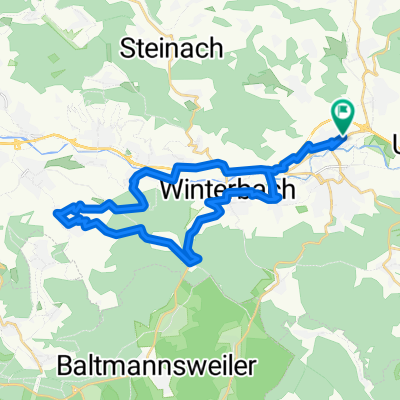
Other popular routes starting in Schorndorf
 Schorndorf - Winnenden
- Distance
- 24.5 km
- Ascent
- 155 m
- Descent
- 120 m
- Location
- Schorndorf, Baden-Württemberg, Germany
 Naturparktour
- Distance
- 50.3 km
- Ascent
- 786 m
- Descent
- 642 m
- Location
- Schorndorf, Baden-Württemberg, Germany
 Schdf-Schnait-Weinstadt-Schdf
- Distance
- 30.8 km
- Ascent
- 450 m
- Descent
- 453 m
- Location
- Schorndorf, Baden-Württemberg, Germany
 Von Schorndorf bis Stuttgart
- Distance
- 46.4 km
- Ascent
- 235 m
- Descent
- 252 m
- Location
- Schorndorf, Baden-Württemberg, Germany
 Schorndorf - Trinkwasser - Schönbühl
- Distance
- 32.5 km
- Ascent
- 475 m
- Descent
- 476 m
- Location
- Schorndorf, Baden-Württemberg, Germany
 Schorndorf-Tübingen über die Alb
- Distance
- 123.1 km
- Ascent
- 2,945 m
- Descent
- 2,818 m
- Location
- Schorndorf, Baden-Württemberg, Germany
 Schdf-Buoch-Kleinheppach-Rems-Schdf
- Distance
- 32.9 km
- Ascent
- 354 m
- Descent
- 353 m
- Location
- Schorndorf, Baden-Württemberg, Germany
 Schorndorf-Bärensee
- Distance
- 34.3 km
- Ascent
- 738 m
- Descent
- 601 m
- Location
- Schorndorf, Baden-Württemberg, Germany
Open it in the app