
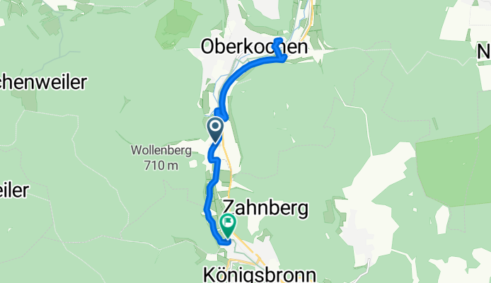
Oberkochen -Königsbronn
A cycling route starting in Oberkochen, Baden-Württemberg, Germany.
Overview
About this route
- 1 h 36 min
- Duration
- 10.9 km
- Distance
- 119 m
- Ascent
- 122 m
- Descent
- 6.9 km/h
- Avg. speed
- ---
- Avg. speed

Route quality
Waytypes & surfaces along the route
Waytypes
Track
4.9 km
(45 %)
Quiet road
2.4 km
(22 %)
Surfaces
Paved
10.9 km
(100 %)
Asphalt
10.9 km
(100 %)
Continue with Bikemap
Use, edit, or download this cycling route
You would like to ride Oberkochen -Königsbronn or customize it for your own trip? Here is what you can do with this Bikemap route:
Free features
- Save this route as favorite or in collections
- Copy & plan your own version of this route
- Sync your route with Garmin or Wahoo
Premium features
Free trial for 3 days, or one-time payment. More about Bikemap Premium.
- Navigate this route on iOS & Android
- Export a GPX / KML file of this route
- Create your custom printout (try it for free)
- Download this route for offline navigation
Discover more Premium features.
Get Bikemap PremiumFrom our community
Other popular routes starting in Oberkochen
 ETT 2016 10. Etappe Mittag
- Distance
- 87.6 km
- Ascent
- 349 m
- Descent
- 598 m
- Location
- Oberkochen, Baden-Württemberg, Germany
 AA--SHG--GP--RT
- Distance
- 121.9 km
- Ascent
- 422 m
- Descent
- 696 m
- Location
- Oberkochen, Baden-Württemberg, Germany
 Rundtour ab AA-Ebnat
- Distance
- 41 km
- Ascent
- 468 m
- Descent
- 468 m
- Location
- Oberkochen, Baden-Württemberg, Germany
 Mi-Radler 31052017
- Distance
- 36.7 km
- Ascent
- 329 m
- Descent
- 341 m
- Location
- Oberkochen, Baden-Württemberg, Germany
 Berg und Krater Tour
- Distance
- 39.8 km
- Ascent
- 435 m
- Descent
- 451 m
- Location
- Oberkochen, Baden-Württemberg, Germany
 Bike the Rock - Heubach
- Distance
- 26.8 km
- Ascent
- 375 m
- Descent
- 527 m
- Location
- Oberkochen, Baden-Württemberg, Germany
 Untere Rohrbachmuehle
- Distance
- 20.4 km
- Ascent
- 927 m
- Descent
- 425 m
- Location
- Oberkochen, Baden-Württemberg, Germany
 Härtsfeldrunde_3
- Distance
- 42 km
- Ascent
- 389 m
- Descent
- 385 m
- Location
- Oberkochen, Baden-Württemberg, Germany
Open it in the app