
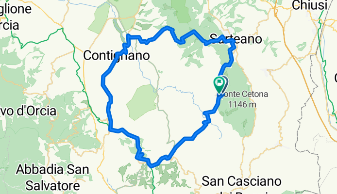
Sarteano-Radicofani-Contignano-Trinoro
A cycling route starting in Cetona, Tuscany, Italy.
Overview
About this route
- -:--
- Duration
- 50.1 km
- Distance
- 999 m
- Ascent
- 1,024 m
- Descent
- ---
- Avg. speed
- ---
- Avg. speed
Route quality
Waytypes & surfaces along the route
Waytypes
Busy road
30.1 km
(60 %)
Quiet road
11.7 km
(23 %)
Surfaces
Paved
37.9 km
(76 %)
Unpaved
11.7 km
(23 %)
Asphalt
37.8 km
(75 %)
Unpaved (undefined)
5.7 km
(11 %)
Continue with Bikemap
Use, edit, or download this cycling route
You would like to ride Sarteano-Radicofani-Contignano-Trinoro or customize it for your own trip? Here is what you can do with this Bikemap route:
Free features
- Save this route as favorite or in collections
- Copy & plan your own version of this route
- Sync your route with Garmin or Wahoo
Premium features
Free trial for 3 days, or one-time payment. More about Bikemap Premium.
- Navigate this route on iOS & Android
- Export a GPX / KML file of this route
- Create your custom printout (try it for free)
- Download this route for offline navigation
Discover more Premium features.
Get Bikemap PremiumFrom our community
Other popular routes starting in Cetona
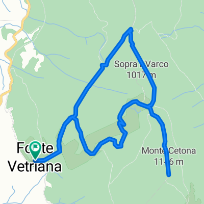 Hiking - Monte Cetona
- Distance
- 8.7 km
- Ascent
- 385 m
- Descent
- 387 m
- Location
- Cetona, Tuscany, Italy
 Cetona
- Distance
- 47.6 km
- Ascent
- 598 m
- Descent
- 549 m
- Location
- Cetona, Tuscany, Italy
 Long Monday Course In Cetona
- Distance
- 5.8 km
- Ascent
- 274 m
- Descent
- 110 m
- Location
- Cetona, Tuscany, Italy
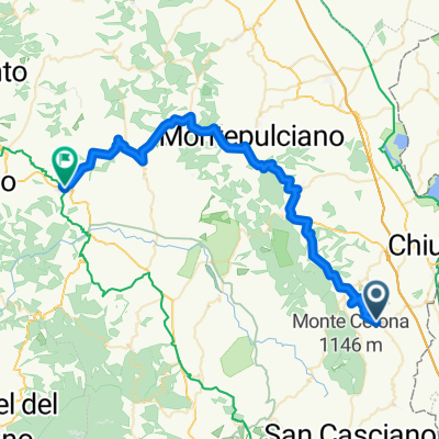
 Cetona - Montepulciano - Cetona
- Distance
- 58.6 km
- Ascent
- 747 m
- Descent
- 743 m
- Location
- Cetona, Tuscany, Italy
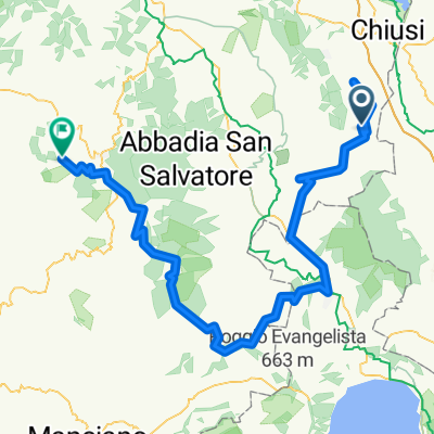
 Abbadia-CastiglioneDOrcia-Monichchielleo-Sateano
- Distance
- 99.2 km
- Ascent
- 1,689 m
- Descent
- 1,704 m
- Location
- Cetona, Tuscany, Italy
 Rund-um-Monte-Centone
- Distance
- 42 km
- Ascent
- 876 m
- Descent
- 900 m
- Location
- Cetona, Tuscany, Italy
 2020 -10 Monticello
- Distance
- 120.4 km
- Ascent
- 1,513 m
- Descent
- 1,166 m
- Location
- Cetona, Tuscany, Italy
 Monte-Amiata
- Distance
- 82.1 km
- Ascent
- 1,586 m
- Descent
- 1,589 m
- Location
- Cetona, Tuscany, Italy
Open it in the app