

semarang explour
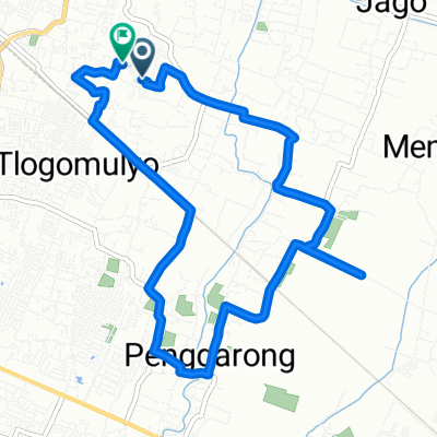
A cycling route starting in Mranggen, Central Java, Indonesia.
Overview
About this route
- 2 h 47 min
- Duration
- 31.6 km
- Distance
- 32 m
- Ascent
- 12 m
- Descent
- 11.3 km/h
- Avg. speed
- ---
- Max. altitude

Route photos


Continue with Bikemap
Use, edit, or download this cycling route
You would like to ride semarang explour or customize it for your own trip? Here is what you can do with this Bikemap route:
Free features
- Save this route as favorite or in collections
- Copy & plan your own version of this route
- Sync your route with Garmin or Wahoo
Premium features
Free trial for 3 days, or one-time payment. More about Bikemap Premium.
- Navigate this route on iOS & Android
- Export a GPX / KML file of this route
- Create your custom printout (try it for free)
- Download this route for offline navigation
Discover more Premium features.
Get Bikemap PremiumFrom our community
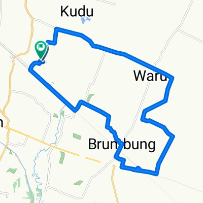
Other popular routes starting in Mranggen
 Grub BB
- Distance
- 11.7 km
- Ascent
- 31 m
- Descent
- 29 m
- Location
- Mranggen, Central Java, Indonesia
 semarang explour
- Distance
- 31.6 km
- Ascent
- 32 m
- Descent
- 12 m
- Location
- Mranggen, Central Java, Indonesia
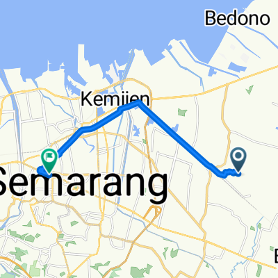
 Rowosari, Kecamatan Tembalang to Jalan Krajan II 99, Kecamatan Tembalang
- Distance
- 10.9 km
- Ascent
- 98 m
- Descent
- 107 m
- Location
- Mranggen, Central Java, Indonesia
 GBB 5 Okt 25
- Distance
- 23.9 km
- Ascent
- 145 m
- Descent
- 172 m
- Location
- Mranggen, Central Java, Indonesia
 tipis2
- Distance
- 5.4 km
- Ascent
- 105 m
- Descent
- 120 m
- Location
- Mranggen, Central Java, Indonesia
 Blok A No.33 to Jalan Pandanaran
- Distance
- 12 km
- Ascent
- 21 m
- Descent
- 22 m
- Location
- Mranggen, Central Java, Indonesia
 Rowosari Tembalang Tipis-tipis
- Distance
- 6.3 km
- Ascent
- 65 m
- Descent
- 62 m
- Location
- Mranggen, Central Java, Indonesia
 nyepi bersepeda
- Distance
- 21.8 km
- Ascent
- 526 m
- Descent
- 517 m
- Location
- Mranggen, Central Java, Indonesia
Open it in the app