An der Bergbahn, Aschau im Chiemgau nach Rasthausstraße, Bernau am Chiemsee
- 11 km
- 60 m
- 157 m
- Aschau im Chiemgau, Bavaria, Germany
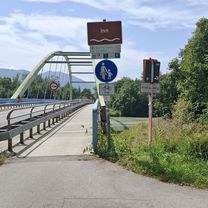
A cycling route starting in Aschau im Chiemgau, Bavaria, Germany.
Overview
Only uphill, can do it once in a while. But it doesn't have to be. Great view at the hut though. A lot of traffic on the weekend.
created this 15 years ago
Route quality
Track
14.9 km
54 %
Path
5.2 km
19 %
Paved
11.3 km
(41 %)
Unpaved
16.3 km
(59 %)
Gravel
15.2 km
55 %
Asphalt
11.3 km
41 %
Unpaved (undefined)
1.1 km
4 %
Continue with Bikemap
You would like to ride Priener-Hütte or customize it for your own trip? Here is what you can do with this Bikemap route:
Free trial for 3 days, or one-time payment. More about Bikemap Premium.
Discover more Premium features.
Get Bikemap PremiumFrom our community
Open it in the app