

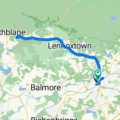
St Ninian's Way- Kirkintilloch to Falkirk
Una ruta en bici que comienza en Kirkintilloch, Escocia, Reino Unido.
Visión General
Sobre esta ruta
This 27th section of St Ninian’s Way starts on the Forth and Clyde Canal tow path where it is joined by the John Muir Way from the north, and continues along JMW all the way to Falkirk, often parallel to the Antonine Wall, and switching to the Union Canal.
This is a long section but there are plenty of towns along the way where overnight accommodation can be found.
From Kirkintilloch proceed east along north bank of Forth and Clyde Canal on BR 754. After 100m the tow path is joined by the John Muir Way from the north. Proceed to Twechar (6 km). Follow JMW across bridge and up along Antonine Wall, over Croy Hill (4 km) to bridge over canal where JMW rejoins the canal tow path (2 km), then keep along JMW and tow path to Banknock (4 km) and then Bonnybridge (6 km). Continue on JMW across bridge and along Antonine Wall to Falkirk Wheel (3 km). Then go along JMW across Union Canal, and through woods and along paths to bridge (3km). Cross bridge and rejoin canal tow path to Falkirk High Street area (6 km).
A great experience - from tramping like a Roman legionary along the historic Antonine Wall to marvelling at modern and towering engineering marvel, the Falkirk Wheel, for canal navigation.
For more details and ordnance survey map of this route please go to
http://johnmuirway.org/route/kilsyth-falkirk
For a map overview of Part 1 and Part 2 of St Ninian’s Way please go to https://www.bikemap.net/en/route/3548129-st-ninians-way-carlisle-to-st-andrews-part-1-carlisle-to-whithorn/
St Ninian’s Way is one of the great pilgrim routes in Scotland to St Andrews - The Way of St Andrews - For other routes see http://www.thewayofstandrews.com
- -:--
- Duración
- 29,9 km
- Distancia
- 136 m
- Ascenso
- 108 m
- Descenso
- ---
- Velocidad Media
- ---
- Altitud máxima

Calidad de la ruta
Tipos de vía y superficies a lo largo de la ruta
Tipos de vía
Carril bici
21,8 km
(73 %)
Camino forestal
3 km
(10 %)
Superficies
Pavimentado
19,1 km
(64 %)
Sin pavimentar
1,2 km
(4 %)
Asfalto
18,8 km
(63 %)
Grava
0,9 km
(3 %)
Destacados de la ruta
Puntos de interés a lo largo de la ruta
Punto de interés después de 1,1 km
Joins John Muir Way
Punto de interés después de 4,4 km
Roman Fort
Punto de interés después de 7,4 km
Roman Fort
Punto de interés después de 10,4 km
Roman Fort
Punto de interés después de 23,1 km
Antonine Wall
Punto de interés después de 25 km
Falkirk Wheel
Continuar con Bikemap
Usa, edita o descarga esta ruta en bici
¿Te gustaría recorrer St Ninian's Way- Kirkintilloch to Falkirk o personalizarla para tu propio viaje? Esto es lo que puedes hacer con esta ruta de Bikemap:
Funciones gratuitas
- Guarda esta ruta como favorita o en una colección
- Copia y planifica tu propia versión de esta ruta
- Sincroniza tu ruta con Garmin o Wahoo
Funciones Premium
Prueba gratuita de 3 días o pago único. Más información sobre Bikemap Premium.
- Navega esta ruta en iOS y Android
- Exporta un archivo GPX / KML de esta ruta
- Crea tu impresión personalizada (pruébala gratis)
- Descarga esta ruta para la navegación sin conexión
Descubre más funciones Premium.
Consigue Bikemap PremiumDe nuestra comunidad
Kirkintilloch: Otras rutas populares que empiezan aquí
 forth & Clyde canal
- Distancia
- 16,8 km
- Ascenso
- 210 m
- Descenso
- 132 m
- Ubicación
- Kirkintilloch, Escocia, Reino Unido
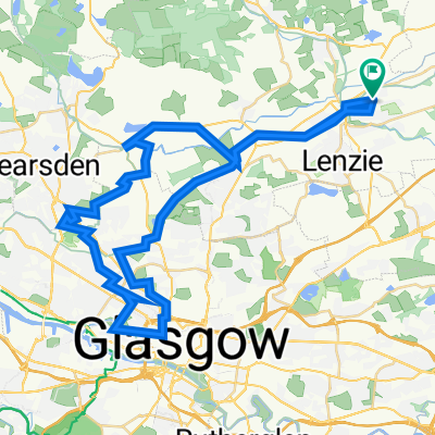
 Relaxed route in Glasgow
- Distancia
- 13,8 km
- Ascenso
- 54 m
- Descenso
- 56 m
- Ubicación
- Kirkintilloch, Escocia, Reino Unido
 ride through Glasgow
- Distancia
- 27 km
- Ascenso
- 192 m
- Descenso
- 159 m
- Ubicación
- Kirkintilloch, Escocia, Reino Unido
 Route from St Marys Parish Church of Scotland, Cowgate, Glasgow
- Distancia
- 8,4 km
- Ascenso
- 93 m
- Descenso
- 61 m
- Ubicación
- Kirkintilloch, Escocia, Reino Unido
 33–43 Alexander Place, Glasgow to 55 Bankhead Road, Glasgow
- Distancia
- 9,4 km
- Ascenso
- 80 m
- Descenso
- 78 m
- Ubicación
- Kirkintilloch, Escocia, Reino Unido
 Fellsview Avenue 50, Kirkintilloch to Fellsview Avenue 48, Kirkintilloch
- Distancia
- 47,5 km
- Ascenso
- 441 m
- Descenso
- 452 m
- Ubicación
- Kirkintilloch, Escocia, Reino Unido
 Fellsview Avenue 77, Kirkintilloch to Fellsview Avenue 44, Kirkintilloch
- Distancia
- 58,9 km
- Ascenso
- 369 m
- Descenso
- 374 m
- Ubicación
- Kirkintilloch, Escocia, Reino Unido
 55.939, -4.155 do 55.942, -4.153
- Distancia
- 25,4 km
- Ascenso
- 253 m
- Descenso
- 271 m
- Ubicación
- Kirkintilloch, Escocia, Reino Unido
Ábrela en la app