

Day 8, 37 hilly miles from Lancaster to Tockholes
Un itinéraire vélo au départ de Galgate, Angleterre, Royaume-Uni.
Vue d'ensemble
À propos du circuit
September 8, 2008. Today we started a half hour earlier than normal (8:00 instead of 8:30). It was a glorious day and we had not realized how pastorally "green and pleasant" is northern Lancashire just a few miles from the (former) dark satanic mills of Preston, Blackburn, Manchester, Liverpool and the dozens of factory towns in between. We turned east off the A6 at Galgate and took back roads through Oakenclough, Inglewhite, and Longridge (where we had coffee at a stylish cafe-wine bar internally integrated, we discovered on entering, with a hair salon. This was actually a short day of cycling - 37 miles in linear distance but about 4,000 feet in accumulated vertical assent. Half way to Blackburn we celebrated our "Everest moment" when the trip accumulated assent reached 29,028 feet. We began to wonder whether the line from the Beatles song was actually "there are 4,000 hills in Blackburn, Lancashire" but we eventually emerged into the rural road to Tockholes, where Charles I hid in a tree from Cromwell's army. Our cycling day ended with a relaxed late lunch at the canine-filled Royal Arms. Our hotel was The Lion, an old and quite large hotel on the High Street, of Shrewsbury.
- -:--
- Durée
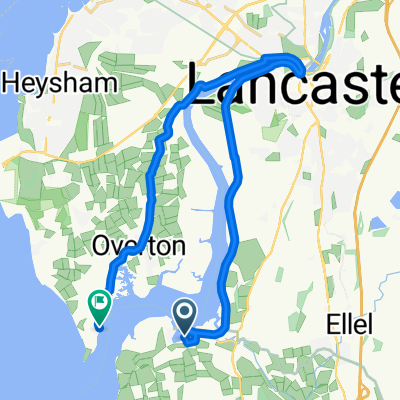
- 58,4 km
- Distance
- 660 m
- Montée
- 458 m
- Descente
- ---
- Vit. moyenne
- 258 m
- Altitude max.

Photos de l’itinéraire


Qualité de l’itinéraire
Types de voies et surfaces le long de l’itinéraire
Types de routes
Route
24,9 km
(43 %)
Route fréquentée
20,7 km
(35 %)
surfaces
Pavé
18,5 km
(32 %)
Asphalte
17,2 km
(30 %)
Pavé (non défini)
1,2 km
(2 %)
Indéfini
40 km
(68 %)
Continuer avec Bikemap
Utilise, modifie ou télécharge cet itinéraire vélo
Tu veux parcourir Day 8, 37 hilly miles from Lancaster to Tockholes ou l’adapter à ton propre voyage ? Voici ce que tu peux faire avec cet itinéraire Bikemap :
Fonctionnalités gratuites
- Enregistre cet itinéraire comme favori ou dans une collection
- Copie et planifie ta propre version de cet itinéraire
- Synchronise ton itinéraire avec Garmin ou Wahoo
Fonctionnalités Premium
Essai gratuit de 3 jours, ou paiement unique. En savoir plus sur Bikemap Premium.
- Navigue sur cet itinéraire sur iOS et Android
- Exporter un fichier GPX / KML de cet itinéraire
- Crée ton impression personnalisée (essaie-la gratuitement)
- Télécharge cet itinéraire pour la navigation hors ligne
Découvre plus de fonctionnalités Premium.
Obtiens Bikemap PremiumDe notre communauté
Galgate : Autres itinéraires populaires qui commencent ici
 Glasson Gallimaufry
- Distance
- 39,2 km
- Montée
- 42 m
- Descente
- 41 m
- Emplacement
- Galgate, Angleterre, Royaume-Uni
 caton short
- Distance
- 25,4 km
- Montée
- 178 m
- Descente
- 177 m
- Emplacement
- Galgate, Angleterre, Royaume-Uni
 Glasson Marina to Sunderland Point
- Distance
- 19,6 km
- Montée
- 67 m
- Descente
- 65 m
- Emplacement
- Galgate, Angleterre, Royaume-Uni
 Jeremy Lane to Tithebarn Hill 2, Glasson Dock
- Distance
- 1,2 km
- Montée
- 0 m
- Descente
- 0 m
- Emplacement
- Galgate, Angleterre, Royaume-Uni
 Route from Hillam Lane, Cockerham, Lancaster
- Distance
- 19,8 km
- Montée
- 10 m
- Descente
- 12 m
- Emplacement
- Galgate, Angleterre, Royaume-Uni
 Fast ride in Lancaster
- Distance
- 27,7 km
- Montée
- 68 m
- Descente
- 66 m
- Emplacement
- Galgate, Angleterre, Royaume-Uni
 Day 8 - Lancaster to Broughton-in-Furness
- Distance
- 110,9 km
- Montée
- 1 005 m
- Descente
- 1 051 m
- Emplacement
- Galgate, Angleterre, Royaume-Uni
 Glasson Dock to Grasmere
- Distance
- 83,6 km
- Montée
- 465 m
- Descente
- 400 m
- Emplacement
- Galgate, Angleterre, Royaume-Uni
Ouvre-la dans l’app