

Saratoga Springs NY to Little Falls NY
Un itinéraire vélo au départ de Saratoga Springs, New York, États Unis.
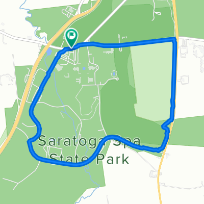
Vue d'ensemble
À propos du circuit
Old Post Road and Malta Ave from south of Saratoga Springs to Ballston Spa was pretty nice. State Highway 67 had mostly good shoulder, but the latter part was nicer scenery-wise than the first part.
From Amsterdam, we were on the Empire State Trail/Erie Canalway Trail. For the first few miles, the paved path was pretty uneven and bumpy. The bulk, though, was prettuy well paved. Toward the end, we had several miles of unpaved trail, that made us feel like we were doing cyclocross. If we weren't getting dumped on with rain, this unpaved section would have been fine. But with all the rain, it was slow going for us. Toward the end before riding into Little Falls, there was a few miles of brand new nicely paved path.
Overall great ride despite our getting dumped on for the last three hours.
- 8 h 24 min
- Durée
- 108,3 km
- Distance
- 743 m
- Montée
- 713 m
- Descente
- 12,9 km/h
- Vit. moyenne
- 270 m
- Altitude max.

Qualité de l’itinéraire
Types de voies et surfaces le long de l’itinéraire
Types de routes
Piste cyclable
59,6 km
(55 %)
Route
6,5 km
(6 %)
surfaces
Pavé
61,7 km
(57 %)
Non pavé
6,5 km
(6 %)
Asphalte
57,4 km
(53 %)
Non pavé (non défini)
6,5 km
(6 %)
Continuer avec Bikemap
Utilise, modifie ou télécharge cet itinéraire vélo
Tu veux parcourir Saratoga Springs NY to Little Falls NY ou l’adapter à ton propre voyage ? Voici ce que tu peux faire avec cet itinéraire Bikemap :
Fonctionnalités gratuites
- Enregistre cet itinéraire comme favori ou dans une collection
- Copie et planifie ta propre version de cet itinéraire
- Divise-le en étapes pour créer un tour sur plusieurs jours
- Synchronise ton itinéraire avec Garmin ou Wahoo
Fonctionnalités Premium
Essai gratuit de 3 jours, ou paiement unique. En savoir plus sur Bikemap Premium.
- Navigue sur cet itinéraire sur iOS et Android
- Exporter un fichier GPX / KML de cet itinéraire
- Crée ton impression personnalisée (essaie-la gratuitement)
- Télécharge cet itinéraire pour la navigation hors ligne
Découvre plus de fonctionnalités Premium.
Obtiens Bikemap PremiumDe notre communauté
Saratoga Springs : Autres itinéraires populaires qui commencent ici
 short lake
- Distance
- 20,5 km
- Montée
- 196 m
- Descente
- 198 m
- Emplacement
- Saratoga Springs, New York, États Unis
 Avenue of the Pines, Saratoga Springs to Avenue of the Pines, Saratoga Springs
- Distance
- 6,2 km
- Montée
- 59 m
- Descente
- 62 m
- Emplacement
- Saratoga Springs, New York, États Unis
 8 Newton Ave, Saratoga Springs to 3065 NY-50, Saratoga Springs
- Distance
- 7,9 km
- Montée
- 158 m
- Descente
- 168 m
- Emplacement
- Saratoga Springs, New York, États Unis
 Saturday morning ride
- Distance
- 36,6 km
- Montée
- 204 m
- Descente
- 204 m
- Emplacement
- Saratoga Springs, New York, États Unis
 Route from Geyser Loop Road, Saratoga Springs
- Distance
- 17 km
- Montée
- 204 m
- Descente
- 190 m
- Emplacement
- Saratoga Springs, New York, États Unis
 71 Lincoln Ave, Saratoga Springs to 3 Stone Clover Dr, Saratoga Springs
- Distance
- 14,5 km
- Montée
- 121 m
- Descente
- 110 m
- Emplacement
- Saratoga Springs, New York, États Unis
 ride from 10/16/16, 3:24 PM
- Distance
- 17,8 km
- Montée
- 103 m
- Descente
- 102 m
- Emplacement
- Saratoga Springs, New York, États Unis
 Long way to Schuylerville
- Distance
- 44 km
- Montée
- 171 m
- Descente
- 232 m
- Emplacement
- Saratoga Springs, New York, États Unis
Ouvre-la dans l’app