
2013_North Cap
Una raccolta di 13 percorsi ciclistici, creata da Oschep Heinz.
Panoramica
Informazioni su questa raccolta
The North Cap Tour - has been a fantastic experience. Throughout the three weeks we have seen a lot of the “higher north”, enjoyed marvellous nature and interesting sightseeing places. Planning a cycling tour up to North Cap has some difficulties. North of the Arctic Circle there is just a limited number of streets. You would expect that in this remote areas might be less traffic, but that is not always so. To avoid the most annoying traffic you should not use “E” roads, sadly this is not possible on few occasions.
- 13
- Percorsi
- -:--
- Durata
- 1.562,3 km
- Distanza
- ---
- Velocità media
- 6.238 m
- Salita
- 5.968 m
- Discesa

creato 8 anni fa
2013_North Cap
Percorsi in questa raccolta
Tutti i 13 percorsi di questa raccolta possono essere aperti sulla mappa o nell’app Bikemap per ulteriori dettagli, dove puoi modificarli nel pianificatore di percorsi oppure scaricarli come file GPX o KML. Usali come base per pianificare i tuoi giri o lascia che Bikemap ti guidi lungo di essi.

Lulea - Kalix
Percorso ciclabile a Luleå, Norrbotten, Svezia
- 101,7 km
- Distanza
- 167 m
- Salita
- 168 m
- Discesa

Kalix - Ylitornio
Percorso ciclabile a Rolfs, Norrbotten, Svezia
- 95 km
- Distanza
- 421 m
- Salita
- 378 m
- Discesa

Ylitornio - Rovaniemi
Percorso ciclabile a Ylitornio, Regione della Lapponia, Finlandia
- 120,2 km
- Distanza
- 315 m
- Salita
- 264 m
- Discesa

Rovaniemi - Raudanjoki
Percorso ciclabile a Rovaniemi, Regione della Lapponia, Finlandia
- 99,4 km
- Distanza
- 409 m
- Salita
- 310 m
- Discesa

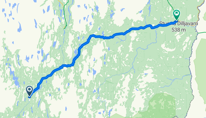
Raudanjoki - Kittila
- 170,5 km
- Distanza
- 280 m
- Salita
- 308 m
- Discesa

Kittila - Enontekio
Percorso ciclabile a Kittilä, Regione della Lapponia, Finlandia
- 142,6 km
- Distanza
- 269 m
- Salita
- 141 m
- Discesa

Enontekio - Kautokeino
Percorso ciclabile a Enontekiö, Regione della Lapponia, Finlandia
- 84,4 km
- Distanza
- 286 m
- Salita
- 259 m
- Discesa
Kautokeion - Karasjok
Percorso ciclabile a Kautokeino, Finnmark, Norvegia
- 127,6 km
- Distanza
- 328 m
- Salita
- 510 m
- Discesa

Karasjok - Olderfjord
Percorso ciclabile a Kárášjohka, Finnmark, Norvegia
- 139,4 km
- Distanza
- 504 m
- Salita
- 641 m
- Discesa

Olderfjord - Honnigvag
- 103,5 km
- Distanza
- 1.121 m
- Salita
- 1.199 m
- Discesa

Harstad - Riksgränsen
Percorso ciclabile a Harstad, Troms, Norvegia
- 155,1 km
- Distanza
- 1.372 m
- Salita
- 876 m
- Discesa

Riksgränsen - Kiruna
- 136,2 km
- Distanza
- 512 m
- Salita
- 475 m
- Discesa