
Crows Nest in bici
Scopri una mappa con 107 percorsi e sentieri ciclabili vicino a Crows Nest, creati dalla nostra community.
Ritratto della regione
Scopri Crows Nest
Trova il percorso in bici giusto per te a Crows Nest, dove abbiamo 107 percorsi ciclabili da esplorare. La maggior parte delle persone va in bici qui nei mesi di Luglio e Agosto.
1.760 km
Distanza registrata
107
Percorsi ciclabili
3152
Popolazione
Community
Utenti più attivi a Crows Nest
Dalla nostra comunità
I migliori percorsi in bici a Crows Nest e dintorni
Sydney Spring Cycle
Percorso ciclabile a Crows Nest, Nuovo Galles del Sud, Australia
Spring cycle 50km
Cue Sheet
Turn left onto Berry St
0.7 km
Slight right onto Arthur St
0.9 km
Arthur St turns left and becomes Mount St (signs for City East/Airport)
1.2 km
Turn right to Route 1
1.2 km
Merge onto Cahill Expy
1.6 km
Take exit Macquarie Street Exit towards City/Macquarie Street Exit
4.4 km
Continue onto Conservatorium Rd
4.6 km
Sharp right towards Cahill Expy
4.7 km
Take the Cahill Expressway ramp to Harbour
4.7 km
Continue onto Cahill Expy
5.0 km
Merge onto Bradfield Hwy
6.0 km
Upper Fort St turns slightly left and becomes Watson Rd
6.1 km
Turn left onto Argyle St
6.3 km
Continue onto Dalgety Rd
6.5 km
Dalgety Rd turns slightly right and becomes Towns Pl
6.7 km
Turn right onto Hickson Rd
6.8 km
Continue onto Sussex St
7.6 km
Turn right onto Hay St
9.4 km
Hay St turns slightly right and becomes Harbour St
9.5 km
Turn left onto Pier St
9.7 km
Take the exit towards Darling Harbour/Market City/Star City
9.8 km
Turn left onto Darling Dr
10.0 km
Turn right onto Ultimo Rd
10.4 km
Turn left onto Harris St
10.4 km
Turn right onto Thomas St
10.6 km
Turn right onto Wattle St
10.9 km
Turn left onto Kelly St
11.1 km
At the roundabout, continue straight onto Glebe St
11.3 km
Turn right to stay on Glebe St
11.5 km
Turn left onto St Johns Rd
11.9 km
Turn right onto Glebe Point Rd
12.1 km
Turn left onto Federal Rd
13.3 km
Turn right
13.4 km
Turn right towards Chapman Rd
13.7 km
Slight left towards Chapman Rd
13.8 km
Turn right onto Chapman Rd
13.9 km
Continue onto Johnston St
14.1 km
Turn right onto Weynton St
14.3 km
Turn left onto Annandale St
14.4 km
Turn right onto Booth St
15.2 km
Continue onto Moore St
15.5 km
Turn left onto William St
16.4 km
Turn right onto Charles St
17.0 km
Slight left
17.3 km
Turn left onto Canal Rd
17.5 km
Turn left onto The Greenway
17.7 km
Turn right towards Hawthorne Parade
18.1 km
Turn left onto Hawthorne Parade
18.2 km
At the roundabout, take the 2nd exit onto Waratah St
18.2 km
At the roundabout, take the 3rd exit onto Boomerang St
18.7 km
Turn left onto Mortley Ave
19.1 km
Continue onto Timbrell Dr
19.3 km
Continue straight onto Henley Marine Dr
19.6 km
At the roundabout, take the 1st exit onto Arthur St
19.7 km
At the roundabout, take the 1st exit onto First Ave
19.9 km
At the roundabout, take the 3rd exit onto Ingham Ave
20.4 km
Continue onto Myalora St
21.1 km
Turn left onto Russell St
21.5 km
Turn right onto Pine Ave
21.7 km
Turn left onto Wareemba St
21.8 km
Turn left onto Great N Rd
22.1 km
Turn right onto Cecil St
22.1 km
Turn left onto Wymston Parade
22.4 km
Turn left onto Udall Ave
22.8 km
Continue onto Crane St
24.6 km
At the roundabout, take the 1st exit onto Patterson St
25.7 km
Turn right onto Flavelle St
26.0 km
At the roundabout, take the 1st exit onto Wellbank St
26.5 km
Turn right onto Queen St
27.5 km
At the roundabout, take the 1st exit onto Pomeroy St
27.7 km
Slight left to stay on Pomeroy St
27.8 km
Enter the roundabout
28.3 km
Exit the roundabout onto Pomeroy St
28.3 km
Turn left
28.4 km
Turn right
29.1 km
Turn left
29.1 km
Turn left onto Victoria Ave
29.7 km
Turn right
29.8 km
Turn left at Oulton Ave
31.1 km
Turn left
31.3 km
Turn right onto Sevier Ave
31.7 km
Turn left onto Shoreline Dr
31.8 km
Turn right onto Mary St
31.9 km
Turn left onto Marquet St
32.0 km
Turn right onto Gauthorpe St
32.3 km
Turn left onto Walker St
32.4 km
Turn left onto Meredith Ave
32.8 km
Turn left onto Old Meadowbank Rail Bridge shared use path
33.6 km
Slight right to stay on Old Meadowbank Rail Bridge shared use path
34.3 km
Turn right onto Bay Dr
34.5 km
At the roundabout, take the 2nd exit onto Bowden St
34.9 km
Slight left to stay on Parramatta Valley Cycleway
36.0 km
Turn left onto Lancaster Ave
36.1 km
Turn left onto Parramatta Valley Cycleway
36.5 km
Turn right onto Wharf Rd
36.7 km
Turn left onto Waratah St
36.8 km
Slight left onto Parramatta Valley Cycleway
37.1 km
Turn left to stay on Parramatta Valley Cycleway
37.8 km
Turn right
39.6 km
Slight right
39.6 km
Turn right
40.1 km
Turn right
40.1 km
Turn left
41.6 km
Turn right
42.6 km
Slight right
43.2 km
Turn left
43.6 km
Turn right
44.0 km
Slight right
44.7 km
Slight right
46.0 km
Turn left onto John Ian Wing Parade
46.3 km
Turn left onto Hill Rd
46.6 km
Turn right onto Pondage Link
47.1 km
Turn left onto Kevin Coombs Ave
47.4 km
Turn left onto Holker Busway
48.1 km
Turn right onto Kevin Coombs Ave
49.7 km
Turn left onto Olympic Blvd
50.3 km
Turn left onto Grand Parade
50.7 km
Turn right toward Dawn Fraser Ave
50.7 km
Turn left onto Dawn Fraser Ave
51.1 km
Turn right onto Australia Ave
51.6 km
Turn left at Figtree Dr
51.9 km
Turn right
52.1 km
Turn left
52.3 km
Turn left
52.8 km
Turn right
52.9 km
Turn left
53.2 km
- 53,2 km
- Distanza
- 268 m
- Salita
- 346 m
- Discesa
Spring Cycle City Ride 16km
Percorso ciclabile a Crows Nest, Nuovo Galles del Sud, Australia
Sydney Spring Cycle City Ride 16km
- 15,5 km
- Distanza
- 231 m
- Salita
- 312 m
- Discesa
Bobbin Head & Akuna Bay
Percorso ciclabile a Crows Nest, Nuovo Galles del Sud, Australia
- 100 km
- Distanza
- 663 m
- Salita
- 661 m
- Discesa
Sydney Harbour National Park
Percorso ciclabile a Crows Nest, Nuovo Galles del Sud, Australia
Sydney Harbour National Park is a cycling route in Sydney. It features an elevation gain of 1,736ft over 20.42mi.
Notable roads/trails that you'll be traveling on: Tobruk Avenue, Spit Road, Edgecliffe Esplanade, Commonwealth Parade, and Earle Street.
- 33,1 km
- Distanza
- 435 m
- Salita
- 440 m
- Discesa
Scopri più percorsi
- Cammeray to Delhi Rd
- Distanza
- 8,7 km
- Salita
- 170 m
- Discesa
- 194 m
- Posizione
- Crows Nest, Nuovo Galles del Sud, Australia
- Recovered Route
- Distanza
- 10,9 km
- Salita
- 147 m
- Discesa
- 219 m
- Posizione
- Crows Nest, Nuovo Galles del Sud, Australia
- 35 Rocklands Rd, Wollstonecraft to 1 Eden Park Dr, Macquarie Park
- Distanza
- 10 km
- Salita
- 166 m
- Discesa
- 206 m
- Posizione
- Crows Nest, Nuovo Galles del Sud, Australia
- 308A Pacific Highway, Crows Nest to 10 Belgrave St, Cremorne
- Distanza
- 2,6 km
- Salita
- 91 m
- Discesa
- 115 m
- Posizione
- Crows Nest, Nuovo Galles del Sud, Australia
- 40 Willoughby Rd, Crows Nest to Albany La, St Leonards
- Distanza
- 0,9 km
- Salita
- 14 m
- Discesa
- 21 m
- Posizione
- Crows Nest, Nuovo Galles del Sud, Australia
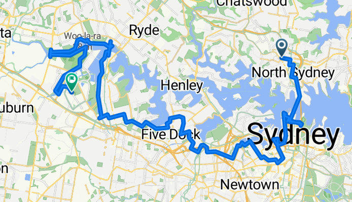
- Slow ride in Crows Nest
- Distanza
- 23,8 km
- Salita
- 124 m
- Discesa
- 205 m
- Posizione
- Crows Nest, Nuovo Galles del Sud, Australia
- 19 Rosalind St, Cammeray to 2 Max Allen Road, Lindfield
- Distanza
- 7,9 km
- Salita
- 86 m
- Discesa
- 163 m
- Posizione
- Crows Nest, Nuovo Galles del Sud, Australia
- 1st out
- Distanza
- 8,3 km
- Salita
- 94 m
- Discesa
- 95 m
- Posizione
- Crows Nest, Nuovo Galles del Sud, Australia