
Prestonpans in bici
Scopri una mappa con 38 percorsi e sentieri ciclabili vicino a Prestonpans, creati dalla nostra community.
Ritratto della regione
Scopri Prestonpans
Trova il percorso in bici giusto per te a Prestonpans, dove abbiamo 38 percorsi ciclabili da esplorare.
1.563 km
Distanza registrata
38
Percorsi ciclabili
7145
Popolazione
Community
Utenti più attivi a Prestonpans


Dalla nostra comunità
I migliori percorsi in bici a Prestonpans e dintorni

bike tour through Prestonpans
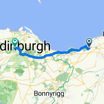
Percorso ciclabile a Prestonpans, Scozia, Regno Unito
- 18,1 km
- Distanza
- 161 m
- Salita
- 159 m
- Discesa

Pans to Oxton - Club ride in the middle !
Percorso ciclabile a Prestonpans, Scozia, Regno Unito
- 84,5 km
- Distanza
- 506 m
- Salita
- 293 m
- Discesa

B1348, Drummohr, Prestonpans to 1 Milton Link, Edinburgh
Percorso ciclabile a Prestonpans, Scozia, Regno Unito
- 8,4 km
- Distanza
- 55 m
- Salita
- 39 m
- Discesa

Prestonpans Cycling
Percorso ciclabile a Prestonpans, Scozia, Regno Unito
- 70,9 km
- Distanza
- 964 m
- Salita
- 892 m
- Discesa
Garmin Edge800®
Scopri più percorsi
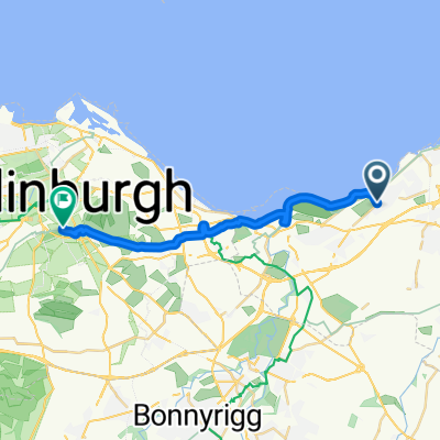 Prestonpans to Edinburgh
- Distanza
- 16,4 km
- Salita
- 98 m
- Discesa
- 35 m
- Posizione
- Prestonpans, Scozia, Regno Unito
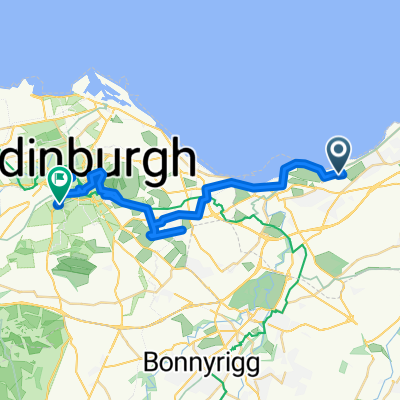 Long bike tour from Prestonpans to エディンバラ
- Distanza
- 30,5 km
- Salita
- 313 m
- Discesa
- 233 m
- Posizione
- Prestonpans, Scozia, Regno Unito
 14 The Pottery, High St, Prestonpans to 13 The Pottery, High St, Prestonpans
- Distanza
- 54,3 km
- Salita
- 161 m
- Discesa
- 160 m
- Posizione
- Prestonpans, Scozia, Regno Unito
 Easy ride in Edinburgh
- Distanza
- 11,8 km
- Salita
- 0 m
- Discesa
- 3 m
- Posizione
- Prestonpans, Scozia, Regno Unito
 Wallyford to Gullane
- Distanza
- 35,3 km
- Salita
- 99 m
- Discesa
- 99 m
- Posizione
- Prestonpans, Scozia, Regno Unito
 13 Mallard Walk, Prestonpans to 1–3 Saint Colme Street, Edinburgh
- Distanza
- 17,5 km
- Salita
- 90 m
- Discesa
- 50 m
- Posizione
- Prestonpans, Scozia, Regno Unito
 poppymedium2022
- Distanza
- 109,9 km
- Salita
- 0 m
- Discesa
- 0 m
- Posizione
- Prestonpans, Scozia, Regno Unito
 poppyshort2022
- Distanza
- 75,9 km
- Salita
- 0 m
- Discesa
- 0 m
- Posizione
- Prestonpans, Scozia, Regno Unito