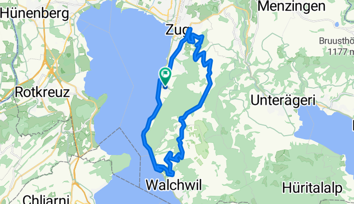
Zug in bici
Scopri una mappa con 1018 percorsi e sentieri ciclabili vicino a Zug, creati dalla nostra community.
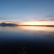
Ritratto della regione
Scopri Zug
Trova il percorso in bici giusto per te a Zug, dove abbiamo 1.018 percorsi ciclabili da esplorare. La maggior parte delle persone va in bici qui nei mesi di Aprile e Maggio.
51.491 km
Distanza registrata
1018
Percorsi ciclabili
23.435
Popolazione
Community
Utenti più attivi a Zug
Percorsi scelti con cura
Scopri Zug attraverso queste raccolte
Tour
Dalla nostra comunità
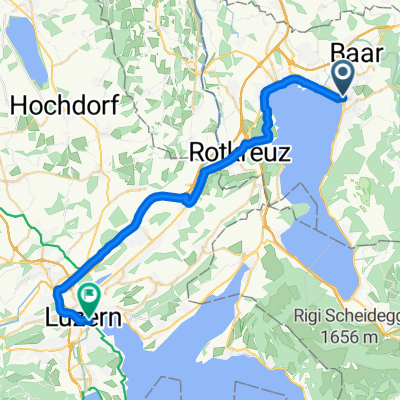
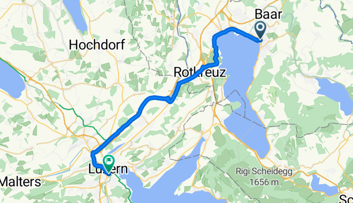
I migliori percorsi in bici a Zug e dintorni
Lengthy Sunday Route In Zug
Percorso ciclabile a Zug, Canton of Zug, Switzerland
- 13,8 km
- Distanza
- 769 m
- Salita
- 770 m
- Discesa
Zug - Around the Rigi - Zug
Percorso ciclabile a Zug, Canton of Zug, Switzerland
Training route that starts in Zug and follows the Zugersee south to Arth and around to Kusnach am Rigi. Here the route starts to climb through the town of Greppen before decending to Weggis. At this stage we are 20km from Brunnen and we are heading to Vitnau and then Gersau, hugging the Lake of Lucerne until we arrive at Brunnen. Routing through Brunnen and then to Schwyz where the climb to Sattel starts (8km of climbing at an average of about 4%. 18-20km is a very good stong pace to set here). At Sattel the route turns left to the Agerisee and the final 20km. The next 10km will be along the lake and likely you will be met with a headwind. At Unterageri the final decent into Zug starts making the last 10km the fastest of the entire route.
- 80,7 km
- Distanza
- 687 m
- Salita
- 684 m
- Discesa
Zugerberg
Percorso ciclabile a Zug, Canton of Zug, Switzerland
Kondition 2/4
Technik 1/4
Dauer 1.5 - 2 h circa
Sehr schöne Feierabendroute
- 14,9 km
- Distanza
- 559 m
- Salita
- 556 m
- Discesa
Zug - Albishorn - Affoltern - Zug
Percorso ciclabile a Zug, Canton of Zug, Switzerland
Bei klarer Sicht ein grandioses Panorama:
Berner-, Zentralschweizer-, Glarneralpen, Säntis. Siehe: www.alpen-panoramen.de, suchen: Albishorn.
Route weitgehend frei von motorisiertem Verkehr, in wunderschöner Landschaft.
Mit normalen Fahrrädern und Bikes kann vor Baar weiterhin am rechten Flussufer (in Fliessrichtung gesehen) und nach der Bahnunterführung am linken,auf guter Naturstrasse, bis zur Brücke nach Deinikon gefahren werden um von dort weiter der Route zu folgen.
Die letzten 600 m bis zum Bergrestaurant ist Schotterstrasse, mit dem Rennrad aber befahrbar.
Total 720 Höhenmeter.
Auf Grund der Routenerkennung ist der Startpunkt verschoben. Er befindet sich beim Ziel, Lorze Brüggli (Treppenunterführung)
- 45,4 km
- Distanza
- 735 m
- Salita
- 734 m
- Discesa
Scopri più percorsi
- Glaubenberg
- Distanza
- 138,2 km
- Salita
- 2.096 m
- Discesa
- 2.080 m
- Posizione
- Zug, Canton of Zug, Switzerland
- Route to Seestrasse 2, 6300 Zug
- Distanza
- 37,5 km
- Salita
- 293 m
- Discesa
- 296 m
- Posizione
- Zug, Canton of Zug, Switzerland
- Zug - Schweikhof retour
- Distanza
- 23,1 km
- Salita
- 337 m
- Discesa
- 338 m
- Posizione
- Zug, Canton of Zug, Switzerland
- Zug-Rigi Rund
- Distanza
- 78,3 km
- Salita
- 548 m
- Discesa
- 554 m
- Posizione
- Zug, Canton of Zug, Switzerland
- Zugersee Training
- Distanza
- 36,5 km
- Salita
- 273 m
- Discesa
- 275 m
- Posizione
- Zug, Canton of Zug, Switzerland
- Um den Zugersee 38Km
- Distanza
- 37,8 km
- Salita
- 163 m
- Discesa
- 170 m
- Posizione
- Zug, Canton of Zug, Switzerland
- Zugerberg Up+Down
- Distanza
- 15,2 km
- Salita
- 595 m
- Discesa
- 595 m
- Posizione
- Zug, Canton of Zug, Switzerland
- Wildspitz Mit Downhill Ürzlebode
- Distanza
- 46,3 km
- Salita
- 1.199 m
- Discesa
- 1.196 m
- Posizione
- Zug, Canton of Zug, Switzerland
Percorsi da Zug
Gita in bici di un giorno da
Da Zug a Lucerne