


Von Sankt Margrethen bis Kempten (Allgäu)
- 88,9 km
- 1.140 m
- 873 m
- Sankt Margrethen, Canton San Gallo, Svizzera

Trova il percorso in bici giusto per te a Sankt Margrethen, dove abbiamo 295 percorsi ciclabili da esplorare. La maggior parte delle persone va in bici qui nei mesi di Luglio e Agosto.
Distanza registrata
Percorsi ciclabili
Popolazione
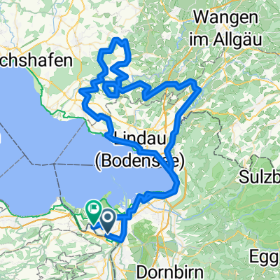
Percorso ciclabile a Sankt Margrethen, Canton San Gallo, Svizzera
Percorso ciclabile a Sankt Margrethen, Canton San Gallo, Svizzera
Percorso ciclabile a Sankt Margrethen, Canton San Gallo, Svizzera
Percorso ciclabile a Sankt Margrethen, Canton San Gallo, Svizzera