
Kella in bici
Scopri una mappa con 45 percorsi e sentieri ciclabili vicino a Kella, creati dalla nostra community.
Ritratto della regione
Scopri Kella
Trova il percorso in bici giusto per te a Kella, dove abbiamo 45 percorsi ciclabili da esplorare.
1.770 km
Distanza registrata
45
Percorsi ciclabili
594
Popolazione


Dalla nostra comunità
I migliori percorsi in bici a Kella e dintorni

Etappe 3a: Schwebda (Eschwege) - Eisenach
Percorso ciclabile a Kella, Free State of Thuringia, Germany
Route entlang des Werra-Radwegs und der Thüringen-Städtekette. In Eisenach ein wenig suboptimal zum Bahnhof gefahren.
Guter und sehr guter Belag, teilweise ein bißchen schmale Wege, aber sehr schöne Landschaft.
- 61 km
- Distanza
- 373 m
- Salita
- 342 m
- Discesa

UHW 003: Wolfsbrunnen - Hattorf über Friedland
Percorso ciclabile a Kella, Free State of Thuringia, Germany
Schloß Wolfsbrunnen - Schwebda - WERRATALSEE - WERRA - Eschwege - Stadtbhf. ESW - Niederhohne - WERRA - Albungen - WERRA - Kleinvach - WERRA - Allendorf - Wahlhausen - Lindewerra - WERRA - Werleshausen - WERRA - Unterrieden - Eichenberg-Dorf - Ernst-Reuter-Schule - B27(Radweg) - Hebenshausen - L3123 - Niedergandern - Reckershausen - LEINE - Friedland - Groß Schneen - Ballenhausen - K21 - Reinhausen - K21(Radweg) - Diemarden - GARTE - Steinsmühle - GARTE - Wittmarshof - GARTE - Benniehausen - GARTE - Wöllmarshausen - Sattenhausen - Himmigerode - Desingerode - Esplingerode - Germershausen - Rollshausen - Gieboldehausen - Strohkrug - Wulften - Hattorf
- 109,1 km
- Distanza
- 377 m
- Salita
- 410 m
- Discesa

super Fahrrad Rundtour vorm Frühstück
Percorso ciclabile a Kella, Free State of Thuringia, Germany
- 54,7 km
- Distanza
- 334 m
- Salita
- 334 m
- Discesa

Kella/Wanfried
Percorso ciclabile a Kella, Free State of Thuringia, Germany
- 11,5 km
- Distanza
- 49 m
- Salita
- 188 m
- Discesa
Scopri più percorsi
 Höhenmeter gemacht rund um Meinhard
- Distanza
- 42,9 km
- Salita
- 807 m
- Discesa
- 945 m
- Posizione
- Kella, Free State of Thuringia, Germany
 Schnelle Tour in Eschwege
- Distanza
- 100,4 km
- Salita
- 1.122 m
- Discesa
- 1.199 m
- Posizione
- Kella, Free State of Thuringia, Germany
 Etappe 3a: Schwebda (Eschwege) - Eisenach CLONED FROM ROUTE 201770
- Distanza
- 61,1 km
- Salita
- 314 m
- Discesa
- 280 m
- Posizione
- Kella, Free State of Thuringia, Germany
 Ritt zur Teufelskanzel
- Distanza
- 22 km
- Salita
- 575 m
- Discesa
- 481 m
- Posizione
- Kella, Free State of Thuringia, Germany
 Hochgeschwindigkeitsroute in Eschwege
- Distanza
- 22 km
- Salita
- 148 m
- Discesa
- 272 m
- Posizione
- Kella, Free State of Thuringia, Germany
 Eichsfeld Teil 2
- Distanza
- 45,6 km
- Salita
- 378 m
- Discesa
- 601 m
- Posizione
- Kella, Free State of Thuringia, Germany
 Am Berg 1, Meinhard nach Lindewerra
- Distanza
- 31,9 km
- Salita
- 440 m
- Discesa
- 517 m
- Posizione
- Kella, Free State of Thuringia, Germany
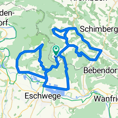 Lange Runde Kella
- Distanza
- 53,3 km
- Salita
- 749 m
- Discesa
- 749 m
- Posizione
- Kella, Free State of Thuringia, Germany