
Laguiole in bici
Scopri una mappa con 93 percorsi e sentieri ciclabili vicino a Laguiole, creati dalla nostra community.
Ritratto della regione
Scopri Laguiole
Trova il percorso in bici giusto per te a Laguiole, dove abbiamo 93 percorsi ciclabili da esplorare. La maggior parte delle persone va in bici qui nei mesi di Luglio e Agosto.
6.622 km
Distanza registrata
93
Percorsi ciclabili
1317
Popolazione
Community
Utenti più attivi a Laguiole

Dalla nostra comunità
I migliori percorsi in bici a Laguiole e dintorni


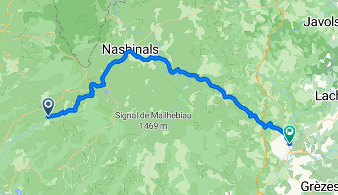
7.etapa St Chely d Aubrac - Le Malzieu-Ville
Percorso ciclabile a Laguiole, Occitanie, Francia
- 80,6 km
- Distanza
- 934 m
- Salita
- 877 m
- Discesa
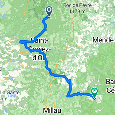
2014 Ride Day 99 - St-Chély-d'Aubrac to Marvejols
Percorso ciclabile a Laguiole, Occitanie, Francia
- 44,7 km
- Distanza
- 673 m
- Salita
- 856 m
- Discesa

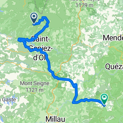
Ride Day 32—13 Oct 2005—48260 Recoules D'Aubrac (Nasbinals) to 15300 Murat
Percorso ciclabile a Laguiole, Occitanie, Francia
- 67,6 km
- Distanza
- 587 m
- Salita
- 757 m
- Discesa
Scopri più percorsi
 Nasbidaniel2
- Distanza
- 60,7 km
- Salita
- 627 m
- Discesa
- 627 m
- Posizione
- Laguiole, Occitanie, Francia
 09-MassifCentral
- Distanza
- 60,8 km
- Salita
- 509 m
- Discesa
- 1.057 m
- Posizione
- Laguiole, Occitanie, Francia
 TAP J 1
- Distanza
- 78,4 km
- Salita
- 900 m
- Discesa
- 1.474 m
- Posizione
- Laguiole, Occitanie, Francia
 étape 5
- Distanza
- 105 km
- Salita
- 1.228 m
- Discesa
- 1.265 m
- Posizione
- Laguiole, Occitanie, Francia
 JATIENZA2
- Distanza
- 44,1 km
- Salita
- 860 m
- Discesa
- 858 m
- Posizione
- Laguiole, Occitanie, Francia
 Route de Sainte-Urcize 21, Nasbinals nach Avenue Albert Thomas 23, Capdenac-Gare
- Distanza
- 114 km
- Salita
- 2.345 m
- Discesa
- 3.338 m
- Posizione
- Laguiole, Occitanie, Francia
 Aveyron-Tag1--4-0719 Runde angepasst 2
- Distanza
- 138,5 km
- Salita
- 1.438 m
- Discesa
- 1.922 m
- Posizione
- Laguiole, Occitanie, Francia
 Aveyron-Tag1--4-0719 Runde angepasst
- Distanza
- 142,3 km
- Salita
- 1.759 m
- Discesa
- 1.875 m
- Posizione
- Laguiole, Occitanie, Francia