
Châtellerault in bici
Scopri una mappa con 100 percorsi e sentieri ciclabili vicino a Châtellerault, creati dalla nostra community.
Ritratto della regione
Scopri Châtellerault
Trova il percorso in bici giusto per te a Châtellerault, dove abbiamo 100 percorsi ciclabili da esplorare. La maggior parte delle persone va in bici qui nei mesi di Luglio e Agosto.
7.736 km
Distanza registrata
100
Percorsi ciclabili
37.210
Popolazione


Dalla nostra comunità
I migliori percorsi in bici a Châtellerault e dintorni
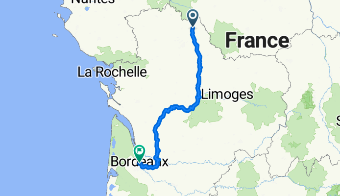
2. Châtellerault bis Bordeaux
Percorso ciclabile a Châtellerault, Aquitania-Limosino-Poitou-Charentes, Francia
- 404,7 km
- Distanza
- 3.009 m
- Salita
- 3.042 m
- Discesa

DAY ONE Châtellerault - Savigny-sous-Faye
Percorso ciclabile a Châtellerault, Aquitania-Limosino-Poitou-Charentes, Francia
- 24,5 km
- Distanza
- 138 m
- Salita
- 79 m
- Discesa
Chemin du Chilloux d'Ozon 17B to Rue des Glycines
Percorso ciclabile a Châtellerault, Aquitania-Limosino-Poitou-Charentes, Francia
- 60,1 km
- Distanza
- 272 m
- Salita
- 240 m
- Discesa

Chatellerault - Lussac Les Châteaux (60 km) - Chabanais (71 km)
Percorso ciclabile a Châtellerault, Aquitania-Limosino-Poitou-Charentes, Francia
- 131 km
- Distanza
- 1.044 m
- Salita
- 939 m
- Discesa
Scopri più percorsi
 SityTrail - 001C Chatellerault St Jacques to St Savin via Angles and En Lo
- Distanza
- 61,2 km
- Salita
- 490 m
- Discesa
- 462 m
- Posizione
- Châtellerault, Aquitania-Limosino-Poitou-Charentes, Francia
 (4) Final Chattelerault - Bordeaux, 282km, 990HM (camping)
- Distanza
- 282,2 km
- Salita
- 574 m
- Discesa
- 592 m
- Posizione
- Châtellerault, Aquitania-Limosino-Poitou-Charentes, Francia
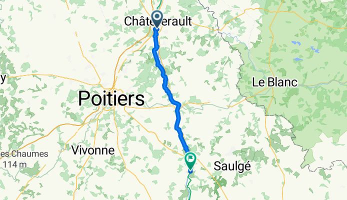
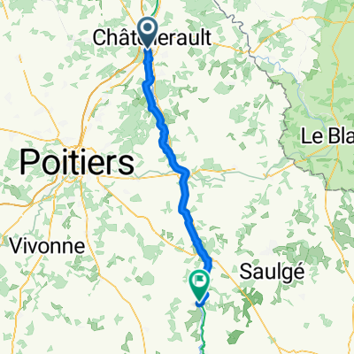 Châtellerault - Lussac-les-Châteaux
- Distanza
- 65 km
- Salita
- 293 m
- Discesa
- 268 m
- Posizione
- Châtellerault, Aquitania-Limosino-Poitou-Charentes, Francia
 11 Tag Châtellerault - Niort
- Distanza
- 112,6 km
- Salita
- 350 m
- Discesa
- 379 m
- Posizione
- Châtellerault, Aquitania-Limosino-Poitou-Charentes, Francia
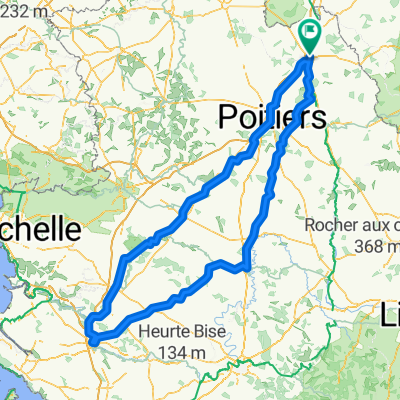
 tour du clain
- Distanza
- 42 km
- Salita
- 231 m
- Discesa
- 231 m
- Posizione
- Châtellerault, Aquitania-Limosino-Poitou-Charentes, Francia
 dag 5 chatelleraut naar nabij Savigne
- Distanza
- 92,5 km
- Salita
- 601 m
- Discesa
- 537 m
- Posizione
- Châtellerault, Aquitania-Limosino-Poitou-Charentes, Francia
 Châtellerault - Lussac-les-châteaux (58km) - Chabanais (130km) - Montbrond (174 km) - Angoulème (220 km)
- Distanza
- 216,9 km
- Salita
- 1.908 m
- Discesa
- 1.856 m
- Posizione
- Châtellerault, Aquitania-Limosino-Poitou-Charentes, Francia
 Voyage de fouuuuuuuuuuu
- Distanza
- 396,1 km
- Salita
- 2.362 m
- Discesa
- 2.362 m
- Posizione
- Châtellerault, Aquitania-Limosino-Poitou-Charentes, Francia