Vas in bici
Scopri una mappa con 5340 percorsi e sentieri ciclabili a Vas, creati dalla nostra community.
Ritratto della regione
Scopri Vas
Trova il percorso in bici giusto per te a Vas, dove abbiamo 5.340 percorsi ciclabili da esplorare. La maggior parte delle persone va in bici qui nei mesi di Luglio e Agosto.
422.268 km
Distanza registrata
5340
Percorsi ciclabili
Percorsi scelti con cura
Scopri Vas attraverso queste raccolte
Dalla nostra comunità
I migliori percorsi in bici a Vas
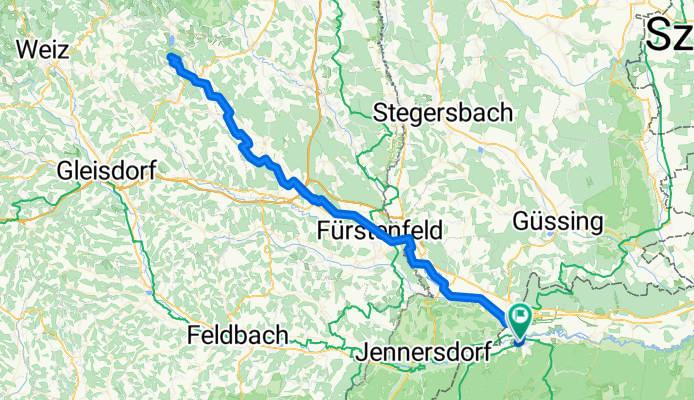
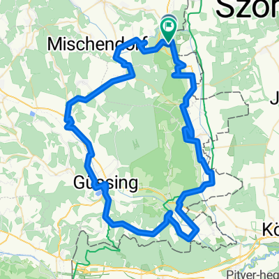
VELOREGIO_14.
Percorso ciclabile a Kőszeg, Vas, Hungary
HU
A mintegy 35 kilométeres túra Kőszegről felvisz minket az Országos Kéktúra kiindulópontjához, a 884 méter magas Írottkőre az osztrák-magyar határon, ahonnan megtekinthetjük a panorámát, mielőtt az osztrák oldalon keresztül visszatérnénk kiindulópontunkra. Kőszeg számos kulturális, történelmi és gasztronómiai élményt rejt, amelyek jól kombinálhatóak egy néhány napos vagy akár egy hetes bringás kirándulással is. Az útvonal az osztrák oldali aszfaltozott útig jó minőségű, ám aszfaltozatlan erdészeti utakon vezet folyamatosan emelkedve; nem igényel olyan komoly tereptapasztalatot, mint a mountain bike-os túrakínálat útjai, azonban a komolyabb szintemelkedés miatt kisgyermekes családoknak kevésbé ajánlott. A jelzett erdészeti út a Hunyadi János útról, a Jurisich gimnázium után, a Chernel ház mellől érhető el, innen emelkedik folyamatosan, festői tájon keresztül az Írottkőig, ahonnan meredeken ereszkedik le B56-os osztrák útra. Ezen ereszkedünk egészen Lékáig (Lockenhaus), amelynek sokat megélt várát mindenképpen érdemes megcsodálni. Lékától jobbra tartunk a határmenti Rattersdorfig (Rőtfalva), ahonnan már közvetlenül el is érjük a határállomást. Innen már csak le kell gurulni a Csónakázó-tó mellett, Kőszegre a Kéthelyi út-Meskó út útvonalon érünk be a legegyszerűbben.
DE
Die 35 Kilometer lange Tour von Kőszeg bringt uns zum Startpunkt der Nationalen Blauen Tour (Orszásgos Kéktúra), dem 884 Meter hohen Írottkő an der österreichisch-ungarischen Grenze, von dem wir das Panorama sehen können, bevor wie über die österreichische Seite zu unserem Ausgangspunkt zurückkehren. Kőszeg hat viele kulturelle, historische und gastronomische Sehenswürdigkeiten/Erlebnisse, die mit ein paar Tagen oder sogar einer einwöchigen Radtour kombiniert werden können. Die Route führt auf unbefestigten, aber hochwertigen Waldwegen zu einer asphaltierten Straße auf der österreichischen Seite. Die Tour erfordert keine ernsthaften Felderfahrungen wie die Routen der Mountainbike-Touren, aber aufgrund einer ernsthafteren Zunahme Höhen, ist diese Tour für Familien mit kleinen Kindern weniger zu empfehlen. Die markierte Waldstraße von Hunyadi János út nach dem Jurisich-Gymnasium ist vom Chernel Haus aus zu erreichen. Von hier aus gibt es Steigerungen, man fährt durch die malerische Landschaft nach Írottkő, ab wo wir steil nach unten zur österreichischer B56 Straße fahren. Wir steigen hinunter nach Léka (Lockenhaus), dessen Festung besuchungswert ist. Von Léka nach rechts erreichen wir bei der Grenzen Rattersdorf (Rőtfalva), von wo aus wir den Grenzen direkt erreichen können. Von hier aus müssen wir neben den See Csónakázó fahren, und der einfachste Weg, um nach Kőszeg zu gelangen, ist die Route: Straße Kéthelyi –Meskó.
EN
This almost 35-km trip takes you from Kőszeg to the starting point of the National Blue Rail, the 884-meter-high Írottkő at the Austrian-Hungarian border where you can look at the panorama before returning to the starting point through the Austrian side. Kőszeg has numerous cultural, historical and gastronomical experiences that can be combined with a several-day or even with a several-week long cycle trip. The route goes through ascending good quality forest roads until Austria; unlike the mountain bike tours, it doesn’t need too much experience but given the ascension we don’t recommend it for families with small children. You can reach the signed forest road from Hunyadi János út after the Jurisich gymnasium and next to the Chernel house. From there it ascends continuously with a beautiful landscape until Írottkő where it goes downwards to the Austrian road B56. Follow it to Léka (Lockenhaus) where you can find a castle that is worth visiting. Turn right towards Rattersdorf (Rőtfalva) in the borderlands and reach the border station. Continue near the Csónakázó lake and reach Kőszeg on the Kéthelyi út-Meskó út route.
- 33,7 km
- Distanza
- 636 m
- Salita
- 635 m
- Discesa
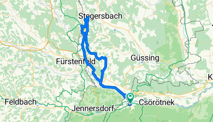
VELOREGIO_06.
Percorso ciclabile a Szombathely, Vas, Hungary
HU
Az útvonal kényelmes egynapos túra komoly szintkülönbségek nélkül a Szombathelytől délre elterülő területeken, egyedül a túra elején kell bemelegítés gyanánt felkapaszkodni egy dombra Náraiig A többi Szombathelyről kiinduló vagy azon áthaladó túrával együtt része lehet egy többnapos csillagtúrázásnak, de akármilyen összetételű kisebb vagy nagyobb csoport számára izgalmas kaland lehet egy egynapos kiruccanásra Szombathelyről. A város önmagában számos látnivalót nyújt, amit a túra előtt vagy után is meglátogathatunk.
Szombathelyről a Nárai úton indulunk kifele, elhaladunk a Bagolyvár mellett, majd az Erdei Iskola úton, az erdőn keresztül, vagy a Külső Nárai úton alacsony forgalmú közúton érjük el Nárait. A Szent Tamás-templom mellett balra fordulunk a Kossuth Lajos utcán, ami elvezet minket egészen Jákig, ahol felfrissülhetünk, és megtekinthetjük a híres középkori templomot. Az út a templomdomb alatt visz keletre, a Széchenyi úton érünk ki Jákról Balogunyomig, ahol a 86-os úton megtett néhány száz méter után jobbra kanyarodunk, és továbbra is alacsony forgalmú közutakon haladunk tovább a táblát követve Sorokpolányig, majd Sorkikápolnán át Nemeskoltáig és Csempeszkopácsig (8442-es út). Innen balra, északnyugatnak fordulunk a 87-es úton, Vasszécsényen és Táplánkereszten át érünk vissza Szombathely városába.
DE
Die Route ist eine bequeme eintägige Tour ohne signifikanten Höhenunterschieden in den Gebieten südlich von Szombathely. Nur am Anfang der Tour muss man auf den Hügel Nárai um zu Aufwärmung fahren. Es kann ein Teil einer mehrtägigen Sternfahrt von den restlichen Fahrradtouren die den Anfagsort in Szombathely haben sein. Es kann aber für kleine bzw größere Gruppen auch ein interesssantes und abendteuervolles Tagesausflug von Szombathely sein. Die Stadt selbst bietet viele Attraktionen, die vor oder nach der Tour besucht werden können.
Von Szombathely fahren wir an der Nárai-Straße an Bagolyvár vorbei, dann auf der Erdei Iskola Straße, durch den Wald oder auf der Äußeren Nárai-Straße, erreichen wir bei einem geringen Verkehr Nárai. Wir biegen bei der St. Thomas Kirche nach links ab an der Kossuth Lajos Straße, die uns bis zu Ják führt wo wir uns erfrischen können und die berühmte mitteralterliche Kirche besuchen können. Die Straße führt in östlicher Richtung entlang des Hügels bei der Kirche. Auf der Széchenyi-Straße gelangen wir von Ják nach Balogunyom, wo wir nach ein paar hunderten Meter auf der Straße 86 nach rechts abbiegen und auf wenig befahrenen Straßen nach Sorokpolány folgen. Über Sorkikápolna nach Nemeskolt und Csempeszkopács (Straße 8442). Von hier aus biegen wir links in nordwestlicher Richtung auf die Straße 87 und kommen zurück nach Szobathely durch Vasszeszszény und Táplánkereszt.
EN
The route is a comfortable one-day trip without serious ascents south of Szombathely. There is a short climb at the beginning of the route to reach Nárai. You can choose to use this with the other routes near Szombathely as part of a multi-day trip with the same starting point, but it is an exciting adventure for any number of people in a group to take a one-day trip from the city. Szombathely offers a lot of points of interests alone the group can explore the city before or after the trip.
Leave Szombathely and Bagolyvár on Nárai út then reach Nárai either on Erdei Iskola út through the woods or on the low traffic road Külső Nárai út. Turn left at the Saint Thomas church on Kossuth Lajos utca that leads to Ják where the famous medieval church worth visiting after some refreshments. The route goes east under the church hill, leave Ják on Széchenyi út and follow it until Balogunyom where after a few hundred meters on route 86 turn right and continue following the signs on low traffic roads to Sorokpolány, then to Nemeskolta and Csempeszkopács through Sorkikápolna, Nemeskolta and Csempeszkopács (route 8442). Turn left on route 87 that leads back to Szombathely through Vasszécseny and Táplánkereszt.
- 52,9 km
- Distanza
- 109 m
- Salita
- 112 m
- Discesa
VELOREGIO_05.
Percorso ciclabile a Szombathely, Vas, Hungary
HU
Az útvonal kényelmes egynapos túrát jelent kisgyermekes családosok számára is számos gyerekbarát programlehetőséggel, ugyanakkor történelmi és kulináris érdekességekkel is szolgál, amik miatt minden típusú kisebb vagy nagyobb csoport számára izgalmas kaland lehet egy egynapos kiruccanásra Szombathelyről. A város önmagában számos érdekességet nyújt, amit a túra előtt vagy után is kihasználhatunk.
Az útvonal a Perint partján, majd a Tófürdő mellett, kitáblázott kerékpárúton hagyja el Szombathelyet Olad felől a Dolgozók útján. A jó minőségű, szükség esetén az autós forgalomtól elválasztott kerékpárút Sé és Torony felé halad tovább (Dozmat felé rövid kitérővel lehet eljutni), majd a Bucsu-Bozsok felé tartó leágazás után ér véget, ahonnan alacsony forgalmú közúton kapaszkodunk fel Nardáig, majd innen a Kossuth Lajos utcán legurulva érünk át Felsőcsatárra, közvetlenül az országhatár mellé. A dombon található a Vasfüggöny-múzeum, számos korabeli relikviával emlékeztet az elmúlt hidegháborús időkre. Utunk a Pinka-szurdokon keresztül a vaskereszti halastó mellé visz, ahol igény szerint ebédelhetünk is, és a Vas-hegy alatti kis falu főutcájának megtekintése után továbbhaladhatunk Horvátlövő, majd Pornóapáti felé, ahol a Szent Margit-templomnál jobbra fordulunk a Fő utcán Nárai felé, ahova dimbes-dombos, erdős út visz minket, majd Náraitól már lefele ereszkedhetünk a Petőfi Sándor, majd a Nárai úton át Szombathely belvárosáig.
DE
Die Route bietet einen komfortablen Tagesausflug für Familien mit kleinen Kindern und bietet eine Reihe kinderfreundlicher Programme sowie historische und kulinarische Erlebnisse. Die Tour ist ideal für allen Arten von kleineren oder größeren Gruppen, ein aufregendes Abenteuer für eine eintägige Reise von Szombathely zu erleben. Die Stadt selbst bietet viele interessante Orte und Möglichkeiten, die Sie vor oder nach der Tour genießen können.
Die Route führt am Ufer des Perints, danach am Tófürdő auf eien Radweg verlässt sie Szombathely von Richtung Olad an der Dolgozók Straße. Der Radweg, der gegebenenfalls vom Autoverkehr getrennt ist, führt weiter zu Sé und Torony (Sie können Dozmat mit einem kurzen Umweg erreichen) und endet nach der Ausfahrt Bucsu-Bozsok. Von dort führt eine verkehrsarme Straße nach Nard und dann von der Kossuth Lajos Sraße erreichen wir Felsőcsatár direkt an der Grenze. Auf dem Hügel befindet sich das Museum des Eisenen Vorhangs mit vielen Relikten, die an die Zeit des Kalten Krieges erinnern. Unser Weg führt dann durch den Pinka Tal zum Teich von Vaskereszt, wo wir eventuell zu Mittag essen können.Nachdem wir die Hauptstraße des kleinen Dorfes unterhalb von Vas-hegy (Vas Berg) gesehen haben, können Sie nach Horvátlövő und dann nach Pornóapáti fahren, wo wir rechts bei der Szent Margit-Kirche in der Nárai-Straße abbiegen, wo uns eine bewaldete Straße hinführt, ab Nárai fahren wir weiter an der Petőfi Sándor Straße und Nárai Straße bis die Innerstadt von Szombathely.
EN
The route is a comfortable one-day trip for families with small children with kid-friendly programs while it offers historical and culinary points of interests which makes it an exciting adventure for smaller or bigger groups of all age. Since Szombathely offers a lot of points of interests alone the group can explore the city before or after the trip.
The route leaves Szombathely on the bank of the Perint and then next to Tófürdő on a bicycle route with signs from Olad on Dolgozók útja. The good quality bicycle road goes towards Sé and Torony (you can reach Dozmat with a small bypass) until it ends at the road towards Bucsu and Bozsok. Follow the low traffic road to ascend to Narda then go down on Kossuth utca to reach Felsőcsatár next to the border. The Iron Curtain Museum on the hill has numerous relics to show the history of the cold war. The route continues through the Pinka canyon to the pond at Vaskereszt where you can get lunch and after visiting the small main road of the village continue towards Horvátlövő then Pornóapáti. Here turn right at the Saint Margaret Church to Fő utca and go towards Nárai on forest roads through hills then after Nárai go down on Petőfi Sándor út and Nárai út to the downtown of Szombathely.
- 40,3 km
- Distanza
- 189 m
- Salita
- 192 m
- Discesa
Bethlen Gábor utca, Szentgotthárd - Bethlen Gábor utca, Szentgotthárd
Percorso ciclabile a Szentgotthárd, Vas, Hungary
- 90,3 km
- Distanza
- 335 m
- Salita
- 338 m
- Discesa
Scopri più percorsi
- 3Határlos kerékpártúrák HU-AT 2.
- Distanza
- 41,8 km
- Salita
- 180 m
- Discesa
- 181 m
- Posizione
- Szentgotthárd, Vas, Hungary
- 40km-es déli kör
- Distanza
- 43,1 km
- Salita
- 194 m
- Discesa
- 192 m
- Posizione
- Szombathely, Vas, Hungary
- 3Határlos kerékpártúrák HU-AT 6.
- Distanza
- 22,2 km
- Salita
- 139 m
- Discesa
- 136 m
- Posizione
- Szentgotthárd, Vas, Hungary
- VELOREGIO_07.
- Distanza
- 41,7 km
- Salita
- 141 m
- Discesa
- 141 m
- Posizione
- Szombathely, Vas, Hungary
- Őrség - kis kör
- Distanza
- 66,9 km
- Salita
- 614 m
- Discesa
- 617 m
- Posizione
- Szentgotthárd, Vas, Hungary
- VELOREGIO_03.
- Distanza
- 34,8 km
- Salita
- 53 m
- Discesa
- 53 m
- Posizione
- Celldömölk, Vas, Hungary
- Hegykerules Jozsival
- Distanza
- 106,2 km
- Salita
- 474 m
- Discesa
- 473 m
- Posizione
- Táplánszentkereszt, Vas, Hungary
- Kőszeg- Ausztria várak
- Distanza
- 78 km
- Salita
- 1.236 m
- Discesa
- 1.239 m
- Posizione
- Kőszeg, Vas, Hungary
Regioni ciclistiche in Vas
Sárvár
413 percorsi in bici
Jánosháza
58 percorsi in bici
Szombathely
1726 percorsi in bici
Szentgotthárd
1059 percorsi in bici
Répcelak
61 percorsi in bici
Scopri dove la gente va in bici in Hungary
Regioni ciclistiche popolari in Hungary
HungaryCsongrád megye HungaryZala HungaryTolna megye HungaryNógrád megye HungaryBács-Kiskun county