
Mars Hill in bici
Scopri una mappa con 4 percorsi e sentieri ciclabili vicino a Mars Hill, creati dalla nostra community.
Sii un pioniere
Ispira altri ciclisti con il tuo percorso a Mars Hill
Bikemap è una community ciclistica globale con milioni di percorsi creati da ciclisti come te. Ci sono ancora pochi percorsi a Mars Hill, quindi traccia le tue uscite preferite sulla mappa per aiutare gli altri a scoprire i migliori percorsi da seguire.
Dalla nostra comunità
I migliori percorsi in bici a Mars Hill e dintorni

North Main Street 114, Mars Hill to North Main Street 114, Mars Hill
Percorso ciclabile a Mars Hill, Carolina del Nord, Stati Uniti
- 34 km
- Distanza
- 462 m
- Salita
- 462 m
- Discesa

Hot Doggett Metric Century (2009)
Percorso ciclabile a Mars Hill, Carolina del Nord, Stati Uniti
- 103 km
- Distanza
- 2.651 m
- Salita
- 2.482 m
- Discesa
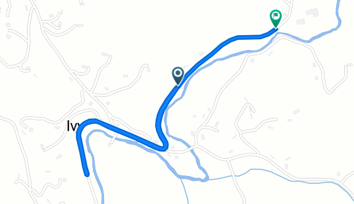
Beech Glen Road to Blue Herron Road
Percorso ciclabile a Mars Hill, Carolina del Nord, Stati Uniti
- 0,6 km
- Distanza
- 42 m
- Salita
- 0 m
- Discesa
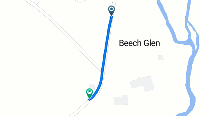
Beech Glen Road to Beech Glen Road
Percorso ciclabile a Mars Hill, Carolina del Nord, Stati Uniti
- 2,5 km
- Distanza
- 52 m
- Salita
- 12 m
- Discesa