
Conneaut in bici
Scopri una mappa con 10 percorsi e sentieri ciclabili vicino a Conneaut, creati dalla nostra community.
Ritratto della regione
Scopri Conneaut
Trova il percorso in bici giusto per te a Conneaut, dove abbiamo 10 percorsi ciclabili da esplorare.
318 km
Distanza registrata
10
Percorsi ciclabili
12.841
Popolazione


Dalla nostra comunità
I migliori percorsi in bici a Conneaut e dintorni


Conneaut OH to Austinburg OH
Percorso ciclabile a Conneaut, Ohio, Stati Uniti
With thunderstorms and lightning forecasted for today, we fortunately only had a relatively short distance of about 20 miles to ride. So, a bit before 10:00 AM, we set off in a light rain.
Again, as with prior days, we had great roads between the hotel, which is by the interstate, and our target road, which was US Rt 20 in this case. A short segment of that portion of the ride (maybe a quarter of a mile or a little more) was unpaved, but not a problem.
As most of the ride on US Rt 20 had little traffic, until getting close to Ashtabula, the lack of any road shoulder was not a problem. This entire segment of US Rt 20 was two lanes in each direction, so there was plenty of room for cars to pass us while we rode in the right lane.
From Ashtabula, for some miles we were on an excellent rails-to-trains bike path called the Western Reserve Greenway Trail. While we’d been spared rain for most of our time on US Rt 20, a while after getting on the trail, claps of thunder filled the air and we even saw a lightning flash or two. Fortunately, though, while we were pelted a little with some rain, it never got really heavy. Soon thereafter, we arrived at the hotel for the night.
- 33,8 km
- Distanza
- 230 m
- Salita
- 188 m
- Discesa

Conneaut to Erie/Forest Park
Percorso ciclabile a Conneaut, Ohio, Stati Uniti
- 96,6 km
- Distanza
- 139 m
- Salita
- 148 m
- Discesa
413–439 Gore Rd, Conneaut to 1230 Walnut Blvd, Ashtabula
Percorso ciclabile a Conneaut, Ohio, Stati Uniti
- 18,2 km
- Distanza
- 49 m
- Salita
- 257 m
- Discesa

380 State St, Conneaut to 102 W Main Rd, Conneaut
Percorso ciclabile a Conneaut, Ohio, Stati Uniti
- 2 km
- Distanza
- 17 m
- Salita
- 12 m
- Discesa
Scopri più percorsi
 251 State St, Conneaut to 380 State St, Conneaut
- Distanza
- 0,7 km
- Salita
- 0 m
- Discesa
- 3 m
- Posizione
- Conneaut, Ohio, Stati Uniti
 102 W Main Rd, Conneaut to 404 Gore Rd, Conneaut
- Distanza
- 3,1 km
- Salita
- 10 m
- Discesa
- 10 m
- Posizione
- Conneaut, Ohio, Stati Uniti
 Recording from 7:19pm, August 18
- Distanza
- 51,1 km
- Salita
- 247 m
- Discesa
- 65 m
- Posizione
- Conneaut, Ohio, Stati Uniti
 USBR 30: Conneaut to Lake City
- Distanza
- 17,5 km
- Salita
- 83 m
- Discesa
- 74 m
- Posizione
- Conneaut, Ohio, Stati Uniti
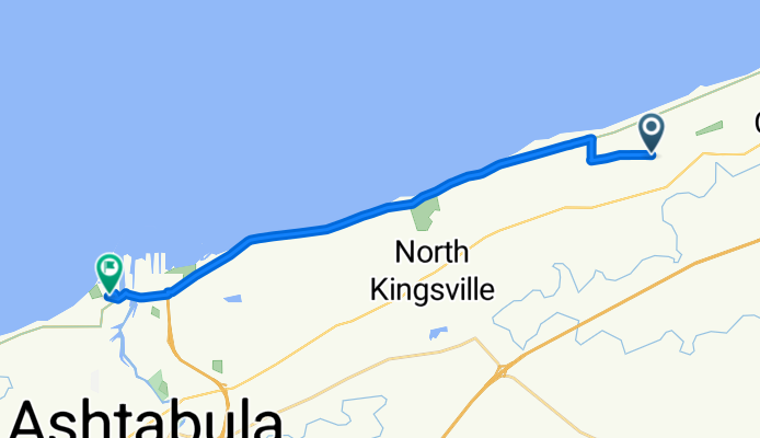
 USBR 30: Conneaut to North Kingsville
- Distanza
- 18,1 km
- Salita
- 72 m
- Discesa
- 60 m
- Posizione
- Conneaut, Ohio, Stati Uniti
 300 Park Ave, Conneaut to 7 W Jackson St, Painesville
- Distanza
- 77 km
- Salita
- 749 m
- Discesa
- 735 m
- Posizione
- Conneaut, Ohio, Stati Uniti