
Horsley Park in bici
Scopri una mappa con 49 percorsi e sentieri ciclabili vicino a Horsley Park, creati dalla nostra community.
Ritratto della regione
Scopri Horsley Park
Trova il percorso in bici giusto per te a Horsley Park, dove abbiamo 49 percorsi ciclabili da esplorare.
1.048 km
Distanza registrata
49
Percorsi ciclabili
1936
Popolazione
Community
Utenti più attivi a Horsley Park
Dalla nostra comunità
I migliori percorsi in bici a Horsley Park e dintorni
Huntingwood to Prestons Maccas
Percorso ciclabile a Horsley Park, New South Wales, Australia
Ride the Shared Path from the M7 Offices (101 Wallgrove Road). Head South to the end of M7 Shared cycleway. Turn right on Camden Valley Way and cycle to BP/McDonalds for refuelling.
- 19,4 km
- Distanza
- 145 m
- Salita
- 160 m
- Discesa
M7 Bubbler to Prestons
Percorso ciclabile a Horsley Park, New South Wales, Australia
M7 cycleway from the mid-point south to Prestons Maccas. 19km one way, 38 km return. All entirely off road, on shared cycleway/pedestrian path.
- 20 km
- Distanza
- 170 m
- Salita
- 183 m
- Discesa
Quick M7 run out and back
Percorso ciclabile a Horsley Park, New South Wales, Australia
Mostly down hill away from start and mostly up on the way back with the dominant hill being up to Elizabeth drive 2 hills back to back.
Parking is best at Sydney west regional park ride through the park towards equestrian centre and then up onto the M7 path.
Some steep hills getting into and out of the park.
NOTE: Parking has opening & closing times as it is a National park.
- 16,1 km
- Distanza
- 193 m
- Salita
- 242 m
- Discesa
M7 Bubbler to Kings Langley Bubbler
Percorso ciclabile a Horsley Park, New South Wales, Australia
Off-road cycleway ride from M7 bubbler (adjacent to Westlink offices at Eastern Creek) to Pearce's Park Kings Langley (where a bubbler and shaded tables can be found).
The M7 bubbler is the half-way point on the cycleway, and the northern half is the easier ride for beginners.
It is 100% off road - very easily Sydney's if not Australia's best cycleway. There is just one road crossing near Pearce's Park, Kings Langley (beyond the northern end of the M7).
M7 sadly lacks water stops, so hopefully this will help you find water !
Note, M7 cycleway has night lighting, but caution should be exercise in the Dean Park area due to vandalism.
- 20,4 km
- Distanza
- 146 m
- Salita
- 147 m
- Discesa
Scopri più percorsi
- Bossley Park to Yagoona via Prospect Canal and Parramatta
- Distanza
- 31,3 km
- Salita
- 103 m
- Discesa
- 152 m
- Posizione
- Horsley Park, New South Wales, Australia
- Marconi Criterium track WSID
- Distanza
- 2,5 km
- Salita
- 30 m
- Discesa
- 28 m
- Posizione
- Horsley Park, New South Wales, Australia
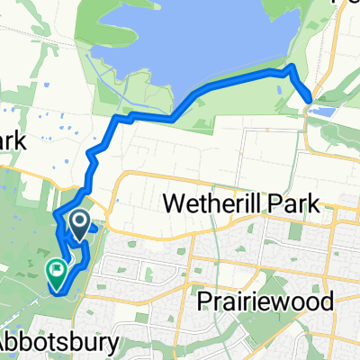
- Cowpasture Road 289, Bossley Park to Risbey Place 20, Bligh Park
- Distanza
- 47,2 km
- Salita
- 22 m
- Discesa
- 42 m
- Posizione
- Horsley Park, New South Wales, Australia
- Route to 40 Grimson Crescent, Liverpool
- Distanza
- 19,5 km
- Salita
- 48 m
- Discesa
- 123 m
- Posizione
- Horsley Park, New South Wales, Australia
- Recovered Route
- Distanza
- 35,6 km
- Salita
- 574 m
- Discesa
- 609 m
- Posizione
- Horsley Park, New South Wales, Australia
- Liverpool Exploring
- Distanza
- 46,4 km
- Salita
- 200 m
- Discesa
- 200 m
- Posizione
- Horsley Park, New South Wales, Australia
- Unnamed Road, Wetherill Park to Fairfield Station
- Distanza
- 10,9 km
- Salita
- 100 m
- Discesa
- 141 m
- Posizione
- Horsley Park, New South Wales, Australia
- Horsley Park to Parramatta Road
- Distanza
- 20,7 km
- Salita
- 80 m
- Discesa
- 144 m
- Posizione
- Horsley Park, New South Wales, Australia