
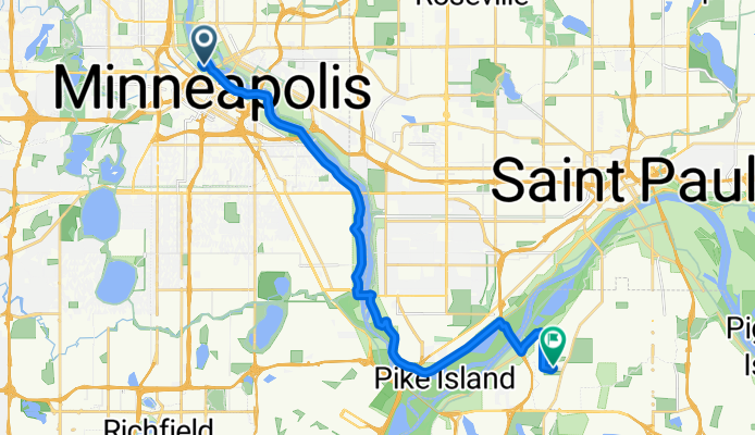
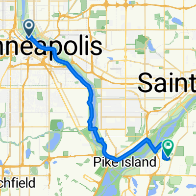
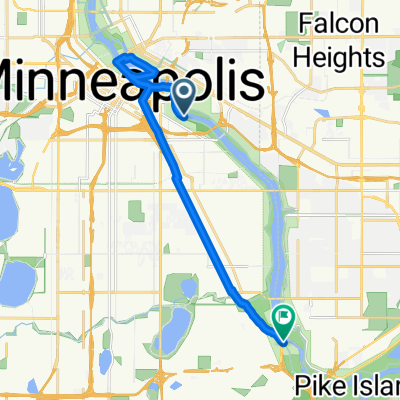
Gita in bici di un giorno da Minneapolis a Mendota Heights
Personalizza il tuo percorso partendo dal nostro modello o scopri come la nostra community preferisce pedalare da Minneapolis a Mendota Heights.
Modello di percorso
Da Minneapolis a Mendota Heights
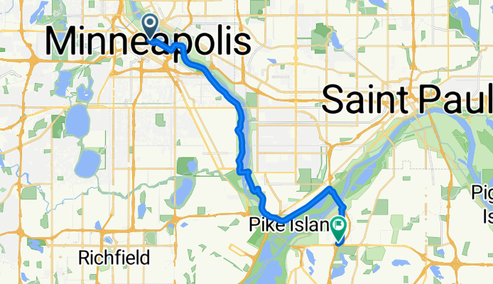
- 1 h 12 min
- Durata
- 21,4 km
- Distanza
- 194 m
- Salita
- 179 m
- Discesa
- 17,9 km/h
- Velocità media
- 275 m
- Altitudine max.
Community
Utenti migliori in questa regione


Dalla nostra comunità
I migliori percorsi in bici da Minneapolis a Mendota Heights

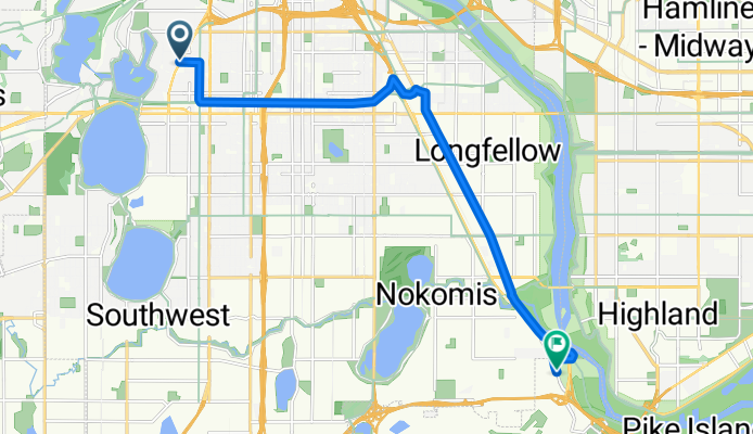
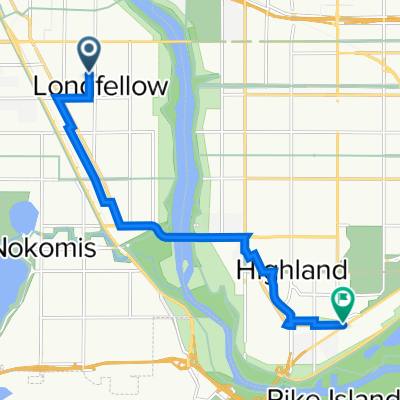
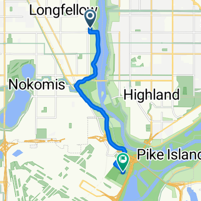
B2B00534 55407>55121 via Hiawatha Trl, Big Rivers Trl, Pilot Knob Rd
Percorso ciclabile a Minneapolis, Minnesota, Stati Uniti
- 14,7 km
- Distanza
- 83 m
- Salita
- 79 m
- Discesa

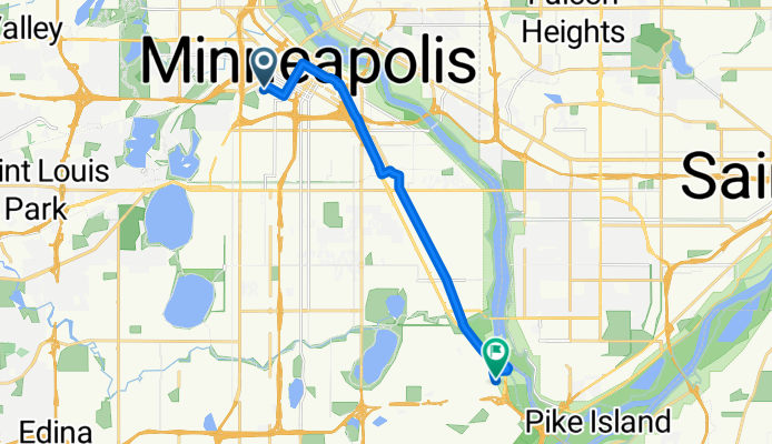
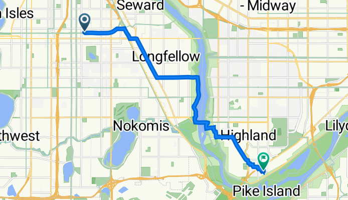
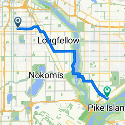
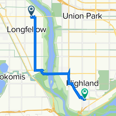
B2B00475 55406>55121 via 46th Ave S, Mendota Bridge, Pilot Knob, Lone Oak Rd
Percorso ciclabile a Minneapolis, Minnesota, Stati Uniti
- 18,2 km
- Distanza
- 114 m
- Salita
- 97 m
- Discesa
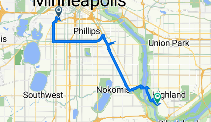
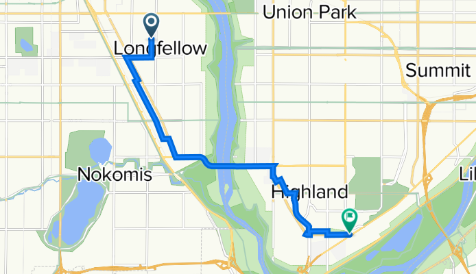
B2B00845 55405>55417 via Greenway, Minnehaha
Percorso ciclabile a Minneapolis, Minnesota, Stati Uniti
- 12,7 km
- Distanza
- 0 m
- Salita
- 17 m
- Discesa
B2B00442 55403 > 55417 via DT Mpls, LRT Trail, Minnehaha
Percorso ciclabile a Minneapolis, Minnesota, Stati Uniti
- 12,7 km
- Distanza
- 77 m
- Salita
- 74 m
- Discesa
Clifton Avenue 416, Minneapolis to Itasca Avenue 2086, Saint Paul
Percorso ciclabile a Minneapolis, Minnesota, Stati Uniti
- 15,7 km
- Distanza
- 35 m
- Salita
- 29 m
- Discesa
N First St, Minneapolis to Evergreen Knolls, Mendota Heights
Percorso ciclabile a Minneapolis, Minnesota, Stati Uniti
- 22,5 km
- Distanza
- 144 m
- Salita
- 118 m
- Discesa
10th Avenue South 2830, Minneapolis to West Maynard Drive 1357W, Saint Paul
Percorso ciclabile a Minneapolis, Minnesota, Stati Uniti
- 12,2 km
- Distanza
- 47 m
- Salita
- 33 m
- Discesa
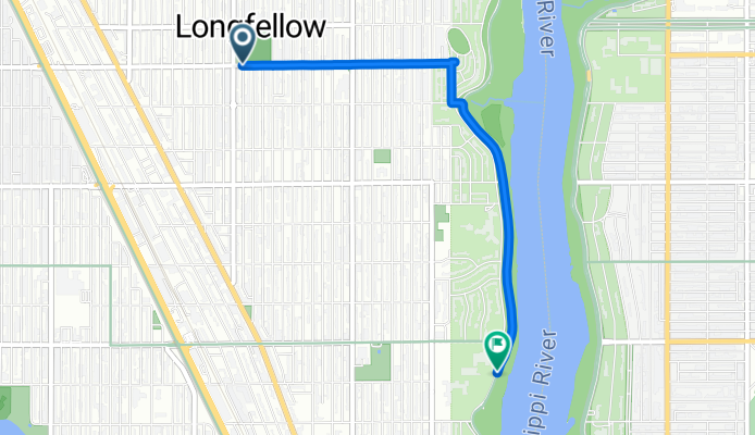
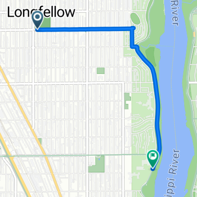
longfellow to bluff
Percorso ciclabile a Minneapolis, Minnesota, Stati Uniti
- 3,2 km
- Distanza
- 7 m
- Salita
- 13 m
- Discesa
Fort Snelling
Percorso ciclabile a Minneapolis, Minnesota, Stati Uniti
- 7,4 km
- Distanza
- 50 m
- Salita
- 52 m
- Discesa
Mpls - W River & 4th to Stone Arch Bridge and back to Minnehaha
Percorso ciclabile a Minneapolis, Minnesota, Stati Uniti
- 15,9 km
- Distanza
- 105 m
- Salita
- 96 m
- Discesa
Scopri più percorsi
 Clifton Avenue 416, Minneapolis to Itasca Avenue 2086, Saint Paul
- Distanza
- 15,7 km
- Salita
- 35 m
- Discesa
- 29 m
- Posizione
- Minneapolis, Minnesota, Stati Uniti
 N First St, Minneapolis to Evergreen Knolls, Mendota Heights
- Distanza
- 22,5 km
- Salita
- 144 m
- Discesa
- 118 m
- Posizione
- Minneapolis, Minnesota, Stati Uniti
 testt
testt- Distanza
- 9,1 km
- Salita
- 59 m
- Discesa
- 65 m
- Posizione
- Minneapolis, Minnesota, Stati Uniti
 10th Avenue South 2830, Minneapolis to West Maynard Drive 1357W, Saint Paul
- Distanza
- 12,2 km
- Salita
- 47 m
- Discesa
- 33 m
- Posizione
- Minneapolis, Minnesota, Stati Uniti
 longfellow to bluff
- Distanza
- 3,2 km
- Salita
- 7 m
- Discesa
- 13 m
- Posizione
- Minneapolis, Minnesota, Stati Uniti
 Fort Snelling
- Distanza
- 7,4 km
- Salita
- 50 m
- Discesa
- 52 m
- Posizione
- Minneapolis, Minnesota, Stati Uniti
 test2
test2- Distanza
- 8,7 km
- Salita
- 59 m
- Discesa
- 64 m
- Posizione
- Minneapolis, Minnesota, Stati Uniti
 Mpls - W River & 4th to Stone Arch Bridge and back to Minnehaha
- Distanza
- 15,9 km
- Salita
- 105 m
- Discesa
- 96 m
- Posizione
- Minneapolis, Minnesota, Stati Uniti
Percorsi da Minneapolis
Gita in bici di un giorno da
Da Minneapolis a Saint Paul
Gita in bici di un giorno da
Da Minneapolis a Richfield
Giro veloce in bici da
Da Minneapolis a Saint Louis Park
Giro veloce in bici da
Da Minneapolis a Saint Anthony