
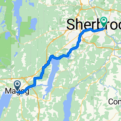
Gita in bici di un giorno da Magog a Sherbrooke
Personalizza il tuo percorso partendo dal nostro modello o scopri come la nostra community preferisce pedalare da Magog a Sherbrooke.
Modello di percorso
Da Magog a Sherbrooke
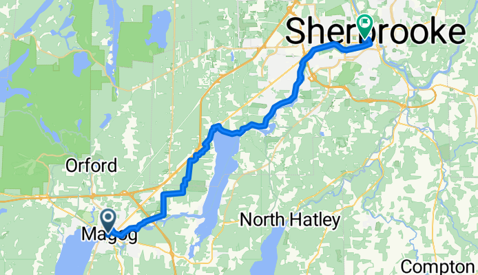
- 1 h 55 min
- Durata
- 33,3 km
- Distanza
- 232 m
- Salita
- 274 m
- Discesa
- 17,4 km/h
- Velocità media
- 251 m
- Altitudine max.
Get ready for a scenic cruise from Magog to Sherbrooke! This roughly 33 km ride (give or take a few hills) is a beautiful way to experience the Eastern Townships. Starting from Magog, a charming lakeside town on the northern tip of Lake Memphremagog—perfect for a pre-ride coffee or lakeside stroll—you’ll head north toward Sherbrooke, the region’s lively university city.
The route is a real mixed bag: expect to roll along quiet roads and cycleways for most of the trip, with more than half the way being paved. There are segments with loose gravel and unpaved paths, so wider tires and a spirit of adventure won’t go amiss. You’ll cruise past picturesque countryside, gentle hills, and sweet little hamlets.
Total ascent is pretty manageable—about 230 m up, 270 m down—so there’s enough climbing to keep things interesting without burning you out. At the finish, Sherbrooke awaits with its riverside parks, culture, and bustling cafés. Don’t forget to check out the murals downtown!
Community
Utenti migliori in questa regione

Dalla nostra comunità
I migliori percorsi in bici da Magog a Sherbrooke


Deauville - Lennoxville
Percorso ciclabile a Magog, Québec, Canada
- 39,3 km
- Distanza
- 221 m
- Salita
- 303 m
- Discesa

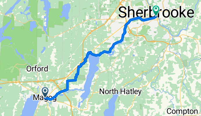
J1 Magog - Sherbrooke
Percorso ciclabile a Magog, Québec, Canada
- 40,1 km
- Distanza
- 193 m
- Salita
- 251 m
- Discesa


J2-Magog-Ayer's Cliff-Sherbrooke
Percorso ciclabile a Magog, Québec, Canada
- 77,2 km
- Distanza
- 1.333 m
- Salita
- 1.404 m
- Discesa
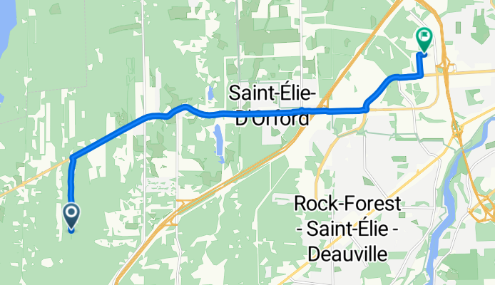
Rue du Griffon to Rue de la Garlock
Percorso ciclabile a Magog, Québec, Canada
- 11,6 km
- Distanza
- 130 m
- Salita
- 113 m
- Discesa

defi des canton 2011
Percorso ciclabile a Magog, Québec, Canada
- 149,9 km
- Distanza
- 873 m
- Salita
- 1.003 m
- Discesa
Grandes-fourches Networkm- Massawippi Axis
Percorso ciclabile a Magog, Québec, Canada
- 14,3 km
- Distanza
- 68 m
- Salita
- 76 m
- Discesa

J2B-Mago-Coaticook-Sherbrooke
Percorso ciclabile a Magog, Québec, Canada
- 104,8 km
- Distanza
- 1.482 m
- Salita
- 1.553 m
- Discesa

Orford-Sherb-Parc S.Daigle
Percorso ciclabile a Magog, Québec, Canada
- 56,6 km
- Distanza
- 603 m
- Salita
- 637 m
- Discesa
Scopri più percorsi
 Magog to Sherbrooke
- Distanza
- 58,1 km
- Salita
- 919 m
- Discesa
- 666 m
- Posizione
- Magog, Québec, Canada
 J2-Magog-Ayer's Cliff-Sherbrooke
- Distanza
- 77,2 km
- Salita
- 1.333 m
- Discesa
- 1.404 m
- Posizione
- Magog, Québec, Canada
 Rue du Griffon to Rue de la Garlock
- Distanza
- 11,6 km
- Salita
- 130 m
- Discesa
- 113 m
- Posizione
- Magog, Québec, Canada
 defi des canton 2011
- Distanza
- 149,9 km
- Salita
- 873 m
- Discesa
- 1.003 m
- Posizione
- Magog, Québec, Canada
 Grandes-fourches Networkm- Massawippi Axis
- Distanza
- 14,3 km
- Salita
- 68 m
- Discesa
- 76 m
- Posizione
- Magog, Québec, Canada
 J2B-Mago-Coaticook-Sherbrooke
- Distanza
- 104,8 km
- Salita
- 1.482 m
- Discesa
- 1.553 m
- Posizione
- Magog, Québec, Canada
 Route to Sherbrooke
- Distanza
- 32,9 km
- Salita
- 207 m
- Discesa
- 262 m
- Posizione
- Magog, Québec, Canada
 Orford-Sherb-Parc S.Daigle
- Distanza
- 56,6 km
- Salita
- 603 m
- Discesa
- 637 m
- Posizione
- Magog, Québec, Canada