Day 6, 70 miles from Peebles to Carlisle
Un percorso ciclabile con partenza da Peebles, Scozia, Regno Unito.
Panoramica
Su questo percorso
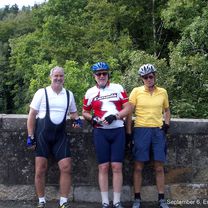
6 settembre 2006. Oggi il tempo era quasi perfetto per andare in bicicletta. Siamo partiti da Peebles, una bellissima cittadina, nella nebbia scozzese a circa 16 gradi, che è salita a basse venti con solo occasionali leggeri periodi di pioggia durante il giorno. Il forte vento da sud-ovest si era attenuato e si era spostato più verso ovest e nord per aiutarci. Il percorso da Peebles a Carlisle attraverso il Paese di Confine (Scozia) e il Cumbria (Inghilterra) è molto rurale e abbiamo portato abbastanza barrette di frutta per durarci se non avessimo trovato un posto per il pranzo. Di fatti siamo arrivati al monastero buddista giusto dopo la chiusura della loro sala da tè, ma in tempo per mangiare con i sostenitori per una donazione di £5. Niente carne ma cibo molto salutare, inclusa un'insalata di avocado. Abbiamo deciso di fermarci dopo 67 miglia e farci portare gli ultimi 4 chilometri attraverso l'ora di punta di Carlisle. Soggiorniamo nell'ex magnifico hotel ferroviario vittoriano, il Crown and Mitre. Il grande bonus è che le stanze hanno vasche da bagno di lunghezza totale, di cui tutti noi abbiamo approfittato dopo tutte le colline di oggi. Abbiamo condiviso il gigantesco ristorante del primo piano con 50 donne giocatrici di bocce di età media della popolazione dei bocciodromi.
- -:--
- Durata
- 112 km
- Distanza
- 1.237 m
- Salita
- 1.374 m
- Discesa
- ---
- Velocità media
- 380 m
- Altitudine max.
Foto del percorso
Qualità del percorso
Tipi di percorsi e superfici lungo il percorso
Tipi di percorso
Strada
23,5 km
(21 %)
Strada tranquilla
7,8 km
(7 %)
Superfici
Asfaltato
33,6 km
(30 %)
Asfalto
33,6 km
(30 %)
Non definito
78,4 km
(70 %)
Continua con Bikemap
Usa, modifica o scarica questo percorso ciclabile
Vuoi percorrere Day 6, 70 miles from Peebles to Carlisle o personalizzarlo per il tuo viaggio? Ecco cosa puoi fare con questo percorso su Bikemap:
Funzionalità gratuite
- Salva questo percorso tra i preferiti o in una raccolta
- Copia e pianifica la tua versione di questo percorso
- Dividilo in tappe per creare un tour di più giorni
- Sincronizza il tuo percorso con Garmin o Wahoo
Funzionalità Premium
Prova gratuita di 3 giorni o pagamento una tantum. Scopri di più su Bikemap Premium.
- Naviga questo percorso su iOS e Android
- Esporta un file GPX / KML di questo percorso
- Crea la tua stampa personalizzata (provala gratis)
- Scarica questo percorso per la navigazione offline
Scopri altre funzionalità Premium.
Ottieni Bikemap PremiumDalla nostra community
Peebles: Altri percorsi popolari che iniziano qui
 Peebles - Romano Bridge - Leadburn Circular
- Distanza
- 44,7 km
- Salita
- 199 m
- Discesa
- 200 m
- Posizione
- Peebles, Scozia, Regno Unito
 Cademuir
- Distanza
- 13,9 km
- Salita
- 255 m
- Discesa
- 258 m
- Posizione
- Peebles, Scozia, Regno Unito
 Peebles - Traquair - Caddenfoot - Innerleithen - Peebles Loop
- Distanza
- 49,6 km
- Salita
- 188 m
- Discesa
- 191 m
- Posizione
- Peebles, Scozia, Regno Unito
 Day 6, 70 miles from Peebles to Carlisle
- Distanza
- 112 km
- Salita
- 1.237 m
- Discesa
- 1.374 m
- Posizione
- Peebles, Scozia, Regno Unito
 england-10-peebles-lanark
- Distanza
- 56,8 km
- Salita
- 459 m
- Discesa
- 472 m
- Posizione
- Peebles, Scozia, Regno Unito
 Back Road to Eddleston
- Distanza
- 21,6 km
- Salita
- 233 m
- Discesa
- 233 m
- Posizione
- Peebles, Scozia, Regno Unito
 Peebles to North Berwick via Innerleithen
- Distanza
- 84,9 km
- Salita
- 549 m
- Discesa
- 681 m
- Posizione
- Peebles, Scozia, Regno Unito
 Route from Kingsmeadows Road 3
- Distanza
- 80,7 km
- Salita
- 503 m
- Discesa
- 503 m
- Posizione
- Peebles, Scozia, Regno Unito
Aprila nell’app


