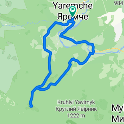
- 6,9 km
- 253 m
- 253 m
- Yaremche, oblast' di Ivano-Frankivs'k, Ucraina
Carpathian peaks. Route 3. Rokyta-Makovytsia.
Un percorso ciclabile con partenza da Yaremche, oblast' di Ivano-Frankivs'k, Ucraina.
Panoramica
Su questo percorso
Il percorso inizia al ponte sul fiume Prutets, che colpisce per la sua bellezza. Lungo il canyon del fiume ci dirigiamo verso le rocce di Kostel e poi saliamo al monte Rokyta. In cima facciamo foto favolose e attraverso i prati di montagna ci dirigiamo al monte Makovytsia, poi scendiamo a Yamna e torniamo al luogo del nostro alloggio.
- -:--
- Durata
- 34,6 km
- Distanza
- 802 m
- Salita
- 804 m
- Discesa
- ---
- Velocità media
- ---
- Altitudine max.
creato 14 anni fa
Continua con Bikemap
Usa, modifica o scarica questo percorso ciclabile
Vuoi percorrere Carpathian peaks. Route 3. Rokyta-Makovytsia. o personalizzarlo per il tuo viaggio? Ecco cosa puoi fare con questo percorso su Bikemap:
Funzionalità gratuite
- Salva questo percorso tra i preferiti o in una raccolta
- Copia e pianifica la tua versione di questo percorso
- Sincronizza il tuo percorso con Garmin o Wahoo
Funzionalità Premium
Prova gratuita di 3 giorni o pagamento una tantum. Scopri di più su Bikemap Premium.
- Naviga questo percorso su iOS e Android
- Esporta un file GPX / KML di questo percorso
- Crea la tua stampa personalizzata (provala gratis)
- Scarica questo percorso per la navigazione offline
Scopri altre funzionalità Premium.
Ottieni Bikemap PremiumDalla nostra community
Yaremche: Altri percorsi popolari che iniziano qui
- Маршрут 306 - Багрівець
- Маршрут 302 - Маливо
- 26,5 km
- 514 m
- 518 m
- Yaremche, oblast' di Ivano-Frankivs'k, Ucraina
- Маршрут 304 - Оглядовий
- 6,2 km
- 164 m
- 163 m
- Yaremche, oblast' di Ivano-Frankivs'k, Ucraina
- Дора-Яремче
- 40,3 km
- 1.375 m
- 1.343 m
- Yaremche, oblast' di Ivano-Frankivs'k, Ucraina
- Яремче-Явірник
- 17,6 km
- 699 m
- 700 m
- Yaremche, oblast' di Ivano-Frankivs'k, Ucraina
- 2012-07-28 Дора-Синячка-Фр 80км
- 79,2 km
- 950 m
- 1.169 m
- Yaremche, oblast' di Ivano-Frankivs'k, Ucraina
- Маршрут 305 - Дівочі сльози
- 6 km
- 242 m
- 239 m
- Yaremche, oblast' di Ivano-Frankivs'k, Ucraina
- Маршрут 303 - Легенда
- 11,5 km
- 162 m
- 162 m
- Yaremche, oblast' di Ivano-Frankivs'k, Ucraina
Aprila nell’app


