
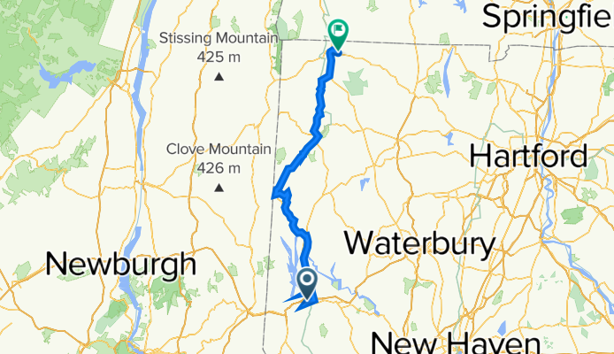
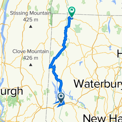
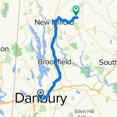
Danbury CT to Canaan CT
Un percorso ciclabile con partenza da Danbury, Connecticut, United States of America.
Panoramica
Su questo percorso
We followed the Western New England Greenway north from Danbury CT to Bulls Bridge. Along the way, in following the trail, we turned onto River Road, which was unpaved, though fortunately pretty hardpacked. This was important due to the heavy rain that had fallen yesterday and all night.
After the long climb to Bulls Bridge, I somehow misread the map and turned us onto US Highway 7, which runs along the east side of Housatonic River. The Western New England Greenway route followed the west side up to Kent, where it returned to the east side and followed US Highway 7 for most of the rest of the way to North Canaan. This was probably a blessing in disguise since I’m guessing that the west side route might well be more unpaved road. In addition, with our taking the much faster US Highway 7 from Bulls Bridge to Kent (and beyond), we probably saved an hour or so of time. As it was, we didn’t arrive at our B&B until about 7:10, which wouldn’t be too much before sunset.
Going through New Milford, we found a really charming village that should be a good place to stay and wander around.
- 8 h 22 min
- Durata
- 93,4 km
- Distanza
- 1.269 m
- Salita
- 1.139 m
- Discesa
- 11,2 km/h
- Velocità media
- 223 m
- Altitudine max.

Qualità del percorso
Tipi di percorsi e superfici lungo il percorso
Tipi di percorso
Strada trafficata
61,7 km
(66 %)
Strada tranquilla
20,3 km
(22 %)
Superfici
Asfaltato
22,9 km
(24 %)
Non asfaltato
5,6 km
(6 %)
Asfalto
18,4 km
(20 %)
Ghiaia
5,3 km
(6 %)
Continua con Bikemap
Usa, modifica o scarica questo percorso ciclabile
Vuoi percorrere Danbury CT to Canaan CT o personalizzarlo per il tuo viaggio? Ecco cosa puoi fare con questo percorso su Bikemap:
Funzionalità gratuite
- Salva questo percorso tra i preferiti o in una raccolta
- Copia e pianifica la tua versione di questo percorso
- Dividilo in tappe per creare un tour di più giorni
- Sincronizza il tuo percorso con Garmin o Wahoo
Funzionalità Premium
Prova gratuita di 3 giorni o pagamento una tantum. Scopri di più su Bikemap Premium.
- Naviga questo percorso su iOS e Android
- Esporta un file GPX / KML di questo percorso
- Crea la tua stampa personalizzata (provala gratis)
- Scarica questo percorso per la navigazione offline
Scopri altre funzionalità Premium.
Ottieni Bikemap PremiumDalla nostra community
Danbury: Altri percorsi popolari che iniziano qui
 Danbury CT to Canaan CT
- Distanza
- 93,4 km
- Salita
- 1.269 m
- Discesa
- 1.139 m
- Posizione
- Danbury, Connecticut, United States of America
 246 Franklin Street Ext, Danbury to 246 Franklin Street Ext, Danbury
- Distanza
- 29,2 km
- Salita
- 318 m
- Discesa
- 319 m
- Posizione
- Danbury, Connecticut, United States of America
 31–33 Backus Ave, Danbury to 60 Beaver Brook Rd, Danbury
- Distanza
- 8 km
- Salita
- 84 m
- Discesa
- 127 m
- Posizione
- Danbury, Connecticut, United States of America
 Danbury to Roxbury
- Distanza
- 33,2 km
- Salita
- 371 m
- Discesa
- 388 m
- Posizione
- Danbury, Connecticut, United States of America
 Ellsworth Avenue 18, Danbury to Rowan Street 12, Danbury
- Distanza
- 5,2 km
- Salita
- 26 m
- Discesa
- 7 m
- Posizione
- Danbury, Connecticut, United States of America
 Moderate route in Danbury
- Distanza
- 3,5 km
- Salita
- 47 m
- Discesa
- 35 m
- Posizione
- Danbury, Connecticut, United States of America
 Anchor St, Danbury to 51 Walnut Hill Rd, Bethel
- Distanza
- 15,1 km
- Salita
- 473 m
- Discesa
- 471 m
- Posizione
- Danbury, Connecticut, United States of America
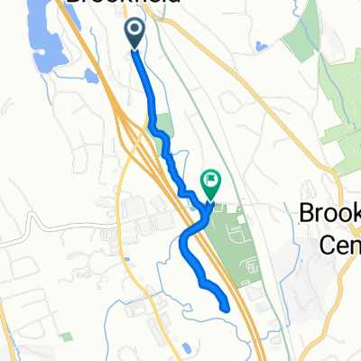 Federal Road 761, Brookfield to Silvermine Road 65, Brookfield
- Distanza
- 3,7 km
- Salita
- 18 m
- Discesa
- 9 m
- Posizione
- Danbury, Connecticut, United States of America
Aprila nell’app