
The Waffle Tour 2 CLONED FROM ROUTE 496988
Un percorso ciclabile con partenza da Gol, Buskerud fylke, Norvegia.
Panoramica
Su questo percorso
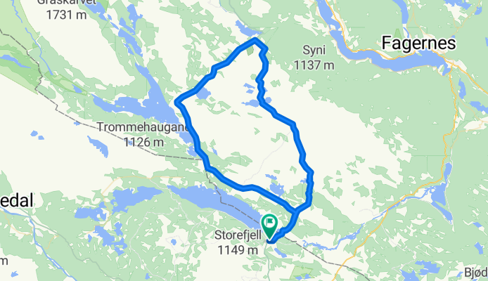
<span style="color: #000000; font-family: verdana, arial, helvetica, sans-serif; font-size: 11px; line-height: 16px; -webkit-border-horizontal-spacing: 4px; -webkit-border-vertical-spacing: 4px;">This route starts off at the intersection/crossroads at Fjellheimskrysset on highway Rv 51 (Gol - Leira).<br style="font: normal normal normal 11px/1.5em verdana, arial, helvetica, sans-serif; color: #000000; line-height: 0.8em;" /><br style="font: normal normal normal 11px/1.5em verdana, arial, helvetica, sans-serif; color: #000000; line-height: 0.8em;" />Follow the Golsfjellveien past the crossroads to Kamben, Ørterstølen and further on to Oset Høyfjellshotell. Continue towards the Tislei dam, cross it, and follow the road up to the crossroads at Buastølen.<br style="font: normal normal normal 11px/1.5em verdana, arial, helvetica, sans-serif; color: #000000; line-height: 0.8em;" /><br style="font: normal normal normal 11px/1.5em verdana, arial, helvetica, sans-serif; color: #000000; line-height: 0.8em;" /> Keep going straight past the different summer farmsuntil you get to Gomobu, which is the first obligatory waffle stop on the route. <br style="font: normal normal normal 11px/1.5em verdana, arial, helvetica, sans-serif; color: #000000; line-height: 0.8em;" /><br style="font: normal normal normal 11px/1.5em verdana, arial, helvetica, sans-serif; color: #000000; line-height: 0.8em;" />From Gomobu the road is steep downhill until you get on to the Panoramavegen (Panorama road) between Hemsedal and Valdres. <br style="font: normal normal normal 11px/1.5em verdana, arial, helvetica, sans-serif; color: #000000; line-height: 0.8em;" /><br style="font: normal normal normal 11px/1.5em verdana, arial, helvetica, sans-serif; color: #000000; line-height: 0.8em;" />On the Panoramavegen you can choose if you want the shorter route by turning left and going straight to Nøsen, where they make great waffles too, or if you want to go right and follow the signs to Trollhovd.<br style="font: normal normal normal 11px/1.5em verdana, arial, helvetica, sans-serif; color: #000000; line-height: 0.8em;" /><br style="font: normal normal normal 11px/1.5em verdana, arial, helvetica, sans-serif; color: #000000; line-height: 0.8em;" />From Trollhovd the route is downhill past Grønsetnabben og Svenskefjorden. Go straight ahead (do not cross the bridge on the right!) and follow the road along the lake and back to Panoramavegen. <br style="font: normal normal normal 11px/1.5em verdana, arial, helvetica, sans-serif; color: #000000; line-height: 0.8em;" /><br style="font: normal normal normal 11px/1.5em verdana, arial, helvetica, sans-serif; color: #000000; line-height: 0.8em;" />Go right and stay on the main road past the Flyvass dam and further along the Tisleifjorden. Go on past Langestølen (shop) and back to Buasttølen. Go left, ride back to Oset and onwards to Fjellheimkrysset.</span>
- -:--
- Durata
- 51,1 km
- Distanza
- 599 m
- Salita
- 598 m
- Discesa
- ---
- Velocità media
- ---
- Altitudine max.
Qualità del percorso
Tipi di percorsi e superfici lungo il percorso
Tipi di percorso
Strada
24 km
(47 %)
Strada tranquilla
23,5 km
(46 %)
Superfici
Non asfaltato
30,1 km
(59 %)
Ghiaia
30,1 km
(59 %)
Non definito
20,9 km
(41 %)
Continua con Bikemap
Usa, modifica o scarica questo percorso ciclabile
Vuoi percorrere The Waffle Tour 2 CLONED FROM ROUTE 496988 o personalizzarlo per il tuo viaggio? Ecco cosa puoi fare con questo percorso su Bikemap:
Funzionalità gratuite
- Salva questo percorso tra i preferiti o in una raccolta
- Copia e pianifica la tua versione di questo percorso
- Sincronizza il tuo percorso con Garmin o Wahoo
Funzionalità Premium
Prova gratuita di 3 giorni o pagamento una tantum. Scopri di più su Bikemap Premium.
- Naviga questo percorso su iOS e Android
- Esporta un file GPX / KML di questo percorso
- Crea la tua stampa personalizzata (provala gratis)
- Scarica questo percorso per la navigazione offline
Scopri altre funzionalità Premium.
Ottieni Bikemap PremiumDalla nostra community
Gol: Altri percorsi popolari che iniziano qui
 Garnos route
- Distanza
- 47,6 km
- Salita
- 1.462 m
- Discesa
- 1.462 m
- Posizione
- Gol, Buskerud fylke, Norvegia
 Golsfjellet
- Distanza
- 69,3 km
- Salita
- 1.019 m
- Discesa
- 973 m
- Posizione
- Gol, Buskerud fylke, Norvegia
 Golsfjellet Tisleidalen
- Distanza
- 69,4 km
- Salita
- 881 m
- Discesa
- 881 m
- Posizione
- Gol, Buskerud fylke, Norvegia
 Nasjonal sykkelrute 5, Golsfjellet - Vang - Lærdalsøyri - Flåm
- Distanza
- 219,9 km
- Salita
- 3.321 m
- Discesa
- 4.130 m
- Posizione
- Gol, Buskerud fylke, Norvegia
 The Waffle Tour 2 CLONED FROM ROUTE 496988
- Distanza
- 51,1 km
- Salita
- 599 m
- Discesa
- 598 m
- Posizione
- Gol, Buskerud fylke, Norvegia
 deel 10: Gol -Vaset
- Distanza
- 82,7 km
- Salita
- 1.488 m
- Discesa
- 901 m
- Posizione
- Gol, Buskerud fylke, Norvegia
 Hallingrittet
- Distanza
- 42,2 km
- Salita
- 746 m
- Discesa
- 746 m
- Posizione
- Gol, Buskerud fylke, Norvegia
 Einarsetrunden på Golsfjellet
- Distanza
- 12,5 km
- Salita
- 0 m
- Discesa
- 0 m
- Posizione
- Gol, Buskerud fylke, Norvegia
Aprila nell’app