

Madrid to Paris
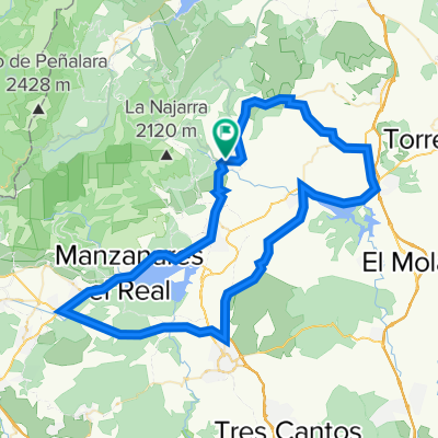
Un percorso ciclabile con partenza da Miraflores de la Sierra, Madrid, Spagna.
Panoramica
Su questo percorso
This trip was invented on the fly, and started after I realized I really couldn't finish my Tangier to Tunis trip. I considered my options and weather forecasts and took the train with my bike to Madrid. I knew there was a mountain range just north of Madrid, and it turned out to be gorgeous biking. Perfect asphalt, it was never too steep uphill, through beautiful forests. Well across on the other side I continued north, and had a day of difficult biking across plains where it was difficult to find a proper road leading in the right direction that wasn't a highway. At the end of the next day I unloaded my bags from my bike and climbed up to Lagunas de Neila, a peak that surely has been part of the Vuelta some time, considering the famous biker names painted on the asphalt. A very very hard detour. Not sure I would have tried had I known how hard it was.
Eventually I ended up in Pamplona, where I took a day off. A great day of strolling around.
Next day was uphill towards the Pyrenees, which I crossed on a gravel road meandering up a sharp ridge in very very VERY hard wind. Well into France, the roads and views were spectacular. I did the Spanish side of the Pyrenees in 2015, so my plan was now to do the French side.
The next day was from Larrau to Bielle which was also gorgeous biking. I finished the day by biking across Col de Marie-Blanque, which ends with 4 km of 11% inclination, and thus qualifies as one of the hardest things I have ever done. Plus it was over 30° C. Marie-Blanque has been part of Tour de France 14 times.
The next day was supposed to be across the Col d'Aubisque, but just when the climb started I ran into a sign saying the Col du Soulor was closed.
My planned route was blocked by snow, and the detour would have been very cumbersome and boring, all the way down north to the plains of France, then uphill again. Plus the weather forecast predicted two days of snow and quite a bit of rain. So, I considered my options again, and decided to bike to Paris. Not as exciting as the Pyrenees, but through parts of France I had never seen. Plus the weather was going to be great.
Which it was, except I had a rather consistent headwind for six whole days. It turned out to be six days of biking. The first two days were beautiful rolling hills, but the further north I got, the hills became smaller and the roads straighter. At the end it was straight and flat as an arrow sometimes for more than 10 km. Well, I have done it now, will not do it again.
The idea of rolling into Paris sounds epic, but in reality it is 2.5 hours of confusing suburbs and a million cars. But finally I rolled onto Pont Neuf.
- -:--
- Durata
- 1.613,2 km
- Distanza
- 25.397 m
- Salita
- 26.499 m
- Discesa
- ---
- Velocità media
- 1.869 m
- Altitudine max.

Qualità del percorso
Tipi di percorsi e superfici lungo il percorso
Tipi di percorso
Strada
484 km
(30 %)
Strada tranquilla
225,8 km
(14 %)
Superfici
Asfaltato
693,7 km
(43 %)
Non asfaltato
48,4 km
(3 %)
Asfalto
677,5 km
(42 %)
Ghiaia
32,3 km
(2 %)
Continua con Bikemap
Usa, modifica o scarica questo percorso ciclabile
Vuoi percorrere Madrid to Paris o personalizzarlo per il tuo viaggio? Ecco cosa puoi fare con questo percorso su Bikemap:
Funzionalità gratuite
- Salva questo percorso tra i preferiti o in una raccolta
- Copia e pianifica la tua versione di questo percorso
- Dividilo in tappe per creare un tour di più giorni
- Sincronizza il tuo percorso con Garmin o Wahoo
Funzionalità Premium
Prova gratuita di 3 giorni o pagamento una tantum. Scopri di più su Bikemap Premium.
- Naviga questo percorso su iOS e Android
- Esporta un file GPX / KML di questo percorso
- Crea la tua stampa personalizzata (provala gratis)
- Scarica questo percorso per la navigazione offline
Scopri altre funzionalità Premium.
Ottieni Bikemap PremiumDalla nostra community
Miraflores de la Sierra: Altri percorsi popolari che iniziano qui
 Soto-Morcuera-Canencia-Soto
- Distanza
- 100,9 km
- Salita
- 1.925 m
- Discesa
- 1.892 m
- Posizione
- Miraflores de la Sierra, Madrid, Spagna
 Puerto de Morcuera y Puerto de Canencia
- Distanza
- 79,3 km
- Salita
- 1.347 m
- Discesa
- 1.347 m
- Posizione
- Miraflores de la Sierra, Madrid, Spagna
 Ruta Sierra 03: 88 Km 1687 m - "Morcuera y Cotos"
- Distanza
- 86,4 km
- Salita
- 1.588 m
- Discesa
- 1.589 m
- Posizione
- Miraflores de la Sierra, Madrid, Spagna
 Soto de Real - Morcuera - Lozoya - Canencia - Miraflores - Soto
- Distanza
- 80,3 km
- Salita
- 1.380 m
- Discesa
- 1.380 m
- Posizione
- Miraflores de la Sierra, Madrid, Spagna
 Miraflores-Morcuera-Rascafría-Majada Cojo 07.07.12
- Distanza
- 57,2 km
- Salita
- 1.333 m
- Discesa
- 1.333 m
- Posizione
- Miraflores de la Sierra, Madrid, Spagna
 Miraflores-CerroSanPedro-Navalafuente-Bustarviejo-Miraflores
- Distanza
- 86,9 km
- Salita
- 769 m
- Discesa
- 769 m
- Posizione
- Miraflores de la Sierra, Madrid, Spagna
 Picos
Picos- Distanza
- 15,7 km
- Salita
- 891 m
- Discesa
- 891 m
- Posizione
- Miraflores de la Sierra, Madrid, Spagna
 Miraflores-Atazar
- Distanza
- 90,9 km
- Salita
- 1.044 m
- Discesa
- 1.045 m
- Posizione
- Miraflores de la Sierra, Madrid, Spagna
Aprila nell’app