- 18 km
- 277 m
- 251 m
- Whittingham, Inghilterra, Regno Unito
Conrad's Ingram Hill short training run
Un percorso ciclabile con partenza da Whittingham, Inghilterra, Regno Unito.
Panoramica
Su questo percorso
Whilst this follows a briidleway and is on access land the return route is somewhat vague, downhill as steep as I dare with little rubber left on the brakes in the dusk!
Slow muddy climb once you leave the tarmac if there has been any rain. Basically I climb a bit, then turn off to the right along the most convienient sheep track and come down the shoulder of the hill. This makes a nice easy downhill, you can choose your own line from the many sheep tracks and finish with the 'technical bit' along the top of the wall towards Bulby's wood.
- -:--
- Durata
- 5,6 km
- Distanza
- 131 m
- Salita
- 128 m
- Discesa
- ---
- Velocità media
- ---
- Altitudine max.
creato 16 anni fa
Continua con Bikemap
Usa, modifica o scarica questo percorso ciclabile
Vuoi percorrere Conrad's Ingram Hill short training run o personalizzarlo per il tuo viaggio? Ecco cosa puoi fare con questo percorso su Bikemap:
Funzionalità gratuite
- Salva questo percorso tra i preferiti o in una raccolta
- Copia e pianifica la tua versione di questo percorso
- Sincronizza il tuo percorso con Garmin o Wahoo
Funzionalità Premium
Prova gratuita di 3 giorni o pagamento una tantum. Scopri di più su Bikemap Premium.
- Naviga questo percorso su iOS e Android
- Esporta un file GPX / KML di questo percorso
- Crea la tua stampa personalizzata (provala gratis)
- Scarica questo percorso per la navigazione offline
Scopri altre funzionalità Premium.
Ottieni Bikemap PremiumDalla nostra community
Whittingham: Altri percorsi popolari che iniziano qui
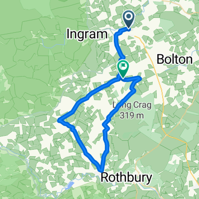
- One way a possible alternative to NCN route 68, the return..by route 68
- glanton r68 coast loop
- 127,8 km
- 1.330 m
- 1.320 m
- Whittingham, Inghilterra, Regno Unito
- ThroptonLoop
- 34,8 km
- 411 m
- 422 m
- Whittingham, Inghilterra, Regno Unito
- Behemoth2019
- 71,1 km
- 1.167 m
- 1.168 m
- Whittingham, Inghilterra, Regno Unito
- Prendwick to Ingram a possible off road braid for NCN route 68
- 5,3 km
- 138 m
- 177 m
- Whittingham, Inghilterra, Regno Unito
- Powburn to A68
- 36,6 km
- 529 m
- 365 m
- Whittingham, Inghilterra, Regno Unito
- Ingram Prendwick Chesters circuit
- 18,1 km
- 401 m
- 398 m
- Whittingham, Inghilterra, Regno Unito
- Ingram Prendwick road to the hill fort and back via the duck pond
- 8,1 km
- 237 m
- 237 m
- Whittingham, Inghilterra, Regno Unito
Aprila nell’app


