Pyrenäen Tag 5: Saint Lary nach Tarascon
- 111,8 km
- 2.427 m
- 2.647 m
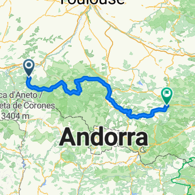
- Aspet, Occitanie, Francia
Un percorso ciclabile con partenza da Aspet, Occitanie, Francia.
Panoramica
La pedalata di oggi, che ha avuto molte salite impegnative, si è svolta interamente all'interno del Parc Naturel Régional des Pyrénées Ariégeoises. Partendo da Saint Lary a 692 m, siamo discesi a St Girons a circa 400 m. Da lì siamo saliti attraversando vari colli fino a 1465 m per poi riscendere al punto di sosta per la sera a 990 m. Lungo il percorso, abbiamo attraversato i seguenti colli:
Col de Crouzette a 1241 m Col du Portel a 1465 m Col de Péguère a 1375 m Col de Jouels a 1247 m Col de Marrous a 990 m
Andare da ovest a est ci ha offerto alcune salite molto ripide fino al primo colle. Quattro anni prima, nel 2001, abbiamo affrontato questa stessa salita ma da est a ovest... e le pendenze per la maggior parte della salita lungo la D17 da Foix erano molto più dolci.
La D18 era una strada molto stretta con le salite più ripide e fortunatamente sono passate solo sei auto mentre faticavamo a salire... e erano sei auto di troppo. Più giù, durante la salita, quando eravamo sulla D3 prima di avvicinarci a Rivèrenet sulla D33, c'è stato un flusso costante di auto che ci ha un po' preoccupati.
Durante la salita e soprattutto tra i primi tre colli, i panorami erano spettacolari. Sembrava di essere sulla cima del mondo. Ricordo che quattro anni fa, quando arrivammo al Col de Péguère e al tavolo d'orientamento che si trova lì, era nebbioso e non riuscivamo a vedere nulla.
creato 14 anni fa
Punti salienti del percorso
Great look-out point with a table identifying the mountains you see.
Continua con Bikemap
Vuoi percorrere Ride Day 14—24 Sept 2005—09800 Saint-Lary to 09000 Col des Marrous – Le Bosc – Foix o personalizzarlo per il tuo viaggio? Ecco cosa puoi fare con questo percorso su Bikemap:
Prova gratuita di 3 giorni o pagamento una tantum. Scopri di più su Bikemap Premium.
Scopri altre funzionalità Premium.
Ottieni Bikemap PremiumDalla nostra community
Aprila nell’app