

LOZERE -TARN - 104 KM - mt aigoual
- 103,3 km
- 1.412 m
- 1.417 m
- Florac, Occitanie, Francia
Un percorso ciclabile con partenza da Florac, Occitanie, Francia.
Panoramica
<span style="font-size: 12pt; font-family: Arial;">After buying some bread, we left Florac centre ville and were off on the 20+ mile downhill to St Chély-du-Tarn where we planned to spend the next night.<span> </span>After stopping for a pleasant picnic lunch in Ste Énimie, we arrived somewhat expeditiously at the hotel in St Chély-du-Tarn.<span> </span></span>
<span style="font-size: 12pt; font-family: Arial;">After dropping our panniers, we set out on an afternoon circle from the hotel.</span>
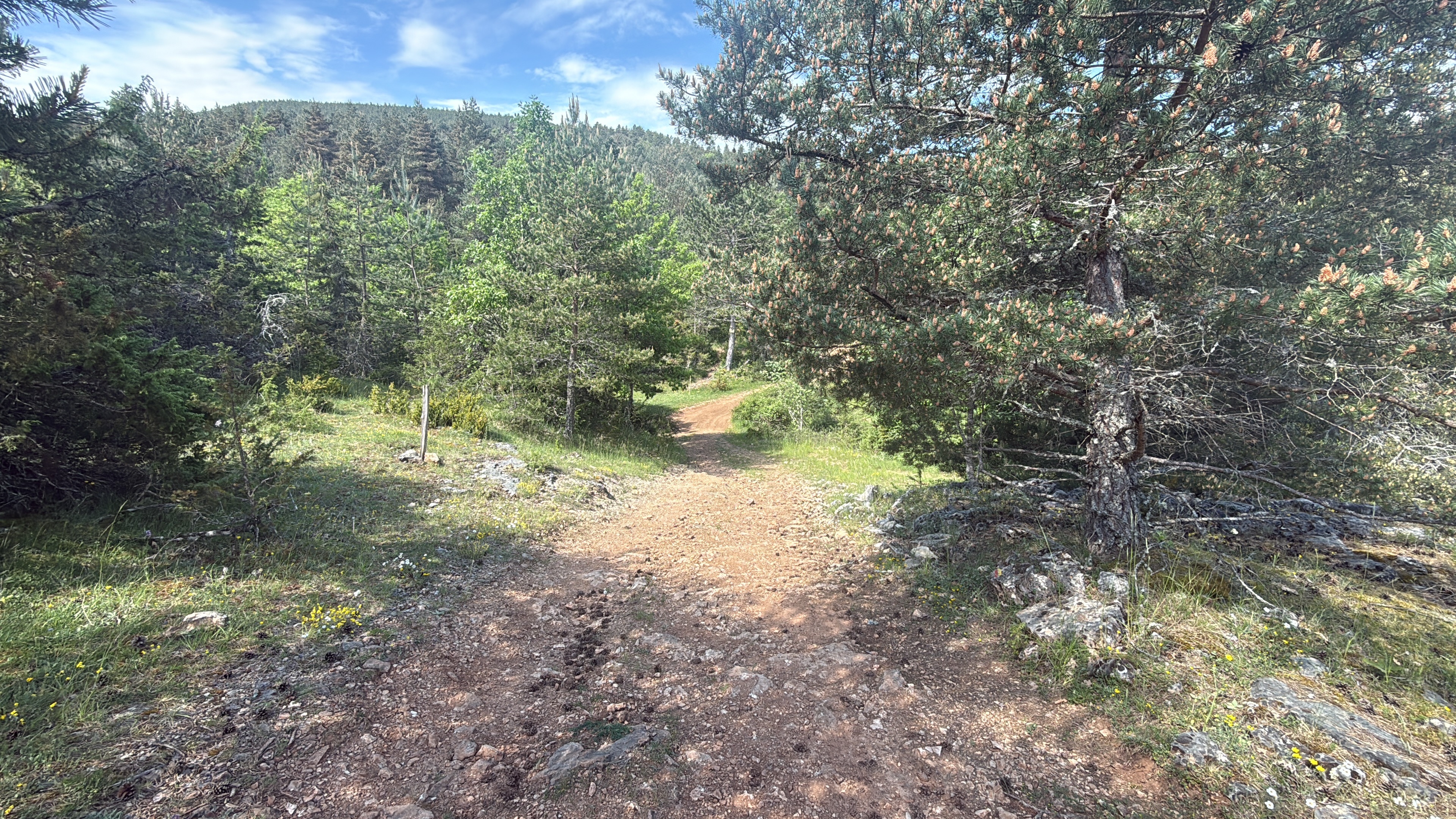
<span style="font-size: 12pt; font-family: Arial;">The Gorges du Tarn is beautiful and rugged, but with a different character than the Gorges de la Jonte that we had ridden through the prior year (2004).<span> </span>It’s also filled (relatively speaking) with tourist activities while the Jonte, we recall, had few.<span> </span>We passed along D907Bis a number of nice hotels, one was even a four-star, before climbing at Les Vignes several hundred meters up the side of the gorge to the plateau that’s at the top of each side of the gorge.<span> </span>The plateau was beautiful as well and very rural in character.</span>
<span style="font-size: 12pt; font-family: Arial;">Our ride from Florac to the hotel was 22 miles and the afternoon ride without the baggage was another 34 miles.</span>
<span style="font-size: 12pt; font-family: Arial;">One additional note. The elevation gain calculated by bikemap.net for this route is shown to be 2100 M. This makes no sense and should logically be maybe 700 M to 900 M of elevation gain. The only real climb of note was on D995.<br /></span>
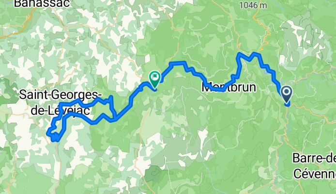
<span style="font-size: 12pt; font-family: Arial;">Due to today's route covering the same road twice, I'm adding the entire route below:</span>
<span style="font-size: 12pt; font-family: Arial;">From Florac to hotel:</span>
<span style="font-size: 12pt; color: #535353; font-family: ArialMT;">D907/N106 Northwest to just before Ispagnac</span>
<span style="font-size: 12pt; color: #535353; font-family: ArialMT;">D907Bis West through Ste Énimie to St Chély-du-Tarn and hotel</span>
<span style="font-size: 12pt; color: #535353; font-family: ArialMT;">[Interestingly, Google Maps shows no road number for D907Bis, which heads west from just after Ispagnac to Ste Énimie and then southwest following the Gorges du Tarn all the way to Le Rozier at the junction of the Tarn and la Jonte Rivers]</span>
<span style="font-size: 12pt; font-family: Arial;">Circle from hotel in</span> @font-face { font-family: "Times New Roman"; }@font-face { font-family: "Arial"; }p.MsoNormal, li.MsoNormal, div.MsoNormal { margin: 0in 0in 0.0001pt; font-size: 12pt; font-family: Arial; }table.MsoNormalTable { font-size: 10pt; font-family: "Times New Roman"; }div.Section1 { page: Section1; } <span style="font-size: 12pt; font-family: Arial;">St Chély-du-Tarn</span>:
<span style="font-size: 12pt; color: #535353; font-family: ArialMT;">D907Bis Southwest from hotel to Les Vignes</span>
<span style="font-size: 12pt; color: #535353; font-family: ArialMT;">D995 West up the side of the Gorges du Tarn to</span>
<span style="font-size: 12pt; color: #535353; font-family: ArialMT;">D46 Northeast to St Georges-de-Lévéjac</span>
<span style="font-size: 12pt; color: #535353; font-family: ArialMT;">An un-numbered road East to</span>
<span style="font-size: 12pt; color: #535353; font-family: ArialMT;">D43 South down into La Malène</span>
<span style="font-size: 12pt; color: #535353; font-family: ArialMT;">D907Bis Northeast back to St Chély-du-Tarn and hotel</span>
Background:<br /><br /><br />My wife and I have been doing self-supported tours in Western Europe (a majority in France) since 1993. This series of rides covers our 2005 2 month route through parts of France. Our beginning and ending point is near Chaduri (south of Angoulême) where our friends have a farm with Gites and Chambres d'Hotes.<br /><br /><br />We rode our Dawes touring bicycles purchased in 1993 heavily loaded with 700Cx32 tires. All of our riding was on paved roads, mostly with very little traffic.<br /><br /><br />If any questions, feel free to email me at jeffkadet@netdiving.com<br /><br /><br />Jeff
creato 14 anni fa
Qualità del percorso
Strada
9,4 km
11 %
Strada tranquilla
8,6 km
10 %
Asfaltato
78,8 km
(92 %)
Non asfaltato
1,7 km
(2 %)
Asfalto
78,8 km
92 %
Ghiaia
1,7 km
2 %
Non definito
5,1 km
6 %
Continua con Bikemap
Vuoi percorrere Ride Day 28—9 Oct 2005—48400 Florac to 48210 St-Chely du Tarn/Sainte Énimie o personalizzarlo per il tuo viaggio? Ecco cosa puoi fare con questo percorso su Bikemap:
Prova gratuita di 3 giorni o pagamento una tantum. Scopri di più su Bikemap Premium.
Scopri altre funzionalità Premium.
Ottieni Bikemap PremiumDalla nostra community
Aprila nell’app