

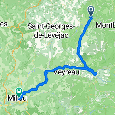
Ride Day 30—11 Oct 2005—48210 St-Chely du Tarn/Sainte Énimie — Circle
Un percorso ciclabile con partenza da Chanac, Occitanie, Francia.
Panoramica
Su questo percorso
Mia moglie aveva pianificato un bel giro di oltre 100 chilometri. Tuttavia, con il cielo nuvoloso relativamente scuro, qualche goccia di pioggia occasionale e il forte vento freddo che ci costringeva a stare coperti, anche sulle due lunghe salite del nostro percorso, ha notevolmente ridotto la distanza. Come ci si può aspettare, il sole è effettivamente comparso proprio quando siamo tornati a St Chély-du-Tarn alla fine della passeggiata. E che c'è di nuovo? Le cose importanti, comunque, sono che non ci siamo bagnati e che abbiamo avuto un grande giro. Da Ste Énimie, siamo saliti al plateau dal Tarn e ci siamo diretti a nord-ovest attraverso il plateau per arrivare a Chanac. Durante la salita al plateau, abbiamo avuto viste spettacolari su Ste Énimie. Abbiamo trovato Chanac un paese particolarmente carino che sarebbe un ottimo posto per soggiornare. Aveva anche una delle più belle piccole chiese modeste che abbia mai visto. Devo aggiungere che Chanac si trova sul fiume Lot. Siamo scesi di diverse centinaia di metri dal plateau per arrivarci… il che significava ovviamente che dovevamo risalire al plateau per tornare alle Gorges du Tarn e al nostro hotel. Sulla D998, proprio prima della lunga discesa verso Ste Énimie, c'era un grazioso piccolo hotel in un punto panoramico che era semplicemente incredibile. La vista si estendeva per miglia sopra e sotto il canyon mostrando molte curve del fiume e le pareti rocciose. Dalla pittura sulla strada, il Tour de France era recentemente passato per la D32 verso Chanac. A un certo punto, abbiamo visto osservazioni pittoriche contrastanti su Armstrong. Una diceva all'incirca che usa droghe e che i funzionari del Tour chiudono un occhio a causa dei soldi. L'altra sosteneva Armstrong e si riferiva ai suoi dieci anni di duro lavoro per allenarsi per il Tour. Contesto: Mia moglie e io abbiamo fatto tour autoguidati in Europa occidentale (la maggior parte in Francia) dal 1993. Questa serie di giri copre il nostro percorso di due mesi nel 2005 attraverso parti della Francia. Il nostro punto di partenza e arrivo è vicino a Chaduri (a sud di Angoulême) dove i nostri amici hanno una fattoria con Gites e Chambres d'Hotes. Abbiamo guidato le nostre biciclette da turismo Dawes acquistate nel 1993, pesantemente cariche con pneumatici 700Cx32. Tutti i nostri percorsi sono stati su strade asfaltate, per lo più con pochissimo traffico. Se hai domande, non esitare a contattarmi via email a jeffkadet@netdiving.com. Jeff
- -:--
- Durata
- 58 km
- Distanza
- 951 m
- Salita
- 951 m
- Discesa
- ---
- Velocità media
- ---
- Altitudine max.

Qualità del percorso
Tipi di percorsi e superfici lungo il percorso
Tipi di percorso
Strada tranquilla
1,2 km
(2 %)
Non definito
56,8 km
(98 %)
Superfici
Asfaltato
47 km
(81 %)
Asfalto
47 km
(81 %)
Non definito
11 km
(19 %)
Continua con Bikemap
Usa, modifica o scarica questo percorso ciclabile
Vuoi percorrere Ride Day 30—11 Oct 2005—48210 St-Chely du Tarn/Sainte Énimie — Circle o personalizzarlo per il tuo viaggio? Ecco cosa puoi fare con questo percorso su Bikemap:
Funzionalità gratuite
- Salva questo percorso tra i preferiti o in una raccolta
- Copia e pianifica la tua versione di questo percorso
- Sincronizza il tuo percorso con Garmin o Wahoo
Funzionalità Premium
Prova gratuita di 3 giorni o pagamento una tantum. Scopri di più su Bikemap Premium.
- Naviga questo percorso su iOS e Android
- Esporta un file GPX / KML di questo percorso
- Crea la tua stampa personalizzata (provala gratis)
- Scarica questo percorso per la navigazione offline
Scopri altre funzionalità Premium.
Ottieni Bikemap PremiumDalla nostra community
Chanac: Altri percorsi popolari che iniziano qui
 Entre Culture et le Monastier
- Distanza
- 36,7 km
- Salita
- 580 m
- Discesa
- 583 m
- Posizione
- Chanac, Occitanie, Francia
 F121-2024-Chanac-Quezac-Saint Emine-Chanac
- Distanza
- 63,4 km
- Salita
- 2.103 m
- Discesa
- 2.109 m
- Posizione
- Chanac, Occitanie, Francia
 F123-2024-Chanac-Correjac-Le Balmes-Chanac
- Distanza
- 42,9 km
- Salita
- 1.243 m
- Discesa
- 1.244 m
- Posizione
- Chanac, Occitanie, Francia
 F124-2024-Chanac-Einrollen-Trekking
- Distanza
- 58,7 km
- Salita
- 1.670 m
- Discesa
- 1.670 m
- Posizione
- Chanac, Occitanie, Francia
 Ride Day 30—11 Oct 2005—48210 St-Chely du Tarn/Sainte Énimie — Circle
- Distanza
- 58 km
- Salita
- 951 m
- Discesa
- 951 m
- Posizione
- Chanac, Occitanie, Francia
 F120-2024-Chanac-Saint Emine-La Malene-Chanac
- Distanza
- 61,1 km
- Salita
- 2.248 m
- Discesa
- 2.255 m
- Posizione
- Chanac, Occitanie, Francia
 Ride Day 31—12 Oct 2005—48210 St-Chely du Tarn/Sainte Énimie to 48260 Recoules D'Aubrac (Nasbinals)
- Distanza
- 86,1 km
- Salita
- 1.224 m
- Discesa
- 644 m
- Posizione
- Chanac, Occitanie, Francia
 Ste. Enimie - Millau (Causse Route nr. 159)
- Distanza
- 76,7 km
- Salita
- 1.119 m
- Discesa
- 1.262 m
- Posizione
- Chanac, Occitanie, Francia
Aprila nell’app