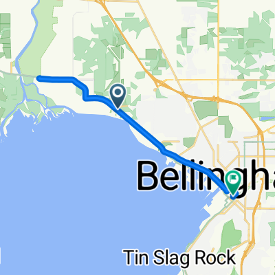
- 5,9 km
- 41 m
- 79 m
- Marietta-Alderwood, Washington, Stati Uniti
Bellingham to Vancouver
Un percorso ciclabile con partenza da Marietta-Alderwood, Washington, Stati Uniti.
Panoramica
Su questo percorso
Nel complesso, il giro è stato meno doloroso del previsto. C'era molta pista ciclabile e per lo più salite e discese ragionevolmente gestibili. Anche se l'ultima parte, quando abbiamo cercato di trovare il nostro alloggio AirBNB per la notte, ci ha portato su alcune pendenze piuttosto ripide, un paio delle quali abbiamo pedalato a vuoto, come si è rivelato. Attraversando il confine, la signora al controllo passaporti ci ha posizionati davanti a una fila di auto e ci ha detto felicemente di non preoccuparci per loro mentre conversava un po' con noi. A quanto pare, non era stata a questo posto molto a lungo, poiché non era a conoscenza del giro RSVP che passa attraverso questo posto di controllo di Lynden ogni estate. Il viaggio fino al punto di controllo è stato davvero piacevole, praticamente solo su strade con buone piste ciclabili o con molto poco traffico (Double Ditch Road). La maggior parte era anche un po' meglio della metà panoramica, con molte terre agricole e alcune vette montuose sullo sfondo. Dal punto di controllo, ci sono state più strade rurali piuttosto buone fino ad arrivare a Murrayville e Langley City. Da lì fino alla fine del nostro giro, eravamo praticamente solidamente in aree urbane. Molte piste ciclabili (la Columbia Britannica merita di essere applaudita per l'estensione e, per la maggior parte, la qualità del loro sistema di piste ciclabili) che ci hanno tenuti comodi su praticamente tutte le strade. L'unica sezione leggermente scomoda è stata la pista ciclabile durante le poche miglia che abbiamo pedalato sulla Fraser Highway. Anche se la pista ciclabile era buona, sia essa che le corsie per le auto erano un po' più strette del solito, il che significava che le auto in sorpasso ci passano normalmente a pochi piedi di distanza. La pista ciclabile sopra il ponte del fiume Fraser era spettacolare. E il ponte di Second Narrows era piuttosto buono anche. Entrando a Vancouver stesso dopo il ponte del fiume Fraser, siamo stati sul Lougheed Highway apparentemente per sempre. Anche se questa era una strada molto trafficata, la pista ciclabile era eccellente. Dopo un lungo e caldo giro, avremmo davvero apprezzato un luogo dove stare che non richiedesse un grande dislivello per arrivarci... specialmente con le nostre borse piuttosto pesanti. Tuttavia, il nostro AirBNB a North Vancouver si trovava a Central Lonsdale e i nostri giri per trovare il posto ci hanno fatto percorrere quasi 200 metri. Una conclusione dura per una grande giornata.
- 8 h 36 min
- Durata
- 106,5 km
- Distanza
- 1.505 m
- Salita
- 1.438 m
- Discesa
- 12,4 km/h
- Velocità media
- 168 m
- Altitudine max.
creato 1 anno fa
Foto del percorso
Qualità del percorso
Tipi di percorsi e superfici lungo il percorso
Tipi di percorso
Strada
23,4 km
(22 %)
Pista ciclabile
14,9 km
(14 %)
Superfici
Asfaltato
77,7 km
(73 %)
Asfalto
70,3 km
(66 %)
Calcestruzzo
6,4 km
(6 %)
Continua con Bikemap
Usa, modifica o scarica questo percorso ciclabile
Vuoi percorrere Bellingham to Vancouver o personalizzarlo per il tuo viaggio? Ecco cosa puoi fare con questo percorso su Bikemap:
Funzionalità gratuite
- Salva questo percorso tra i preferiti o in una raccolta
- Copia e pianifica la tua versione di questo percorso
- Dividilo in tappe per creare un tour di più giorni
- Sincronizza il tuo percorso con Garmin o Wahoo
Funzionalità Premium
Prova gratuita di 3 giorni o pagamento una tantum. Scopri di più su Bikemap Premium.
- Naviga questo percorso su iOS e Android
- Esporta un file GPX / KML di questo percorso
- Crea la tua stampa personalizzata (provala gratis)
- Scarica questo percorso per la navigazione offline
Scopri altre funzionalità Premium.
Ottieni Bikemap PremiumDalla nostra community
Marietta-Alderwood: Altri percorsi popolari che iniziano qui
- Home Rd, Bellingham to E Holly St, Bellingham
- Chuckanut Century North 2
- 74,2 km
- 304 m
- 328 m
- Marietta-Alderwood, Washington, Stati Uniti
- Airport Dr, Bellingham to 2858 W Maplewood Ave, Bellingham
- 33,5 km
- 393 m
- 414 m
- Marietta-Alderwood, Washington, Stati Uniti
- Marine Dr, Marietta to E Holly St, Bellingham
- 13,7 km
- 103 m
- 123 m
- Marietta-Alderwood, Washington, Stati Uniti
- Bellingham to Vancouver
- 106,5 km
- 1.505 m
- 1.438 m
- Marietta-Alderwood, Washington, Stati Uniti
- Northwest Avenue to Meridian Street
- 1,9 km
- 16 m
- 12 m
- Marietta-Alderwood, Washington, Stati Uniti
- Guide Meridian 4647, Bellingham to Portal Way 7080, Ferndale
- 17 km
- 47 m
- 83 m
- Marietta-Alderwood, Washington, Stati Uniti
- 4260 Mitchell Way, Bellingham to 10 Lummi Key, Bellevue
- 174,8 km
- 627 m
- 669 m
- Marietta-Alderwood, Washington, Stati Uniti
Aprila nell’app


