St Margarets Way- Earlsferry to St Andrews
Un percorso ciclabile con partenza da Saint Monans, Scozia, Regno Unito.
Panoramica
Su questo percorso
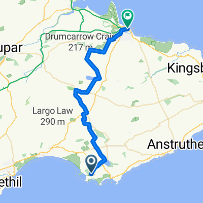
Striking north from Chapel Green and off the Fife Coastal Path, in the footsteps of early pilgrims heading to St Andrews, the Way continues along quiet roads and tracks until Largo Ward, where there is a strip of main road with a grass verge, past the famous Peat Inn, to Radernie, where it is signposted to Cameron Reservoir . This ancient pilgrim path is currently being restored but may be muddy in parts. After Cameron Reservoir the Way passes through Denhead and the welcoming Golf Club House at Craigtoun with a great view onto the spires of St Andrews, the long sandy beaches, and the North Sea before descending along the picturesque burn and forest track of Lumbo burn to St Andrews.
This is the 5th and final section of St Margaret’s Way, the great 100km pilgrimage trail from Edinburgh to St Andrews, part of the revival of the 1000 year old pilgrimage, The Way of St Andrews. (http://www.thewayofstandrews.com)
- -:--
- Durata
- 31,4 km
- Distanza
- 268 m
- Salita
- 252 m
- Discesa
- ---
- Velocità media
- ---
- Altitudine max.
Continua con Bikemap
Usa, modifica o scarica questo percorso ciclabile
Vuoi percorrere St Margarets Way- Earlsferry to St Andrews o personalizzarlo per il tuo viaggio? Ecco cosa puoi fare con questo percorso su Bikemap:
Funzionalità gratuite
- Salva questo percorso tra i preferiti o in una raccolta
- Copia e pianifica la tua versione di questo percorso
- Sincronizza il tuo percorso con Garmin o Wahoo
Funzionalità Premium
Prova gratuita di 3 giorni o pagamento una tantum. Scopri di più su Bikemap Premium.
- Naviga questo percorso su iOS e Android
- Esporta un file GPX / KML di questo percorso
- Crea la tua stampa personalizzata (provala gratis)
- Scarica questo percorso per la navigazione offline
Scopri altre funzionalità Premium.
Ottieni Bikemap PremiumDalla nostra community
Saint Monans: Altri percorsi popolari che iniziano qui
- St.Monans Loop
- Distanza
- 14,7 km
- Salita
- 74 m
- Discesa
- 66 m
- Posizione
- Saint Monans, Scozia, Regno Unito
- Coastal Path - never again
- Distanza
- 9,7 km
- Salita
- 67 m
- Discesa
- 67 m
- Posizione
- Saint Monans, Scozia, Regno Unito
- 14, Marine Park, Leven to A917, Broomlees, Kilconquhar, Leven
- Distanza
- 2,7 km
- Salita
- 22 m
- Discesa
- 8 m
- Posizione
- Saint Monans, Scozia, Regno Unito
- Woodland Way, Kilconquhar2, Leven to Woodland Way, Kilconquhar, Leven
- Distanza
- 12,2 km
- Salita
- 116 m
- Discesa
- 110 m
- Posizione
- Saint Monans, Scozia, Regno Unito
- Saint to Saint
- Distanza
- 32,7 km
- Salita
- 134 m
- Discesa
- 118 m
- Posizione
- Saint Monans, Scozia, Regno Unito
- Route from 25 Station Road, Anstruther
- Distanza
- 13,6 km
- Salita
- 298 m
- Discesa
- 46 m
- Posizione
- Saint Monans, Scozia, Regno Unito
- St Margaret's Elbow- via Crail and Fife Ness to St Andrews
- Distanza
- 37,4 km
- Salita
- 174 m
- Discesa
- 159 m
- Posizione
- Saint Monans, Scozia, Regno Unito
- Route from Woodland Way, Kilconquhar, Leven
- Distanza
- 4,6 km
- Salita
- 20 m
- Discesa
- 42 m
- Posizione
- Saint Monans, Scozia, Regno Unito
Aprila nell’app