

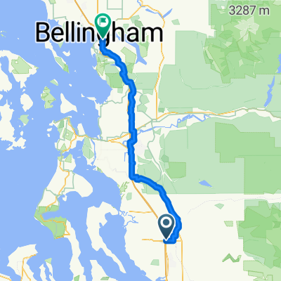
Arlington to Seattle
Un percorso ciclabile con partenza da Smokey Point, Washington, Stati Uniti.
Panoramica
Su questo percorso
Una percentuale elevata di questo percorso era su piste ciclabili asfaltate. Il Centennial Trail da Arlington fino a Snohomish è stato meraviglioso e ha permesso di andare veloce. Il North Creek Trail, d'altra parte, si snodava e sarebbe ottimo per chi non ha fretta. E naturalmente, il Burke-Gilman Trail è meraviglioso e veloce anche.
Le strade iniziali a sud-ovest di Snohomish avevano troppe auto e nessuna spalla fino a quando non eravamo ben su Seattle Hill Road. Dal momento in cui è iniziata la corsia per biciclette fino a quando non ci siamo girati sulla Bothell-Everett Highway, Seattle Hill Road era eccellente. Tuttavia, per arrivare a Seattle Hill Road, ci sono stati non solo diversi chilometri di guida senza spalla, ma anche una breve ma ripida salita che era anche senza spalla. Abbiamo tenuto il traffico fermo mentre ci arrampicavamo lentamente. Se pedalassimo di nuovo a Snohomish, dobbiamo vedere quale potrebbe essere una migliore strada per evitare queste strade affollate senza spalla e questa ripida salita senza spalla.
La Bothell-Everett Highway era veloce con una buona corsia per biciclette, ma era molto trafficata e rumorosa.
- 6 h 56 min
- Durata
- 97,6 km
- Distanza
- 1.514 m
- Salita
- 1.459 m
- Discesa
- 14,1 km/h
- Velocità media
- 145 m
- Altitudine max.

Foto del percorso


Continua con Bikemap
Usa, modifica o scarica questo percorso ciclabile
Vuoi percorrere Arlington to Seattle o personalizzarlo per il tuo viaggio? Ecco cosa puoi fare con questo percorso su Bikemap:
Funzionalità gratuite
- Salva questo percorso tra i preferiti o in una raccolta
- Copia e pianifica la tua versione di questo percorso
- Dividilo in tappe per creare un tour di più giorni
- Sincronizza il tuo percorso con Garmin o Wahoo
Funzionalità Premium
Prova gratuita di 3 giorni o pagamento una tantum. Scopri di più su Bikemap Premium.
- Naviga questo percorso su iOS e Android
- Esporta un file GPX / KML di questo percorso
- Crea la tua stampa personalizzata (provala gratis)
- Scarica questo percorso per la navigazione offline
Scopri altre funzionalità Premium.
Ottieni Bikemap PremiumDalla nostra community
Smokey Point: Altri percorsi popolari che iniziano qui
 15405 67th Ave NE, Arlington to 15405 67th Ave NE, Arlington
- Distanza
- 13 km
- Salita
- 118 m
- Discesa
- 116 m
- Posizione
- Smokey Point, Washington, Stati Uniti
 Arlington to Seattle
- Distanza
- 97,6 km
- Salita
- 1.514 m
- Discesa
- 1.459 m
- Posizione
- Smokey Point, Washington, Stati Uniti
 Easy ride in Arlington
- Distanza
- 40,9 km
- Salita
- 196 m
- Discesa
- 195 m
- Posizione
- Smokey Point, Washington, Stati Uniti
 172nd St NE, Arlington to Lakeway Dr, Bellingham
- Distanza
- 93,7 km
- Salita
- 604 m
- Discesa
- 593 m
- Posizione
- Smokey Point, Washington, Stati Uniti
 Smokey Point Dr, Arlington to Lakeway Dr, Bellingham
- Distanza
- 92,3 km
- Salita
- 964 m
- Discesa
- 952 m
- Posizione
- Smokey Point, Washington, Stati Uniti
 15405 67th Ave NE, Arlington to 15405 67th Ave NE, Arlington
- Distanza
- 10,9 km
- Salita
- 69 m
- Discesa
- 70 m
- Posizione
- Smokey Point, Washington, Stati Uniti
 15405 67th Ave NE, Arlington to 15405 67th Ave NE, Arlington
- Distanza
- 11,1 km
- Salita
- 65 m
- Discesa
- 66 m
- Posizione
- Smokey Point, Washington, Stati Uniti
 15291–15359 67th Ave NE, Arlington to 15405 67th Ave NE, Arlington
- Distanza
- 5,2 km
- Salita
- 23 m
- Discesa
- 23 m
- Posizione
- Smokey Point, Washington, Stati Uniti
Aprila nell’app